The Year 2010 in Google Earth

Google Earth had another fantastic year in 2010 in terms of new features along with an amazing amount of content! The amount of new content Google has added in a single year is almost too large to comprehend. We wish we had detailed statistics on just how big it is, but Google doesn’t usually release their content statistics. New imagery released during the year covered millions of square miles across all seven continents. And, not just current imagery, but in some cases multiple instances for different years going back several decades.

Also in 2010 we saw the release of Google Earth 6 and it’s many great new features, tons of new 3D buildings released covering nearly every major city in the world, Street View was greatly expanded world-wide, SketchUp got some excellent new features, and dozens of applications using the Google Earth plugin were released.

Read the full entry to see our most popular posts and tips on Google Earth from each month in 2010.
More great models from Andy Dell

Back in August, we showed you some of the great 3D models that Andy Dell was creating in Hounslow, and more recently we showed you some of the great 3D models found on the grounds of the Hampton Court Palace in London.

As it turns out, Andy has been building a lot of other models in that same area of London. The models aren’t yet in Google Earth, but they’re all available in the 3D Warehouse. As you can see below, the buildings look excellent and are very well built.

Here’s some of what he has been working on:

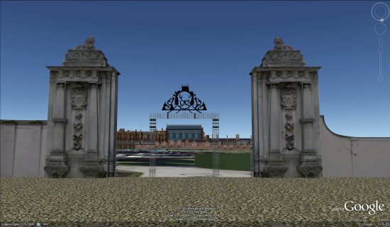
Hampton Court Main Gates3D WarehouseKML

1-main-gates.jpg

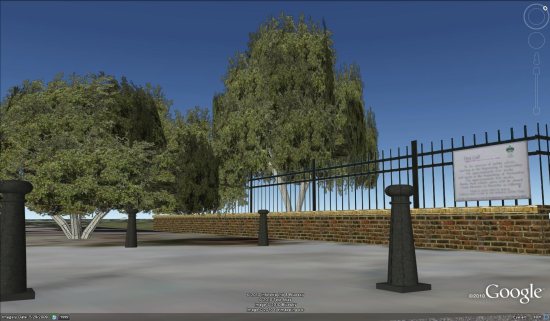
Bushy Park Entrance3D WarehouseKML

2-bushy-park.jpg

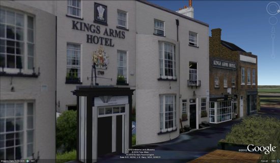
King Arms Hotel3D WarehouseKML

3-king-arms.jpg

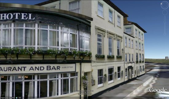
Liongate Hotel3D WarehouseKML

4-liongate.jpg

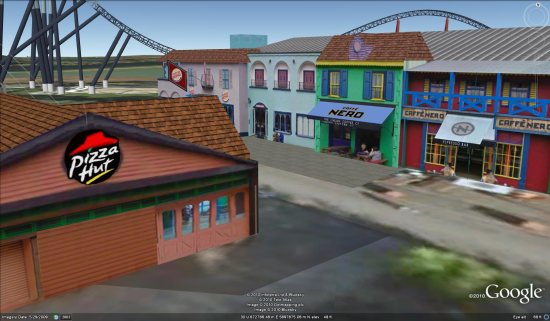
Along with those models, he’s done a good bit of work in nearby Thorpe Park. He’s built a variety of buildings in the park:

5-thorpe-park1.jpg

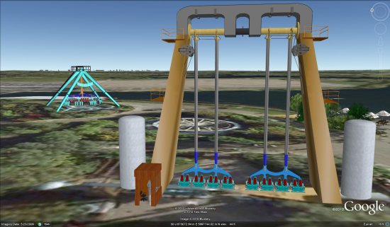
And even some of the rides!

6-thorpe-park2.jpg

You can view all of those items in this collection in the 3D Warehouse.

Great work, Andy!

If you or someone you know is building excellent 3D models in Google Earth, please
let us know
about them so we can check them out.

DoubleCAD XT and SketchUp

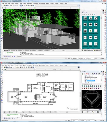
Having been here for almost seven years, I’ve concluded that there are as many SketchUp workflows as there are SketchUp users. Trying to recommend a single catch-all combination of tools and methods is like stapling Jell-O to a piece of paper — difficult, messy and ill-advised. When tools like DoubleCAD XT (and DoubleCAD XT Pro) from IMSI/Design come along, things get a little easier to explain.

Most SketchUp modelers who design things for a living spend their time somewhere between the second and third dimensions. Models are 3D, but construction (or fabrication) requires 2D documents. Often, those 2D drawings are too complex to use LayOut in SketchUp Pro to make; LayOut isn’t a dedicated drafting tool, after all.

A SketchUp model imported into DoubleCAD XT Pro

DoubleCAD XT is (as its name implies) most certainly a full-featured CAD tool. It’s more affordable than AutoCAD LT, and it “holds hands” with SketchUp better than any other CAD system on the market. Among other things, DoubleCAD XT:

  • exports COLLADA files which you can open in SketchUp
  • imports .SKP files natively
  • imports and recognizes SketchUp layers
  • generates viewports from scenes in your models
  • converts components into DoubleCAD blocks automatically

If you’re a Windows user who routinely creates 2D documents, you owe it to yourself to give DoubleCAD a whirl. The no-cost version (did I forget to mention that DoubleCAD XT is free?) is extremely capable, and the Pro version adds lots, lots more for US$695.