The Street View on Russia

Welcome to Russia! You can now virtually travel through the world’s largest country to the cities of Moscow and St. Petersburg using Google Maps Street View.

Take an online stroll around famous Red Square and Moscow Kremlin, or go to outskirts of Moscow to wander around the beautiful Tsaritsino or Kuskovo parks. You can also visit the former site of the palace in Kolomenskoye, once considered the 8th World Wonder.


Red Square, Moscow


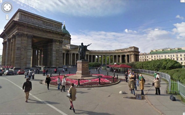
St. Petersburg, the second largest city in Russia and northernmost megapolis in the world, was once a country capital, and the history of this young city started with The Peter and Paul Fortress. Today, the entire historical center of St. Petersburg is a UNESCO Heritage Site that you can enjoy via Street View.


Historical Center, St. Petersburg


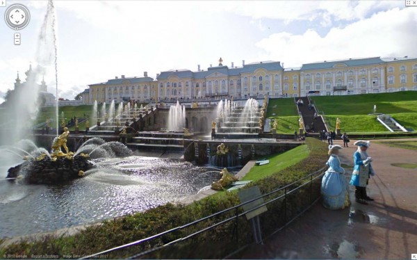
Within St. Petersburg, you can see the great palaces and parks that Russian emperors and nobles built, with Peterhof being its crown jewel. In fact, whole southern shore on the Gulf of Finland consists of palaces and parks including Peterhof, the Oranienbaum, and Alexandria.


Peterhof, St. Petersburg

We hope you enjoy your virtual trip to Russia, and look forward to sharing more countries, cultures and sites as Street View continues to expand to more places. For a demo on how Street View works, start here.

Also, if you have a story to share about a place in Russia, find it in Street View and share it on Google+ with the #streetview.

Explore university campuses in 3D and StreetView


As part of the continual additions to Street View, Google has just added more university campuses around the world to the product, bringing the total number of Street View-able campuses to nearly 100.

Combine that with the fact that thousands of new 3D buildings are added to Google Earth each week, along with 3D trees in a growing number of cities, and you have some excellent tools at your disposal to help browse around your favorite college.

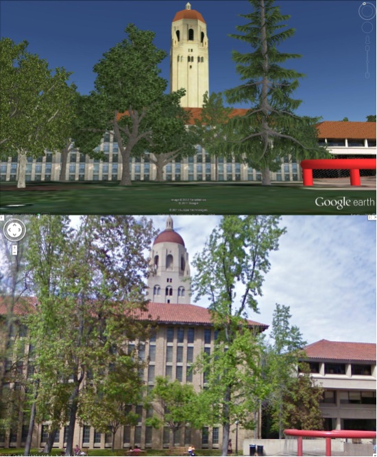
For example, below is Stanford University shown in Google Earth and Street View so you can compare the views:


stanford-comp.jpg 

Google has spotlighted a few other universities in a recent blog post and you can view the full list of Street View-enabled campuses on their site.

You can also view some extra goodies at a few schools (like the virtual campus at Northeastern University) and utilities such as Campus Bird help provide more geo context for hundreds of schools.

As good continues to add Street View at more schools, and schools continue to work on their 3D buildings, this kind of exploration will only get better!

Celebration Town


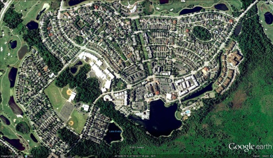
While Disney is famous for their theme-parks, did you know that they also built a town? Google Sightseeing takes us on a brief tour of Celebration, the town that Disney built in the mid-1990s.


celebration.jpg 

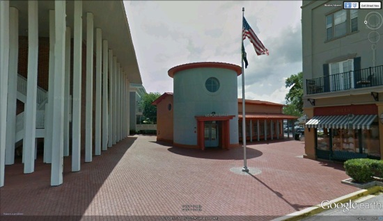
The city was was designed around its downtown, to encourage walking rather than driving. The town has some very cute buildings it in, such as the post office seen below. However, Disney was careful to keep it generically cute, and not include any Disney-like features such as Mickey Mouse ears or Dumbo-shaped bushes.


post-office.jpg 

Once complete, as planned, Disney sold the town to a property investment corporation. You can learn more about the city on their official website.

As they typically do, Google Sightseeing has created a KML file to showcase all of the locations found in their post. The city has sharp aerial imagery from 2010 and very comprehensive Street View imagery, making it a fun town to explore in Google Earth!