Pacific Crossing in Google Earth

Join a journey of discovery virtually in Google Earth, as Liquid Robotics launches four wave-powered robotic gliders to cross the Pacific ocean in their Pacific Crossing (PacX) Challenge Expedition. The wave gliders are attempting to set a new world record for the longest distance ever attempted by an unmanned vehicle and will be collecting data about the Pacific ocean for use by scientists and students back on dry land. These R2D2s of the sea will cross 25,000 miles over 300 days and collect over 2 million data points, helping build the record of oceanic knowledge.

Wave glider robots await launch from San Francisco in this first expedition blog post in Google Earth.
To follow the wave gliders in Google Earth, download the expedition KML file or open the PacX Gallery page and click on the ship icon. You will be able to read updates from scientists sharing the latest robotic observations, from wave height in storms to weather measurements like barometric pressure, wind speed and air temperature. The ship icon will represent the location of the wave gliders, starting in the San Francisco bay.

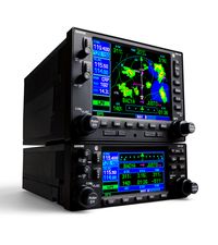
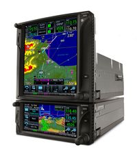
The Garmin "430/530"


Since their introduction in 1998, the Garmin GNS series GPS/NAV/COM products have been widely accepted, with over 100,000 of them flying the skies today. But 13 years later, the time has come to bid farewell. Due to decreased demand and limited parts availability, we announced this week that Garmin will soon stop accepting orders for new GNS series products and will discontinue the line. The GNS 530W or GPS 500W will be available until November 30, 2011, and the GNS 430W, GNC 420W and GPS 400W are expected to remain available through the first half of 2012. If you currently own a GNS series product, there is no need to worry. Rest assured that Garmin will continue supporting these products with repair services and maintenance software releases for many years to come. Most of all, thank you to all of our customers for your continued support of these products over the past 13 years.

The GNS series is a tough act to follow, but here at Garmin, we challenged ourselves to

come up with something even better – and we’ve done it in the all new GTN series, which will serve as the GNS series replacement for the next decade and beyond. The GTN series represents a significant improvement in features,


integration and simplicity. It does everything your GNS series products did, plus a whole lot more! Not only does the GTN serve as the GPS/NAV/COM, but it also is a full-featured MFD with moving map, traffic, terrain, weather information and more. It has a touchscreen graphical user interface for quick and intuitive operation. The graphical flight plan editing feature makes modifying your flight plan a breeze, and loading airways has never been easier. Selectmodels offer remote transponder and remote audio panel integration. And some GTN models have the ability to overlay an electronic approach chart right on the moving map. Plus, right now we’re offering serious savings on the GTN during a limited-time promotion.


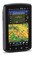
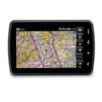
The Garmin aera 796 and 795 -Navigators with 3D Vision


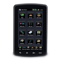
Garmin announced its newest flagship aviation portable GPS series, the aera 796 and aera 795. These new devices have all of the great features you have come to know and love from a Garmin aviation portable like a 5 Hz GPS receiver, the patented Panel Page and XM weather integration, plus the aera 796/795 is enhanced with even more features that make it Garmin’s most capable aviation portable yet! Some new additions include a touchscreen user interface, pilot-selectable screen orientation and 3D Vision.

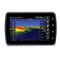
What is 3D Vision?
3D vision is a unique 3D view of the surroundings outside the aircraft. It uses GPS position and the terrain-alerting database to recreate a behind-the-aircraft perspective view of the topographic landscape. The resulting virtual reality display offers pilots a supplemental 3D depiction of land and water features including terrain, obstacles, runways and airport signposts all shown in relative proximity to the aircraft. With the flick of a finger, the 3D view can be rotated around the aircraft to easily view the surrounding terrain.

A path to a paperless cockpit

Because of the comprehensive offering of electronic charts, the aera 796 may be qualified for use as either a Class I or Class II Electronic Flight Bag (EFB). Geo-referenced IFR Enroute charts and VFR Sectional charts come pre-loaded, and the aera 796  also includes geo-referenced Garmin FliteCharts®, an electronic version of the AeroNav U.S. Terminal Procedures Publication. For pilots who prefer Jeppesen charts and diagrams, Garmin also offers a ChartView enablement option. Garmin ChartView utilizes Jeppesen’s extensive library to provide global charting capabilities. More “paperless” offerings include a digital document viewer, scratch pad and pre-loaded geo-referenced AeroNav IFR and VFR enroute charts.

Plus a large touchscreen display
The large icons on the high-resolution 7-inch touchscreen display make this device so easy to use. Using  your finger, you can quickly pan across the map, pinch zoom and quickly access information. The icons along the bottom row of the display are even customizable, so you can pick your favorite features and anchor them at the bottom of the display for even faster access.

The aera 796/795 will be on display and available for purchase next week at the AOPA Aviation Summit in Hartford, Connecticut. Come by and visit us! If you can’t make it to the show, but want to get your hands one one, visit your local Garmin authorized dealer.