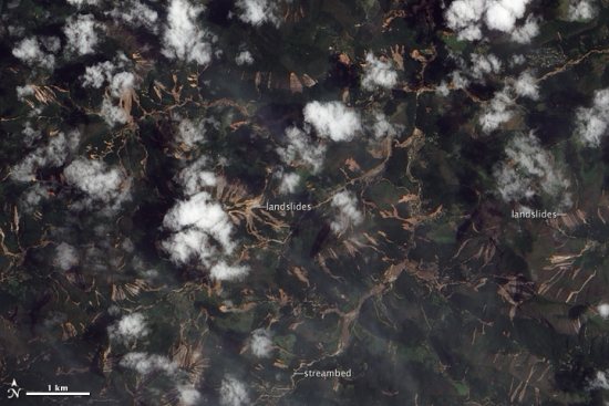
Back in mid-January, Rio de Janeiro, Santa Catarina and other areas of Brazil expereinced devastating mudslides as the result of nearly 10 inches of rain in a single day. The landslides are reported to have killed nearly 1000 people, and have left at least 8,700 homeless. Since then, NASA has been attempting to capture fresh imagery of the area but has been unable to due to satellite imagery’s biggest nemesis — clouds.
The situation is similar to the flooding in Pakistan last year; Google wanted to provide imagery of the area to assist those that were trying to help, but they were unable to get any for quite a while due to persistent cloud cover.
Fortunately, clouds broke a few days ago and NASA’s EO-1 satellite was able to capture some remarkable images of the area.
They’ve also provided a KML file with imagery of the mudslides, for those that wish to view the imagery inside of Google Earth.
UPDATE: After we published this post, DigitalGlobe sent us a great PDF they put together showing before/after shots of some of the affected areas. Download the PDF here.