Libya Crisis Map

Libya Crisis Map

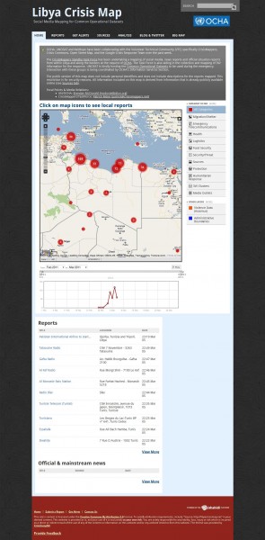
The UN OCHA’s Information Management unit in Geneva has asked the CrisisMappers Standby Task Force to provide a live map of reports of the current crisis in Libya generated from Twitter, Facebook, Flickr, YouTube and mainstream media sources.

Summary

* Over 300 unique reports mapped; detailing nearly 400 different events
* Two main clusters of reports: largest around Tripoli – Zauara (extending west towards the border with Tunisia); secondone around Bengbazi extending to the border crossing with Egypt at Bardiyah. The background to all maps is the heatmap showing these two clusters.
* Violence mainly in two locations: (i) in and around Tripoli, extending West to the Border with Tunisia; (ii) in Benghazi, and extending far into the south-west of the country
* People movement locations mainly across borders at: (i) Ghat Awbari into Algeria; (ii) Saloum and Al Jaghub into Egypt; (iii) Ghadamis into Algeria; (iv) all along the border with Tunisia; (v) Matan as Sarah into Chad; (vi) Al Awaynat into Sudan
* Health is most reported need. Health services reportedly being provided in all locations reporting health needs except Saloum and Ajdabiya
* Protection is the next most reported need. Most of these reports relate to issues relating to the personal safety of civilians
* Food is the third most reported need. Food supplies reportedly being provided in all locations reporting food needs.
Geospatial Revolution: Episode Three Released

Once again, right on time, Penn State Public Broadcasting has released Episode Three of their excellent “Geospatial Revolution” project.

If you’ve missed either of the first two episodes, I strongly suggest you go back and watch them. Episode One covered a wide overview of “how” and “why” questions regarding geospatial technologies, and Episode Two dug into more specific examples including the City of Portland and the well-known shipping company UPS.

Episode Three covers a variety of safety and war-related topics, such as:

• “Mapping the Road to Peace”

• “Waging Modern War”

• “Serving and Protecting”

• “Staying Safe”

You can watch each segment individually on their site, or watch the full 15 minute video below:

I hope you enjoy the video, and be watching for their fourth and final episode on May 3, 2011.

Pedaling to new places with Street View

Street View enables you to visit places around the world virtually, from the scenic Champs-Elysées in Paris to bustling Times Square in New York City. We’re able to collect imagery of most of these places with a car, but when we find an interesting place that a car can’t reach, we get more creative.

In 2009 we introduced the Trike, a modified bicycle outfitted with Street View equipment, to visit these locations, from towering castles to picturesque gardens. The Trike team has been pedaling around the world, and today we’ve added more of these unique places to Street View in Google Maps.

With the Trike we’re able to take you inside the grounds of historic locations like the Château de Chenonceaux in Civray-de-Touraine, France.

In addition to historic sites, you can also view beautiful outdoor scenery of places like the National Botanic Gardens in Dublin.

You can now see 360-degree panoramic images of these gardens at the San Diego Art Institute, as well as several other gorgeous spots in Balboa Park in San Diego, California.

To continue exploring these and other beautiful and historic places around the world, we encourage you to visit Street View in Google Maps. If you are the owner of a private property and would to make your location available for users to explore in Street View, please visit this site to learn about our partner program.