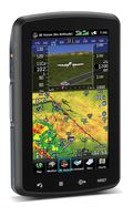
 Garmin announced its newest flagship aviation portable GPS series, the aera 796 and aera 795. These new devices have all of the great features you have come to know and love from a Garmin aviation portable like a 5 Hz GPS receiver, the patented Panel Page and XM weather integration, plus the aera 796/795 is enhanced with even more features that make it Garmin’s most capable aviation portable yet! Some new additions include a touchscreen user interface, pilot-selectable screen orientation and 3D Vision.
What is 3D Vision?
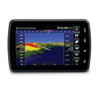
3D vision is a unique 3D view of the surroundings outside the aircraft. It uses GPS position and the terrain-alerting database to recreate a behind-the-aircraft perspective view of the topographic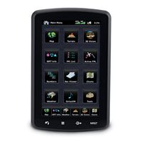 landscape. The resulting virtual reality display offers pilots a supplemental 3D depiction of land and water features including terrain, obstacles, runways and airport signposts all shown in relative proximity to the aircraft. With the flick of a finger, the 3D view can be rotated around the aircraft to easily view the surrounding terrain.
A path to a paperless cockpit
 Because of the comprehensive offering of electronic charts, the aera 796 may be qualified for use as either a Class I or Class II Electronic Flight Bag (EFB). Geo-referenced IFR Enroute charts and VFR Sectional charts come pre-loaded, and the aera 796 also includes geo-referenced Garmin FliteCharts®, an electronic version of the AeroNav U.S. Terminal Procedures Publication. For pilots who prefer Jeppesen charts and diagrams, Garmin also offers a ChartView enablement option. Garmin ChartView utilizes Jeppesen’s extensive library to provide global charting capabilities. More “paperless” offerings include a digital document viewer, scratch pad and pre-loaded geo-referenced AeroNav IFR and VFR enroute charts.
Plus a large touchscreen display
The large icons on the high-resolution 7-inch touchscreen display make this device so easy to use. Using your finger,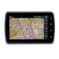 you can quickly pan across the map, pinch zoom and quickly access information. The icons along the bottom row of the display are even customizable, so you can pick your favorite features and anchor them at the bottom of the display for even faster access.
The aera 796/795 will be on display and available for purchase next week at the AOPA Aviation Summit in Hartford, Connecticut. Come by and visit us! If you can’t make it to the show, but want to get your hands one one, visit your local Garmin authorized dealer.
The Garmin’s GTU 10 tracking unit
When Garmin announced their GTU 10 tracking unit earlier this year, everyone was quick to think of the scenarios in their busy lives that could be made easier, safer or more secure through the use of this versatile new product.
Whether you’re a parent keeping an eye on your young kids after school, a pet owner watching after your curious cat or canine or a faithful friend or family member supporting your loved ones’ favorite endurance events, the small and simple GTU 10 can come in handy with its location tracking and geofence alerts. How easy is GTU to use? Just watch these introductory videos, and then share your thoughts on how you’d answer: “How do you GTU?”
Bing Maps: “The Hurricane Season”
The term ‘hurricane season’ recently brought new meaning to many communities across the U.S. East Coast in the wake of Hurricane Irene. Being able to see the latest developments and impacted locations online through Bing Maps makes it possible to better anticipate, respond and recover from the destruction of hurricanes.
Around the world, people use Microsoft technology every day to stay in touch during difficult times. Today, we’re calling out a Bing Maps app launched by the Wall Street Journal that tracks hurricanes in the Atlantic Ocean. Tech geek or not, you have to admit this is a useful app, especially now during hurricane season. Let’s take a closer look.
The app is an interactive graphic that charts both current hurricanes as they are happening, and chronicles previous hurricanes dating back to 2005. So if you’ve always wanted to be a weatherman, you can bookmark the link and visit it often to see the latest weather patterns – hurricane season or not. The app is easy to use, so no meteorology degree is required.
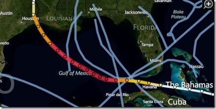
To watch a current storm’s path, you can follow it from the moment your browser opens to the app. The storms strength is categorized on the right hand side of the screen so you can see the severity of the storm and the route it is predicted to take. Here, we see an example of a storm pattern that started near the Bahamas as a tropical storm and as it grew stronger it became a Category 5 making its way up through the Gulf of Mexico. As it got closer to the Gulf Coast it became less intense, still remaining a Category 3 and then tapering off back to a tropical storm status.
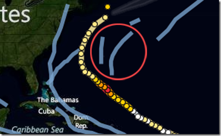
To see a past hurricane, just click on one of the blue lines and it will take you to the storm’s history and the calendar at the top will move to the month it happened.
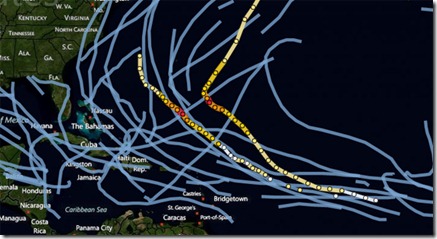
With Bing Maps, it’s easy to zoom in and out by scrolling your mouse so you can zoom in to see high-levels of detail or zoom out to see the past patterns of multiple hurricanes in the Atlantic.
For you self-proclaimed geeks, here’s more on how the app was built and all the things it can do:
Bing Maps’ partner, OnTerra built the hurricane tracker working closely with the Wall Street Journal team. It was created using the Bing Maps AJAX7 API, JQuery and JavaScript. It gets data from NOAA which is processed into JSON data files and refreshed every few hours, which includes the hurricane path, predicted path and the cone of uncertainty polygons. The application works great on modern web browsers including iPhone, iPAD, Android and Blackberry devices, unlike Flash and Silverlight applications. The HTML5 support in the AJAX7 API provides solid mobile device integration for interactive mapping apps like the Wall Street Journal Hurricane Tracker.
