Spreadsheet Mapper now with more advanced customization

Do you have a spreadsheet of locations that you’d like to see on a map? Here on the Google Earth Outreach team we talk to many nonprofits who use Google Earth and Maps to tell their stories and visualize their data. Often the data is in spreadsheets, or other tabular formats. Converting these rows and columns into a map brings the spreadsheet to life by providing geographic context and a new way to visualize the information.

Spreadsheet Mapper is a tool that enables anyone to easily create a well-designed KML file to show off their data in Google Earth and Maps. Since Spreadsheet Mapper is a Google Docs template, you fill in your data using the familiar interface of a spreadsheet, and create a great KML without any coding. It gives you all the cloud-based benefits of Google Docs, including collaborative editing and the ability to publish directly to the web.

When we released Spreadsheet Mapper 2 a few years ago, it had a number of limitations, especially with regard to the number of placemarks it could create and the available balloon templates. In response to user feedback, and taking advantage of new features in Google spreadsheets and Google Apps Scripts, we have upgraded Spreadsheet Mapper with a variety of new and improved features:

  • More placemarks: Support for 1,000 placemarks and ability to add more as needed
  • Flexible balloon design: Take advantage of even more balloon design templates and simplified starter templates
  • Simplified publication: Just click “Publish to the web” to share your map (no more fussing with URLs)
  • New customization options: Advanced users can change the default view and network link details

Ready to try it? The Spreadsheet Mapper v3 tutorial will get you started.

The Fusion Table data on mobile devices

We’ve talked a bit about Google’s Fusion Tables product before — a great way to turn a table full of data (such as an Excel spreadsheet) into a fully functional map!

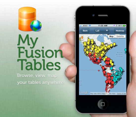
The maps can easily be shared through a Google Maps interface or even in Google Earth, but the mobile support for Fusion Table projects has been pretty weak. That’s where the folks from Build-A-Map have stepped in, with a new product called My Fusion Tables.

my-fusion-tables.jpg

My Fusion Tables a mobile application that allows you to browse, view, and map data from Google Fusion Tables on both mobile phones and tablets. You can find it in the iOS App Store or on Google Play.

Redesigned Google Search App for Windows 7.5 phones


Windows Phone owners can now get easy access to the Google Search App, available in the Windows Phone Marketplace. Check out these features which help you get useful results fast:
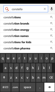
  • Google Autocomplete: As you type in your search, our autocomplete feature offers search predictions that often match your intended search term making search entry easier and faster.
  •  

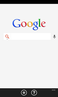
  • Voice Search: With our voice feature, you can avoid typing all together. Simply press the microphone and begin speaking your query.
  •  

  • My Location: With your permission, Google can use your device location to provide nearby results easily and accurately. For instance, a search for “coffee shops” quickly displays the nearest places you can go to for a cup of coffee.


The new Google Search app now has Voice Search (left) as well as Google Autocomplete (right)

You can download the app from the Windows Marketplace and try it for yourself. It’s available worldwide in English, Spanish, French, Italian, and German.

(Cross posted on the Inside Search Blog)