ArcGIS software for $100

You may be interested to know that ESRI, developer and supplier of one of the most popular commercial GIS software, also offers a home use licence for a suite of its products. For a $100 annual fee, the ArcGIS for Home Use 12-month term license includes:

  • ArcView
  • ArcGIS 3D Analyst
  • ArcGIS Geostatistical Analyst
  • ArcGIS Network Analyst
  • ArcGIS Publisher
  • ArcGIS Schematics
  • ArcGIS Spatial Analyst
  • ArcGIS Tracking Analyst

This offer is available to anyone. The catch is that the software is supplied only for non-commercial, self-education purposes. For any other use, you have to pay many thousands of dollars to acquire the software.

This is a similar program that Microsoft introduced a long time ago for its Office suite of software products. For example, if your employer has purchased Microsoft Office for use within the organisation, you can obtain the same software package for home use for under $50.

The ArcGIS for Home Use program is available worldwide. Customers in the United States can order it online. Customers outside the United States should contact their local distributor .
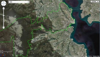
Free postcodes with Reference Map

Following on from my yesterday’s announcement about free reference map service – just a quick post on how to take advantage of free postal boundaries data that come pre-packaged with it.

To view on a map any of 2,507 postal area boundaries at full resolution (as defined by the Australian Bureau of Statistics for Census 2006 population and housing data) just follow this simple URL pattern:

http://www.aus-emaps.com/svs/ref/map.php?kmzl=2000&svs=2

Multiple postcodes can be added to the map as follows (at this stage one at a time only):

?kmzl=2000,3000&svs=2,2

A set of simple instructions on how to configure other map parameters can be found on aus-emaps.com web widgets page.

Since this reference map can be embedded in a website page, a simple javascript code can add additional functionality to render the content dynamically. It means you can now start serving postal boundaries and/or any other data in kmz or geoRSS format directly on your web site! Here is a link to a simple example showing you exactly how to do it.

And this file will also be handy to script the functionality: list of postal areas (Census 2006 version in csv format). Please note, Northern Territory postal area boundary data are named with leading “0” (ie. 0800).