I’m a great fan of live real-time maps of city transit systems. There is something about watching trains moving in real-time on a map that really appeals to my inner geek.
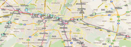
This real-time Google Map of Munich’s S-Bahn shows the transit system’s trains live as they move around the city. Each train is represented on the map with a numbered map marker indicating which line it is travelling on.
You can click on any of the train markers and view its next stop and its destination station. It is also possible to click on any station on the network and view the times and destination of the next trains scheduled to arrive.
The GE Show: Future Flight: Points of Departure
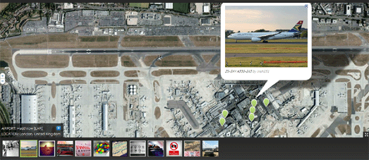
General Electric’s Points of Departure is a nicely designed Google Map showcasing the 6,000 most popular airports in the world. You can browse the airports by name, by the busiest airports, the most scenic or even view those situated on small islands.
Each airport is shown with Google Maps satellite view. Pictures from Flickr are also displayed beneath the map and their location shown on the map with map markers. The map also includes a permalink buttom that allows you to share your favourite map view.
Australian Social Diversity on Google Maps
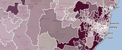
Arek of the All Things Spatial blog has created a series of Google Maps to highlight social diversity in New South Wales, Australia.
The Australian Bureau of Statistics attempts to quantify socio-economic diversity for geographic locations with a suite of four summary measures called Socio-Economic Indexes for Areas (SEIFA). Arek has imported the Bureau’s data for the four measures into Fusion Tables and created a map for each.
Each map provides a heat-map visualisation of one of the measure. In each map you can click on any of New South Wales’ postal areas to view the area’s rank and decile.
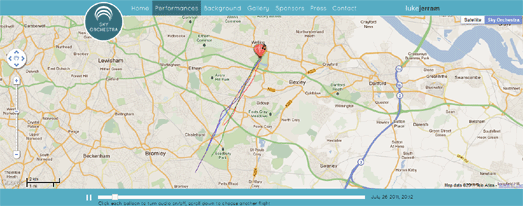
London has today entered into the fantasy world of steampunk. In what seems like an episode from 2D Goggles a number of hot air balloons have been flying over London blasting out music to the populace below.
Don’t worry if you don’t live in London or if you have missed any of the balloons’ flights as you can replay it all on a handy Google Maps based application.
The map shows each of the hot air balloons and their flight track. If you click on the map marker of any of the hot air balloons you can then listen to the music that was played during the flight.
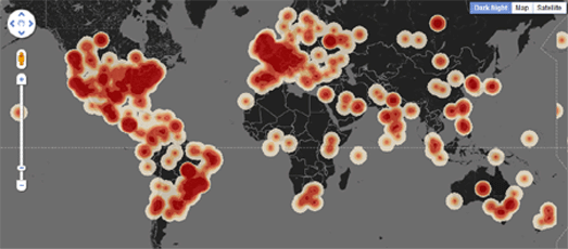
There is one year to go to the 2012 London Olympics. A number of events are being held in London to celebrate the occasion (including the flying of musical hot air balloons).
CASA is tracking all of today’s Twitter messages that include the hashtag ‘1yeartogo’ and have created a nice heat map of all the Tweets.
The map is actually a little sneak preview of a new heat map visualisation that will be made available to the general public in the next few weeks on MapTube. CASA are responsible for some of the best Google Maps tools (for example the CASA Image Cutter) so I can’t wait to play with this new heat map tool when it is released.
They Draw & Travel – World Map
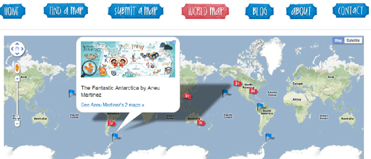
They Draw & Travel is a collection of wonderful user submitted hand drawn maps.
As part of the launch of the website a Marvellous Map competition was held with a grand prize of $1,000 for the winner and 5 runner-ups each receiving $200. The six winners of the competition will be announced on Friday.
The World Map lets you browse the 225 maps (so far) submitted to They Draw & Travel on Google Maps. You can click on any of the 225 map markers and view the hand drawn map submitted for that location.
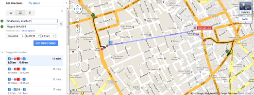
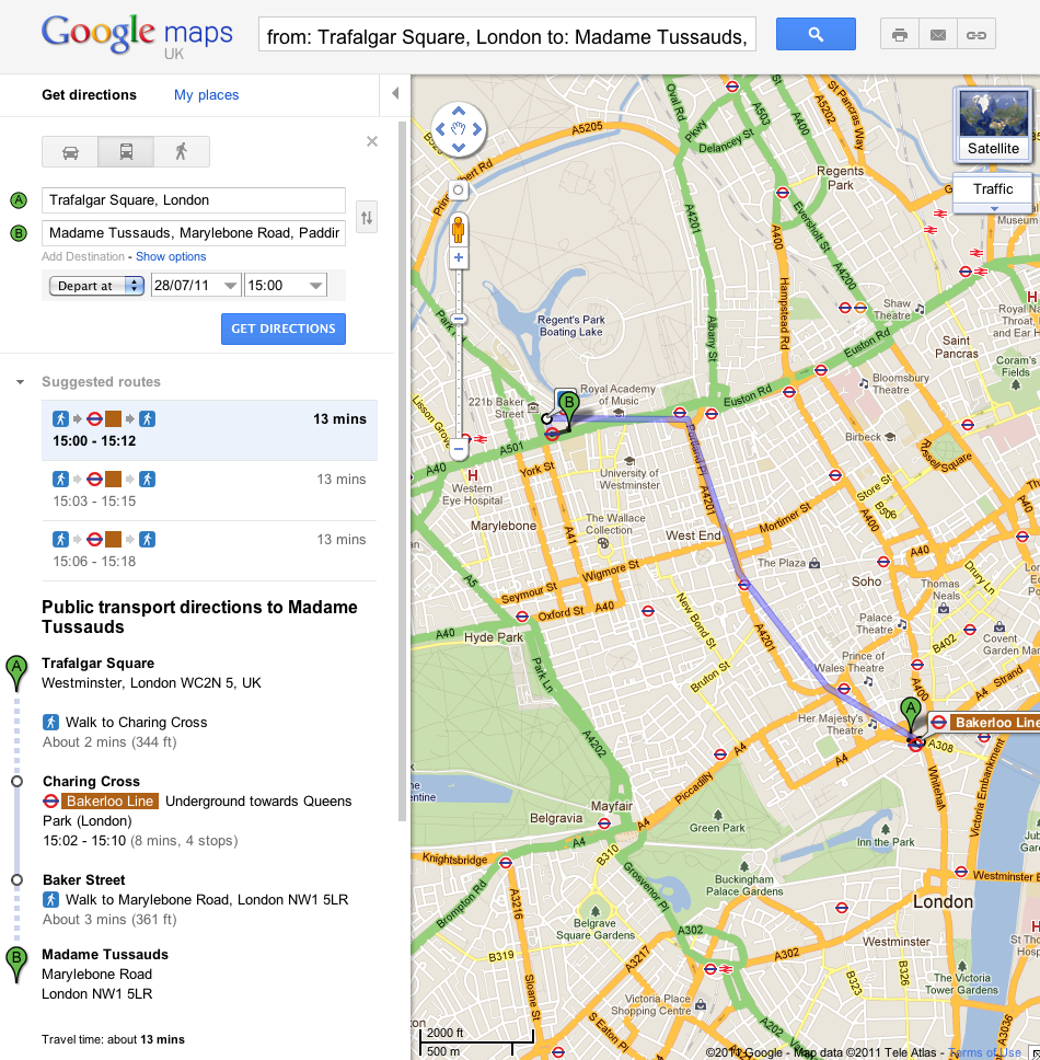
Public transport directions for London has been added to Google Maps. If you want to get around in London you can now get transit directions that include the London Underground, DLR, buses and trams.
To get public transit directions in London on Google Maps you just need to select ‘Get directions’, type in your starting point and destination and click on the train icon that appears in the side panel.
The resulting direction will then tell you which underground station you need to go to and even which tube line you need to catch.
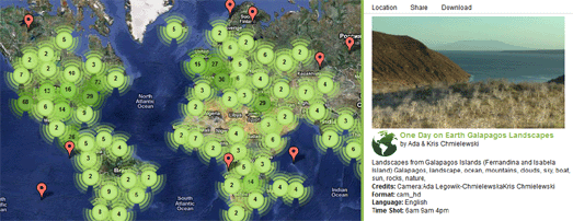
On 10.10.10 One Day on Earth asked people around the world to create a video of their world. The goal of the project was to “create an open shareable archive and documentary film of the world on 10/10/10.”
Whilst you wait for the finished full-length film to be released you can browse and watch the thousands of videos that were contributed around the world on this Google Map.
If you click on a map marker you can watch the selected video in the map sidebar. For each video you can view details, such as where and when it was shot and who by.
By GoogleMapsMania