Free postcodes with Reference Map

Following on from my yesterday’s announcement about free reference map service – just a quick post on how to take advantage of free postal boundaries data that come pre-packaged with it.

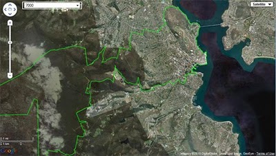
To view on a map any of 2,507 postal area boundaries at full resolution (as defined by the Australian Bureau of Statistics for Census 2006 population and housing data) just follow this simple URL pattern:

http://www.aus-emaps.com/svs/ref/map.php?kmzl=2000&svs=2

Multiple postcodes can be added to the map as follows (at this stage one at a time only):

?kmzl=2000,3000&svs=2,2

A set of simple instructions on how to configure other map parameters can be found on aus-emaps.com web widgets page.

Since this reference map can be embedded in a website page, a simple javascript code can add additional functionality to render the content dynamically. It means you can now start serving postal boundaries and/or any other data in kmz or geoRSS format directly on your web site! Here is a link to a simple example showing you exactly how to do it.

And this file will also be handy to script the functionality: list of postal areas (Census 2006 version in csv format). Please note, Northern Territory postal area boundary data are named with leading “0” (ie. 0800).

An excellent flight simulator for Google Earth

Back in 2006, Frank showed you how you could sort of use Google Earth as a flight simulator. It was crude, but effective. In late 2007, Google put a more realistic flight simulator into Google Earth, but kept it hidden as a secret mode.

More recently, this February we saw a demo of GEVision, which integrates Microsoft Flight Sim technology but uses Google Earth for the terrain and imagery.

Now we have our first look at Xavier Tassin’s Google Earth Flight Simulator, which might be the best one yet!

flight-sim.jpg

It uses the Google Earth Plug-in, and you can try it for yourself at ge-flightsimulator.com. If you need help with the controls, here are some instructions.

A few other notes about the project, from Xavier:

  • I have been playing around with Flight Sims since MS Flight Simulator 1.0 (I was 6 at that time 🙂
  • 6 years ago, I had a first try at making an Online Flight Simulator (www.keynoise.com) as a commercial for an Australian acquaintance of mine who is selling the Evektor Sportstar down under. This Sim was build with Shockwave and got more success than just being a commercial. Sadly, technical limitations and lack of time stopped my progress into making something better.
  • 6 month ago I tried “Ships” from PlanetAction, and realized that the GE plug-in would be a great platform for making my dream come true: make a worldwide scenery Flight Simulator.
  • The biggest challenge into making GE Flight Simulator was to work around the lack of a 3D physics engine in Javascript: it took me some time but I finally made my own. Also, as Google Earth is not really meant to be a game platform, it is difficult (and requires a lot of maths!) to animate complex objects. But all in all I was really surprised by the performances I could get out of the plug-in.
  • For the beta version, I tried to integrate as many of the features I though to be important to make it fun. It is not perfect yet but it gives a good idea of what can be achieve with a bit of Javascript and the GE plug-in. I am especially excited about the multi-player mode and I would like to get some feedback from users on that.
  • For the Future, I am planning to add more planes, improve the flight models, add an airport database and some aeronautical charting, improve the multi-player feature. I also would like (if enough interest is shown) to open an aircraft marketplace to everyone.

All in all, it’s a great flight sim. Try it for yourself, and tell us your thoughts in the comments below.