The world’s longest bridge over water, connecting China’s port city of Quingdoa with an airport on the other side of Jiaozhou Bay, has finally opened. The bridge is 26.4 miles long, making it the longest bridge in the world.
The building of the bridge has generated some amazing statistics:
• It stands on 5,200 pillars.
• It cost around $1.5 billion to build.
• It uses enough steel for almost 65 Eiffel Towers – 450,000 tons, along with 81 million cubic feet of concrete.
• It can withstand a magnitude 8 earthquake, typhoons, or the impact of a 300,000 ton ship.
GEC member TomKjeldsen found the bridge in Google Earth, and added a few paths to show the bridge in the “open water” areas that don’t show anything in there.
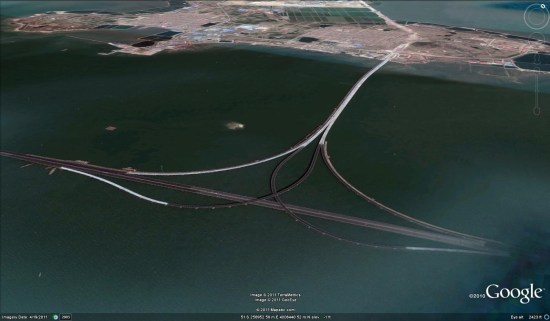
To see it for yourself, you can simply use this KMZ file. 
The bridge will hold its title for about 5 years; in 2016, a 30 mile bridge is expected to be completed that links Hong Kong with Macao and Guandong province.