Thanks to sharp-eyed GEB reader ‘Andreas’, it seems that Google has just pushed out a fresh imagery update. The full extent of the update is still unknown, but it appears to be quite sizable.

As is usually the case, you can use Google Maps to determine for sure whether or not a specific area is fresh. This new imagery isn’t in Google Maps yet, so you can compare Earth vs. Maps to see what’s new; the fresh imagery is already in Google Earth, but the old imagery is still in Google Maps. If you compare the two side-by-side and they’re not identical, that means that you’ve found a freshly updated area in Google Earth!
[UPDATED – 13-August, 1:52pm EST]
- China: Beijing, Shenzhen — thanks ‘drone’ and ‘hongxz’
- Ethiopia: Gode — thanks ‘Snakeye’
- United States: Arizona (Buckeye, Camp Verde, Casa Grande), California (Bakersfield, Coalinga, Huron, Sacramento, Visalia), Illinois (Harrisburg), Iowa (Des Moines, Sioux City), Missouri (Columbia, Jefferson City, Joplin), Nebraska (Lincoln, Omaha), New Mexico (Carlsbad, Farmington), New York (Rochester), Ohio (Dayton), Oklahoma (Tulsa), Texas (Abilene, Big Spring, Dalhart, Junction, Monahams) — thanks ‘Alex’, ‘Andreas’, ‘Munden’ and ‘Steven’
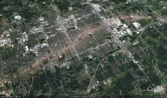
As ‘Munden’ points out in the comments, the imagery from the tornado that struck Joplin, MO is stunning:


