Street View: Ski and snow

From the streets to the slopes, Street View in Google Maps recently updated its special collections to include a number of new ski resorts, so you can tour some of the world’s most beautiful ski terrain right from your browser. Whether you’re planning your annual trip to your favorite resort or hunting for an exciting new adventure, Street View can transport you to your desired destination. Tour a few of our favorite ski resorts below.

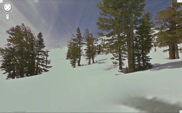
First stop off the ski lift is the world famous Squaw Valley, in northern California. Squaw Valley has been a ski destination since it hosted the Olympic Winter Games in 1960.

Squaw Valley Resort – Going down Gold Coast Face

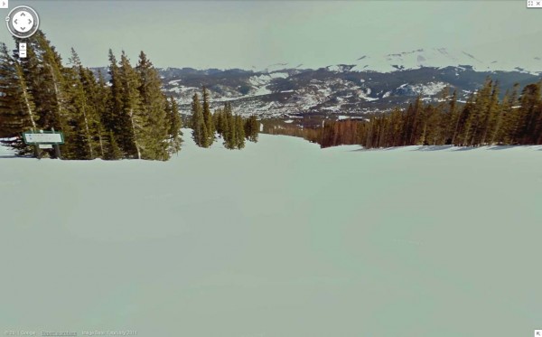
Following a record setting 519 inches of snowfall last season, Breckenridge Ski Resort is celebrating its 50th anniversary this year. Take a tour of this famous Colorado destination.

Breckenridge Resort, Looking down Four O’Clock

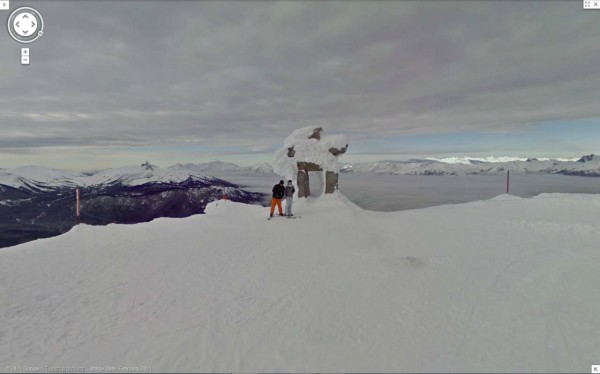
Last, but surely not least, you can tour Whistler Blackcomb, home of the 2010 Winter Olympics. We captured Whistler with our Street View cameras last year and made some recent updates. Located in the Coast Mountain range of British Columbia, Whistler, known for both its scenery and adrenaline-pumping runs, is one of the most famous ski destinations in the world.

Whistler Blackcomb, Whistler Peak

All snow view imagery was captured by the Street View snowmobile which made its debut two years ago at the Winter Olympics in Vancouver. To get a glimpse of a few more resorts you can go to the gallery or watch the video:

Whether you’re a snowbird, a beach bum, an urban adventurer or something else entirely, there’s something for everyone in our growing set of Street View collections. To see some of our favorite special collections, visit the Street View gallery.
The New Google Earth Imagery – November


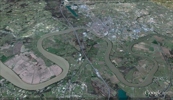
Despite the previous imagery update occurring  just a week ago, it appears that Google has pushed out a bit more new imagery. GEB reader ‘Andreas’ noticed some fresh imagery in a few places around the globe, but it’s been difficult to determine if it’s new to Google Earth or not. Most of the imagery is from about six months ago and it’s already in Google Maps, but none of it shows up in recent update files.


france.jpg 

Because the new imagery is already in Google Maps, it’s a bit more work to determine which areas are new. To figure out if a particular area is new, you can:
1: Look at the date in Google Earth for the imagery you think might be fresh.
2: Check the updates between then and now in the the update KML to see if it was released in a previous update. If it wasn’t, then it’s new!

[UPDATED — 10-November, 1:16pm EST]

  • France: Bourgoin-Jallieu, Libourne
  • Germany: Waldkraiburg/Landshut
  • Italy: Altamura

Sweden is hiding “secrets” visible from space


• Some of their “military secrets” are visible on Google Earth, but not on their local mapping sites (Hitta.se and Eniro.se).

• Google uses imagery from Lantmäteriet to cover parts of the country, and Lantmäteriet sensors some sensitive areas.
• There are two main underground control centers for Sweden’s air force; one is visible in Google Earth, the other isn’t.
• The one that is visible is because Google is using imagery from DigitalGlobe for that part of the country, and they’re not censoring it.

Stefan goes on to point out something even more interesting — historical imagery of the obscured area from a few years ago clearly reveals the facility, and the imagery was also from Lantmäteriet; they just weren’t obscuring it yet!

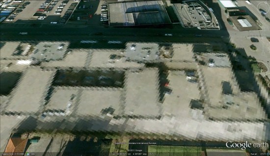
The bigger problem is the method of how the imagery is being obscured. In many cases, such as the Netherlands and the French nuclear plant we mentioned above, imagery is simply blurred to hide details of the buildings.


netherlands.jpg 

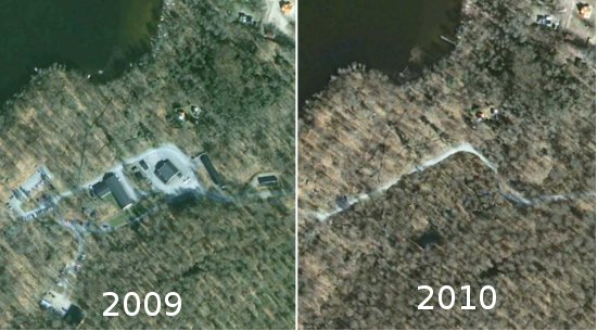
In the case of Sweden, the modify the imagery to look like fields and forests. While this could potentially help hide their secrets more effectively, it also puts into question the accuracy of all of their imagery.

Stefan shows the example of the village of Hästveda, seen below before and after the photoshopping that removed it from their imagery.


sweden.jpg