Indoor maps of Las Vegas Casinos and more

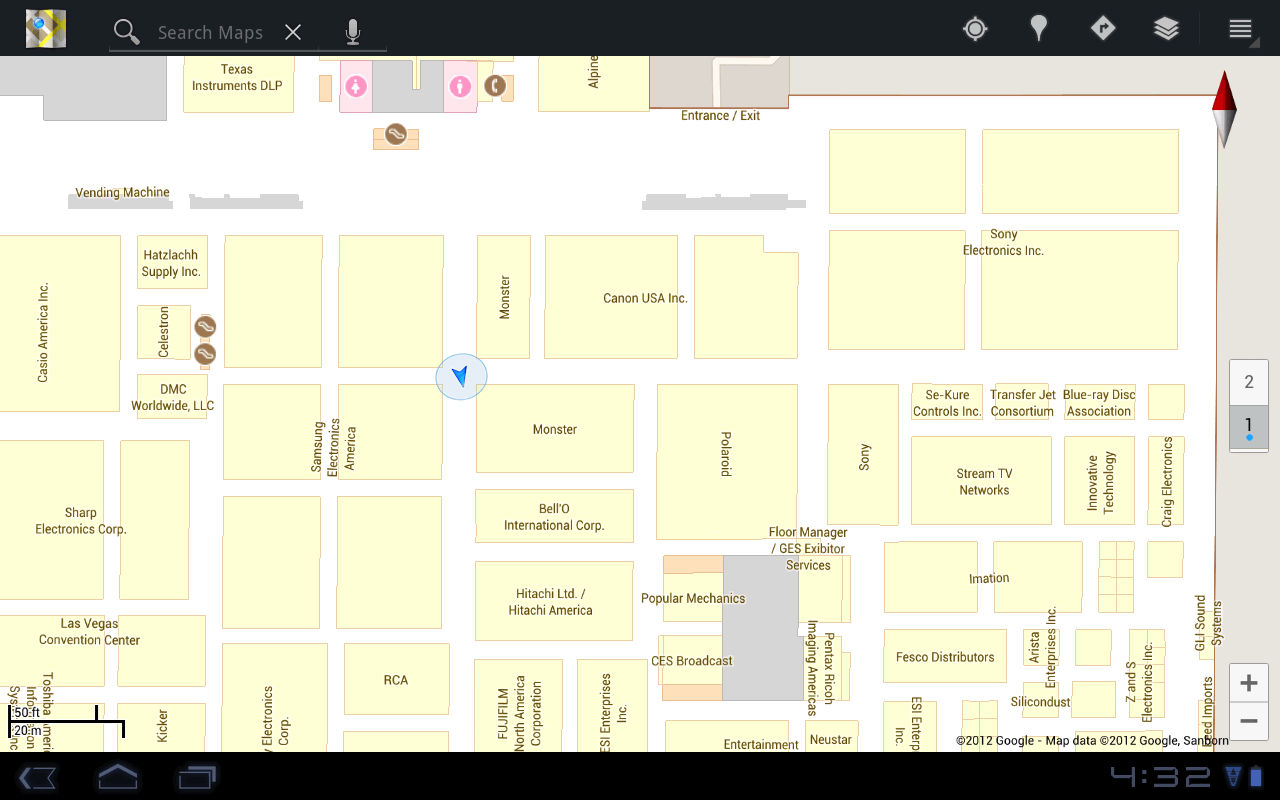
At the 2012 Consumer Electronic Show (CES) in Las Vegas, NV, attendees will now be able to use Google Maps on their Android devices to help them find their way in the sea of exhibitors and attractions throughout the Las Vegas Convention Center, select resorts and casinos along the Las Vegas strip, as well as the Las Vegas McCarran International Airport.

Las Vegas Convention Center with CES Exhibitors

Since November of last year, you’ve been able to use Google Maps in select places to get detailed floor plans and indoor location information within a few meters, as well as an accurate floor level location. Today, we’ve expanded the list of places with indoor maps by partnering with MGM Resorts International, Caesars Entertainment and others, to provide indoor maps for Caesars Palace, Bellagio, The Venetian, The Palazzo, MGM Grand and many more.

We hope that these indoor maps will come in handy when finding your way through the slots and to the shops. And for those of you who catch gadget-fever with CES in town, we’ve also partnered with a number of Best Buy stores in the Las Vegas area. For more detailed list of indoor maps partners, go to our help center or to see a demo, start here

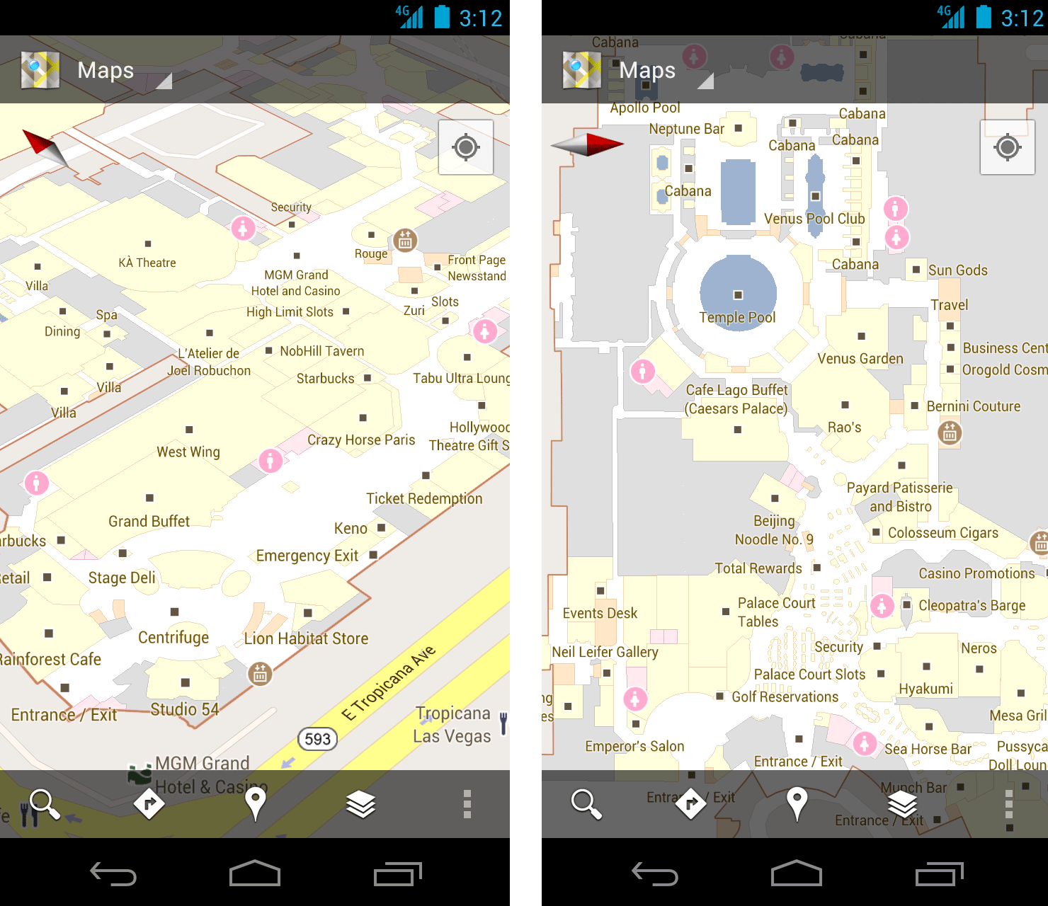
Left: MGM Grand Hotel and Casino, Right: Caesars Palace
Starting today, we’re also releasing some of the first floor plans in Google Maps that were uploaded through the Google Maps Floor Plans tool. From malls to convention centers, museums and educational institutions from California to New York you will now be able to see these floor plans in Google Maps for Android

So the next time you are looking for the perfect table to win the jackpot or can’t find the nearest restroom, simply open Google Maps on your Android device and let indoor maps show you the way. If you’re attending CES, please come by the the Google Maps booth to learn more and preview our upcoming Google Maps game!

Bing Maps Aerial Imagery into Desktop themes

Some of the best imagery from the Bing Maps Global Ortho Project is collected into Windows 7 Desktop Themes.  These themes change your PC desktop experience as the images rotate through on a regular basis so you never know which part of the world you’ll be looking at next! The United States version is the most content-rich Windows 7 Desktop Theme with nearly 200 images from all parts of the Continental United States, and has had almost a million downloads. The European version just launched last month and contains photos from 10 different countries in Western Europe. Once downloaded, both of these themes are updated through RSS feeds as new imagery is available. For a deeper dive on these themes, check out this post . What are you waiting for? Go download one today!

Bing Maps Aerial Imagery – United States
Windows 7 desktop theme
Click here to Download
Click here for Details

Bing Maps Aerial Imagery – Europe
Windows 7 desktop theme
Click here to Download
Click here for Details

Google Earth: High-resolution imagery in Antarctica

As Google has continually improved the quality of their imagery across the globe, one area always seemed to stay low-res — Antarctica. Thanks to the help of the Polar Geospatial Center (PCG), that’s beginning to change.

A great example of that is the Mackay Glacier Tongue, located in Granite Harbor, seen here:

mackay.jpg

You can see it for yourself, as shown in the article, using this KML file.

So far, the PGC has helped Google update nearly 1,000,000 square kilometers, with another 275,000 square kilometers added every three months. While it will take a while to get the entire continent updated (more than 14,000,000 sq km), they’re certainly making great progress.

Along with updating the quality of the imagery, they’re also working to improve the accuracy of the location of the imagery. The PGC’s Paul Morin will be heading down to the Antarctic Peninsula soon to help improve the imagery from being off by as much as 30 meters to being accurate within a single meter.

The full article at The Antarctic Sun is quite interesting and well worth your time to read. We all enjoy the constantly improving imagery quality in Google Earth, and the PGC is just one of many companies working with Google to help move things forward.

(via @OgleEarth)