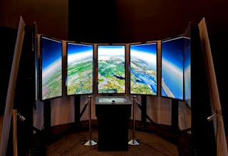
Thirty-five years ago this week, the Viking 1 lander touched down on the surface of Mars, beginning an olympian mission of exploration lasting more than 6 years. Today, the Liquid Galaxy immersive Google Earth display lands at the Smithsonian National Air and Space Museum in Washington, DC, in the “Moving Beyond Earth” exhibit.
Photo by Mark Avino, Smithsonian National Air and Space Museum
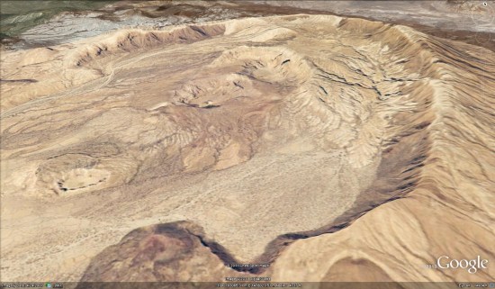
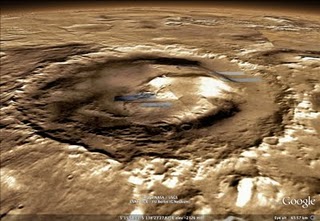
It’s part of the museum’s annual Mars Day! event, where visitors can learn about the red planet, past and future missions to Mars, and talk to scientists active in Mars research. Adding to the excitement, NASA has just announced the location of the landing site for the next mission to Mars, the Mars Science Laboratory. In November, this SUV-sized robot will make the leap into space and is expected to land in Gale Crater, to look for signs that Mars might have once harbored life.
Designed during engineers’ 20% time, Liquid Galaxy consists of several screens in a circular arrangement, all running Google Earth in parallel for an immersive virtual experience. Visitors can use the podium with touchscreen and a 3D mouse to navigate to an up-close and personal near-360-degree view of the landing site in Google Earth, as well as anywhere else on Mars, the Moon, and of course Earth.
Admission to the museum is free, so be sure to stop by the next time your travels take you to the capital of the United States. While you’re there, enjoy the largest collection of historic spacecraft and aircraft in the world, including a proof test article of the Viking Mars Lander. (Of course, the Viking 1 lander itself took a one-way trip!)
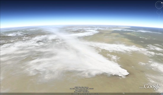
If you can’t make the trip to Washington or Mars yourself, you can always explore the Martian surface from the comfort of your own home using Google Earth, checking out the progress of the current crop of robot explorers, seeing the latest imagery from orbiting satellites or scouting out the Mars Science Laboratory’s future landing site for yourself.
 Be aware the KML is loading the full 5 MB file from NASA’s server, as it’s amazingly sharp, so it’ll take a few moments to load.