Highlighting terrain by only showing the roads on the map


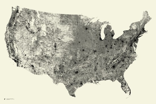
What if someone were to create a map that showed every street in the country and nothing else? Fathom Information Design did just that, and the results are amazing!
 

streets.jpg 

It feels kind of like the city lights of Earth that we recently wrote about, as you can clearly see cities form without any kind of borders or other overlays in there.

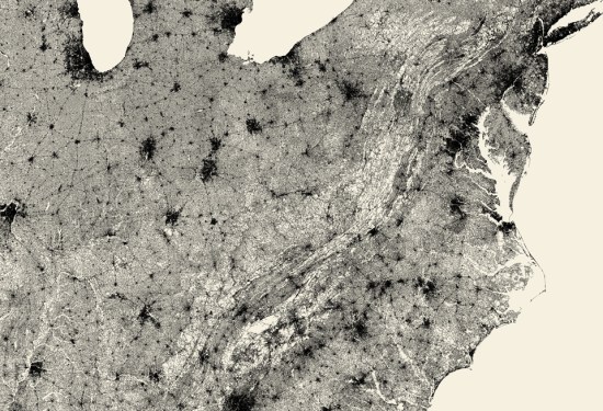
What’s even more remarkable about the “All Streets” map is how clearly the mountain ranges are defined. Simply by drawing in the roads, you can see them without any difficulty. A great example is the Appalachian Mountains, seen here:
 

appalachian.jpg 

You can view and/or purchase the map over on the Fathom website.

(via +Adrienne St. Aubin)
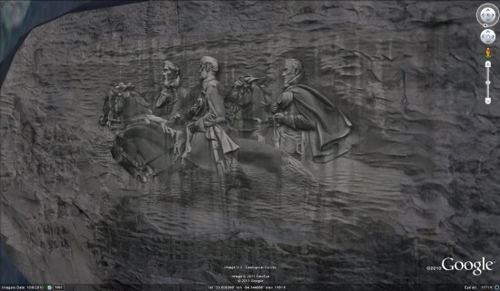
The Stone Mountain sculpture


stone-mountain.jpg 

The carving on the mountain is widely thought to be 190 feet x 90 feet, provided by their official website as well as on Wikipedia. However, based on measurements made in Google Earth, Peter believed the actual size to be closer to 167′ x 77′. After repeated inquiries, Stone Mountain Park was able to confirm the actual size of the carving at 158′ x 76′ — even smaller than he had suggested (though still quite massive).

It’s also widely advertised that the total cutout on the mountain covers 3 acres. As it turns out, the cutout are is roughly 359′ x 191′ which amounts to 1.57 acres.

Peter’s new model just recently went live in the 3D Warehouse, so you can use this KML file to fly there and see it in Google Earth.

Finding a lost family with Google Earth

A neat story from British Columbia yesterday; a family was hiking on Mount Tzouhalem this past Sunday when they got lost in the dark on their way back down the mountain. When calling for help, they described the area around them (fences, horses, etc). One of the search managers started up Google Earth, found an area that matched their description, and helped lead to their rescue!

As you can see in the image below, the mountain is in relatively high-resolution in Google Earth, which helped make this possible:

tzouhalem.jpg

If you want to check out the mountain for yourself, you can fly there using this KML file. For more info, check out the full story on BCLocalNews.com.