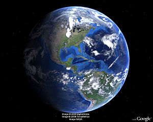
 Once again it’s Earth Day. A time to sit back and think about our wonderful planet, and some of us will be out picking up some trash, or just enjoying nature.
While researching thoughts for this post, I had a chance to talk to David Levine from Geostellar for a few minutes yesterday. They’re doing some great work in developing systems to allow you to view the solar potential of any building on earth. They generate the data using LIDAR and other techniques, then export it for viewing in Google Earth and the Google Earth Plugin. Android and iOS apps are due out later this year. To get an idea of what they do, check out the video below.
For those of you stuck inside due to weather, work, or other reasons – perhaps you might want to spend the day exploring our wonderful planet through the power of Google Earth. Here are a few links of stories from Google Earth Blog (GEB) in the past year describing environmental related content available for viewing in Google Earth:
• The Home Greenover Project — A neat way to show off eco-friendly homes.
• Diving Deep with Richard Branson — A new expedition to explore the “last frontiers of our own planet” at the deepest parts of the ocean.
• Visualizing the vast problem of marine debris — Exploring the issue of trash in the world’s oceans.
• Flooding Google Earth — Visualizations of Earth if sea levels experience significant rises.
• Predict how much solar power your house could generate — Based on your area, predict how much solar energy your home could generate.
• The WaterAid Point Mapper, helping find fresh water — A great tool to help sub-Saharan organizations map rural water points.
• Google Earth Engine, an amazing tool for scientists and researchers — Released at COP 16, this tool helps scientists analyze massive amounts of climate-related data.
• Sea Ice Extent Animation updated for 2010 — An animation showing the changes in the size of the ice cap.
• A climate change tour of cold places — NSIDC released this project to show the snowy and icy regions of the world covering sea ice, glaciers, ice shelves and permafrost.
• Tour of the proposed Belo Monte Dam Complex — A great visualization of the high-debated proposed dam complex in the Amazon.
• New weather features in Google Earth 5.2 — Some cool enhancements to the weather layer in Google Earth 5.2.
• Interactive multi-layered Google Earth map of 4 degree temp rise — A map showing the potential impact of a 4 degree rise in global temperature.
• Soil Moisture Animations — A worldwide map showing soil moisture levels, and important tool for people in a variety of fields.


