Have you ever dreamed of embarking on an exciting expedition? Well, now you can follow a ship traveling the ocean in Google Earth. National Geographic and Oceana scientists in collaboration with the Chilean Navy are traveling on their next Mission Blue expedition to the remote Salas y Gomez Island. This island is 250 miles (390 km) east of Easter Island. They aim to discover what lies beneath these largely unexplored waters.
To follow along, open Google Earth and search for “Easter Island, Chile”. Look for the blue ship icon heading eastward as it travels to Salas y Gomez Island. Check back daily through March 10th to track this expedition (make sure the Places layer is turned on). The science team will share updates from the expedition as they travel east from Easter Island toward Salas y Gomez Island – including photographs, videos and links to the National Geographic News Watch blog. National Geographic and Oceana are members of Mission Blue.
We are also excited that we were able to quickly publish new imagery for the island in Google Earth and Google Maps, so that now anyone can visit Salas y Gomez virtually.
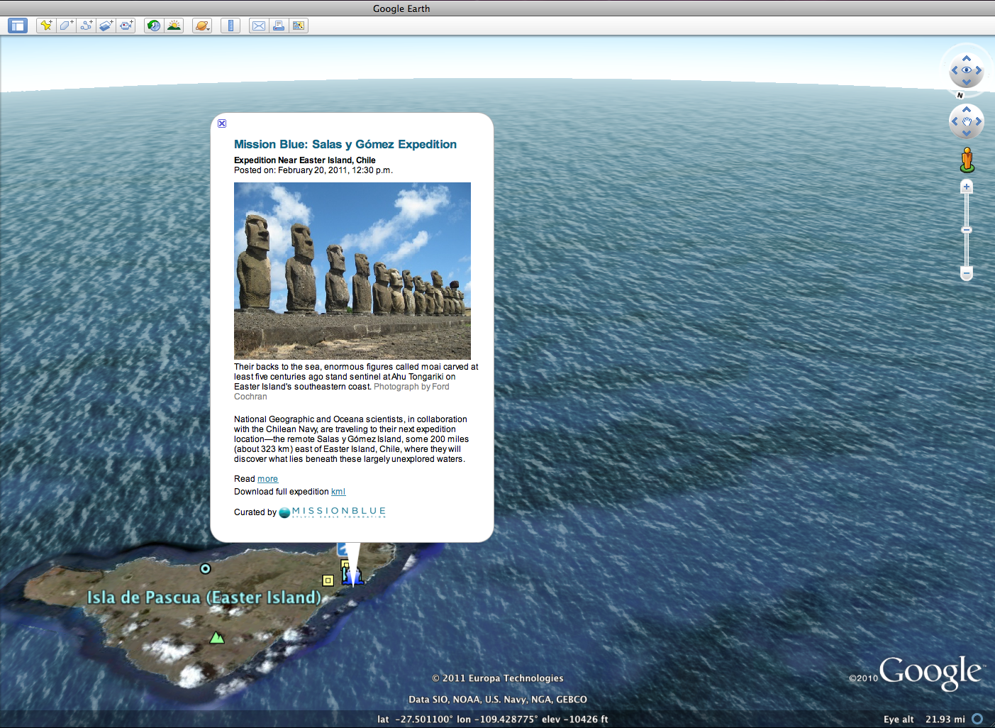 Click on the blue ship icon near Easter Island in Google Earth
to see the most recent post from the expedition.
In addition to the ship icon in Google Earth, you can also download the expedition KML or visit the Google Earth Gallery to download the file.
To bring this expedition to life for thousands of teachers and students around the globe, the National Geographic Ocean Education Program is working with Oracle® Education Foundation in the Oracle ThinkQuest online community. Educators can find lesson plans, submit questions to the research team while at sea, discuss with classrooms around the world and more. Visit the ThinkQuest website to apply to join the global community of teachers and students.
We hope you enjoy this virtual adventure at sea with the research team at Mission Blue.