The Liquid Galaxy at the Space Museum in Washington

Thirty-five years ago this week, the Viking 1 lander touched down on the surface of Mars, beginning an olympian mission of exploration lasting more than 6 years. Today, the Liquid Galaxy immersive Google Earth display lands at the Smithsonian National Air and Space Museum in Washington, DC, in the “Moving Beyond Earth” exhibit.


Photo by Mark Avino, Smithsonian National Air and Space Museum

It’s part of the museum’s annual Mars Day! event, where visitors can learn about the red planet, past and future missions to Mars, and talk to scientists active in Mars research. Adding to the excitement, NASA has just announced the location of the landing site for the next mission to Mars, the Mars Science Laboratory. In November, this SUV-sized robot will make the leap into space and is expected to land in Gale Crater, to look for signs that Mars might have once harbored life.
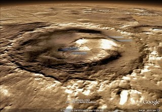
Designed during engineers’ 20% time, Liquid Galaxy consists of several screens in a circular arrangement, all running Google Earth in parallel for an immersive virtual experience. Visitors can use the podium with touchscreen and a 3D mouse to navigate to an up-close and personal near-360-degree view of the landing site in Google Earth, as well as anywhere else on Mars, the Moon, and of course Earth.

Admission to the museum is free, so be sure to stop by the next time your travels take you to the capital of the United States. While you’re there, enjoy the largest collection of historic spacecraft and aircraft in the world, including a proof test article of the Viking Mars Lander. (Of course, the Viking 1 lander itself took a one-way trip!)

If you can’t make the trip to Washington or Mars yourself, you can always explore the Martian surface from the comfort of your own home using Google Earth, checking out the progress of the current crop of robot explorers, seeing the latest imagery from orbiting satellites or scouting out the Mars Science Laboratory’s future landing site for yourself.
The Future of Google Places

The Google Lat Long Blog has formally announced the changes to Places that roll out earlier in the day with their normal happy talk:

Making constant tweaks and adjustments to our user interfaces and overall user experience have always been the norm at Google, and you may have recently heard about our renewed effort across all Google products to make the user experience more focused, elastic and effortless. Changes have already started to appear on Google Maps, and we’ve now simplified our Place pages across desktop and mobile devices as well.

But there was one thing that was unique in today’s post about the change that departed from the past. For the first time that I can remember Google has provided, even if guarded and vague, some clue about the future direction of Places:

Beyond today’s transition, our long-term vision for local search includes:
  • Bringing you more personalized results when you search for local places — because we understand that information from the people you know is most meaningful;
  • Integrating some of the great information that’s been buried on Place pages into your web search experience across all Google platforms;
  • Giving you more ways to rate, discover and share places you love faster and easier than ever, wherever you are, and on whichever device you choose.

The discovery of Machu Picchu

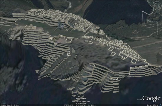
This Sunday, July 24, Peru is celerating the 100th anniversary of the Discovery of Machu Picchu, the Inca city declared one of the new seven wonders of the world and a UNESCO World Heritage Site.

The site was beautifully modeled in 3D by Peter Olsen.

machu-picchu.jpg

To go along with the awesome 3D model, there are a variety of other sites that show off the area in amazing 3D. While this site is in Romanian, you can work your way through it using the arrows at the bottom of the screen and clicking on various parts of the complex.

More impressive is the Quest3D model of the site, though you need to install a special program to make it work which will probably turn quite a few people off.

Ultimately, Peter’s Google Earth model is still the best way to see how amazing Machu Picchu really is. You can fly to it using this KML file, or watch the video below for a quick look at what Peter constructed.