The QGIS 1.7 is Released


So this awesome happened over the weekend:

“We are pleased to announce the latest release in our 1.X series of releases. To download your copy, please visit the QGIS download page. This release is named after the town of Wroclaw in Poland. The Department of Climatology and Atmosphere Protection, University of Wroclaw kindly hosted our last developer meeting in November 2010.”

The release has some great new symbology and data management improvements continuing the push of QGIS as a full fledged GIS client.  I use QGIS much more than any GIS client these days  and coupled with FME, there isn’t anything I can’t do.

Google Earth: New 3D cities released- Berkeley, Cologne and The Hague


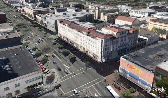
Google has just expanded the 3D building count in three cities, adding tens of thousands of buildings in the process. The three cities are Cologne (Germany), The Hague (Netherlands) and Berkeley (California, US). Here’s a shot of how Berkeley looks with all of the new 3D buildings:


berkeley-ca.jpg 

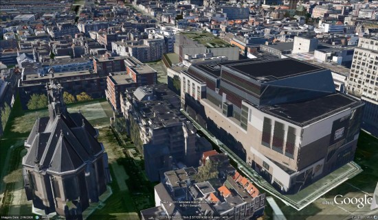
While all three cities look great, the most interesting has to be The Hague. If you’ll remember, there was a large workshop back in February where 60 people got together to help build out the city in 3D. The workshop must have gone quite well, because the city looks great!


hague.jpg 

Congrats to all of the users that participated in modeling out that city. Also, thanks to anyone else whose building showed up today as part of the update — your hard work helps make Google Earth better for everyone!

The world’s longest bridge in Google Earth

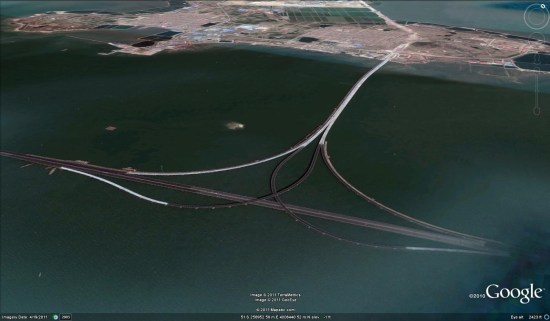
The world’s longest bridge over water, connecting China’s port city of Quingdoa with an airport on the other side of Jiaozhou Bay, has finally opened. The bridge is 26.4 miles long, making it the longest bridge in the world.

The building of the bridge has generated some amazing statistics:

• It stands on 5,200 pillars.

• It cost around $1.5 billion to build.

• It uses enough steel for almost 65 Eiffel Towers – 450,000 tons, along with 81 million cubic feet of concrete.

• It can withstand a magnitude 8 earthquake, typhoons, or the impact of a 300,000 ton ship.

GEC member TomKjeldsen found the bridge in Google Earth, and added a few paths to show the bridge in the “open water” areas that don’t show anything in there.

Qingdao.jpg

To see it for yourself, you can simply use this KMZ file.

The bridge will hold its title for about 5 years; in 2016, a 30 mile bridge is expected to be completed that links Hong Kong with Macao and Guandong province.