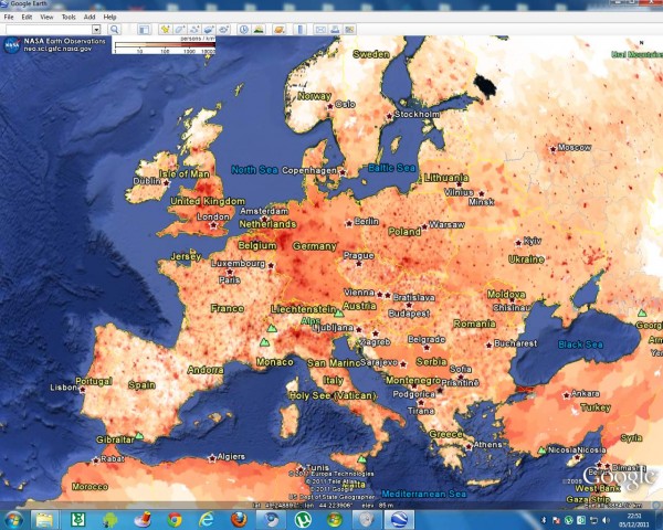
NASA’s Earth Observation site dozens of layers of the global scientific data is formatted for viewing with Google Earth.
These are grouped into the ocean, atmosphere, energy, land, and the Life category. The layers are too many to list, but they include:
Sea surface temperature
Chlorophyll concentrations (MODIS)
Snow cover and sea ice extent
Cloud water content (MODIS)
Total precipitation (TRMM)
Water vapor (MODIS)
The temperature of the land surface
radiation
Active Fires (MODIS)
Land cover classification (MODIS)
permafrost
Vegetation index [NDVI] (MODIS)
The population density
The layers are highlighted in red above were combined into a single network link, which you can download the screenshot below. This will give you a preview of some of the available data. Visit NASA’s Earth Observing site other overlays the data.


