Sixty years ago today, in the Ukrainian capital of Kyiv, the Soviet Academy of Sciences finally granted formal recognition to Sergey Lebedev’s pioneering MESM project. MESM, a Russian abbreviation for “Small Electronic Calculating Machine,” is regarded as the earliest, fully operational electronic computer in the Soviet Union—and indeed continental Europe.
Recently we were privileged to get a first-hand account of Lebedev’s achievements from Boris Malinovsky, who worked on MESM and is now a leading expert on Soviet-era computing.
Described by some as the “Soviet Alan Turing,” Sergey Lebedev had been thinking about computing as far back as the 1930’s, until interrupted by war. In 1946 he was made director of Kyiv’s Institute of Electrical Engineering. Soon after, stories of “electronic brains” in the West began to circulate and his interest in computing revived.

Initially, Lebedev’s superiors were skeptical, and some in his team felt working on a “calculator”—how they thought of a computer—was a step backward compared to electrical and space systems research. Lebedev pressed on regardless, eventually finding funding from the Rocketry department and space to work in a derelict former monastery in Feofania, on the outskirts of Kyiv.
Work on MESM got going properly at the end of 1948 and, considering the challenges, the rate of progress was remarkable. Ukraine was still struggling to recover from the devastation of its occupation during WWII, and many of Kyiv’s buildings lay in ruins. The monastery in Feofania was among the buildings destroyed during the war, so the MESM team had to build their working quarters from scratch—the laboratory, metalworking shop, even the power station that would provide electricity. Although small—just 20 people—the team was extraordinarily committed. They worked in shifts 24 hours a day, and many lived in rooms above the laboratory. (You can listen to a lively account of this time in programme 3 of the BBC’s ”Electronic brains” series.)
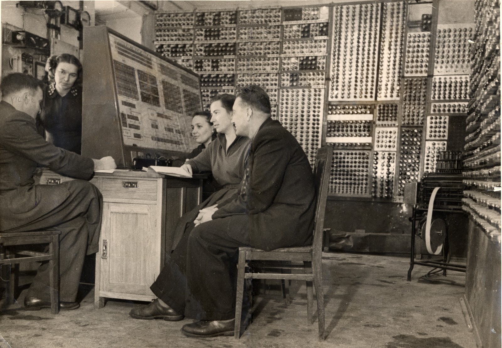
MESM ran its first program on November 6, 1950, and went into full-time operation in 1951. In 1952, MESM was used for top-secret calculations relating to rocketry and nuclear bombs, and continued to aid the Institute’s research right up to 1957. By then, Lebedev had moved to Moscow to lead the construction of the next generation of Soviet supercomputers, cementing his place as a giant of European computing. As for MESM, it met a more prosaic fate—broken into parts and studied by engineering students in the labs at Kyiv’s Polytechnic Institute.
*All photos thanks to ukrainiancomputing.org.

 to see a comparison between some of Dr. Parcek’s imagery and the base Google Earth imagery for the same area.