Google Earth provides some amazing imagery of the earth, but as most of you know, the wide view of earth isn’t the greatest due to the patchwork of imagery across the globe. Fortunately, back in 2006 Frank released the Blue Marble, which uses beautiful imagery from NASA to show off the earth. NASA imagery shows a different image for each month of the year so you see a cloudless representation of the earth with vegetation colors and snow/ice as seen from space for that month, and the file below shows the current month.
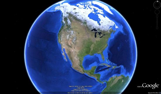
The Blue Marble allows Earth to look more realistic when viewed from space, but the file automatically hides itself as you zoom in so that you can still see the sharp satellite imagery on the ground.
Due to some issues with the file locations, Frank recently had to update the file. While he was in there he made some nice tweaks to it, including removing the old cloud images. The result is a great-looking, lightweight file to make Google Earth look excellent! Frank had hopes Google would someday add such a feature into Google Earth, but there’s no sign of that yet. Best viewed if you turn off other layers like the Borders layer so it looks more like the view from space. You can also turn on the Weather->Clouds layer and the View->Sun menu option to add realism.
To try it for yourself, simply download this KML file and that’s it! Thanks to Frank for continuing to maintain such a great add-on.
You can also view a Blue Marble time animation Frank created that shows all 12 months of the Blue Marble in Google Earth.


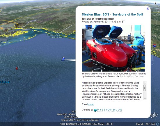
 to view the expedition. Through the KML you’ll find photos, videos, updates and links to updates on the National Geographic Mission Blue blog