Follow the Mission Blue expedition to Salas y Gomez

While many of us would like to embark on a voyage across the ocean, we can’t all be Frank Taylor. Fortunately, Google Earth provides a great way to explore places virtually, such as with the latest installment in the “Mission Blue” series.

Last month, we showed you Mission Blue’s tracking of the gulf oil spill recovery effort. This month, they’re heading east from Easter Island to the tiny island of Salas y Gomez in an effort to do some research in the largely unexplored waters around the island.
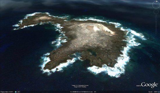
salas.jpg

As with the gulf spill mission, they’re providing updates in a variety of ways. You can track it by finding the blue ship icon near Easter Island (be sure the “Places” layer is turned on), by downloading this KML file, or you can track them in the Google Earth Gallery using the Google Earth Plug-in.

Salas y Gomez was updated in the most recent imagery update, featuring imagery that is just a few weeks old. It’s a bit fuzzy, but it’s much better than what they used to have there. To check out the island for yourself, you can fly there using
this KML file.

For more, check out the full entry on the LatLong Blog or read stories from the crew on the Mission Blue News Watch blog.
Mission Blue: Tracking the gulf oil spill recovery effort

Last April, we were all very aware of the major oil spill in the Gulf of Mexico. There were a variety of tools released to help track the spill, including aerial imagery, visualization tools, EPA data and much more.

However, now that the leak has been stopped for a while, people are turning their attention elsewhere. That’s where Mission Blue comes in. Their primary goal is to “raise public awareness and move people to help protect this vital natural resource”, and in this case they’re working to “identify areas with potential for Gulf ecosystem recovery”.

Because the impact of the oil spill is still under debate, they’re out on an expedition into the Gulf to see how the area is recovering from the spill. While they’re out there, information and videos are being shared as often as possible.

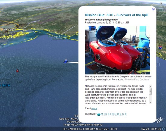
mission-blue.jpg

If you have the “Places” layer turned on in Google Earth, you can click the blue ship icon just outside of Pensacola, Florida. Alternatively, you can simply download this KML file to view the expedition. Through the KML you’ll find photos, videos, updates and links to updates on the National Geographic Mission Blue blog here.

Return to the Gulf of Mexico

With support from Google, the Waitt Foundation, Hope Spots LLC and the National Geographic Society, Sylvia Earle and Mission Blue are embarking on an expedition to the Gulf of Mexico that will take a deep look at how the region is recovering from the five million gallons of oil spilled from the BP Deep Horizon Oil Spill last year. Follow along with the expedition by checking back daily and clicking on the blue ship icon in Google Earth located off of the US coast near Pensacola, Florida, where the expedition begins (make sure the Places layer is turned on). The science team will share updates and media from the expedition, including photographs, videos and links to Google maps on the National Geographic News Watch blog here.
“Our goal is to identify areas with potential for Gulf ecosystem recovery,” said Dr. Earle, founder of SEAlliance and recipient of the 2009 TED Prize that developed into Mission Blue, an international ocean conservation movement. “That is going to require protection of places healthy enough to replenish and rebuild populations. What’s happened here is far from over for the clams and oysters and other sea life critical to a healthy Gulf of Mexico.”

The fate and impact of the spilled oil, gas and dispersants applied following the blowout into the Gulf are the subject of intense discussion by experts. The expedition team, assembled under the broad banner of the Mission Blue initiative, seeks answers to questions about the current status of key species and ecosystems.

Other research participants include: Dr. Thomas Shirley, Larry McKinney, Douglas Weaver and Harriet Nash from the Harte Research Institute at Texas A&M University-Corpus Christi; Edith Widder and Brandy Nelson, Ocean Research & Conservation Association and Carl Safina, Blue Ocean Institute. Research dives are planned using a Dual Deepworker submersible made available to the expedition by the Waitt Institute.

You can also experience the expedition for yourself by downloading this KML for viewing in Google Earth.