New Google Earth imagery of post-earthquake Japan

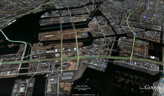
GeoEye is moving very fast after the major earthquake and tsunami that struck Japan yesterday, already pushing out some fresh imagery from Tokyo, Kamaishi and Kushiro.

[UPDATE: Fukushima and Yokohama now available as well]

tokyo.jpg

To see the imagery for yourself, simply download the appropriate file below:

Tokyo: KML

Kamaishi: KML

Kushiro: KML

Fukushima: KML

Yokohama: KML

They’re posting continual update on the @EarthOutreach Twitter account, so stay tuned to that for the most recent imagery as it becomes available.

Also, they’ve just created a special Google Map to show all of the fresh imagery they’ve pushed out, so keep an eye on that as well.

Mission Blue: Tracking the gulf oil spill recovery effort

Last April, we were all very aware of the major oil spill in the Gulf of Mexico. There were a variety of tools released to help track the spill, including aerial imagery, visualization tools, EPA data and much more.

However, now that the leak has been stopped for a while, people are turning their attention elsewhere. That’s where Mission Blue comes in. Their primary goal is to “raise public awareness and move people to help protect this vital natural resource”, and in this case they’re working to “identify areas with potential for Gulf ecosystem recovery”.

Because the impact of the oil spill is still under debate, they’re out on an expedition into the Gulf to see how the area is recovering from the spill. While they’re out there, information and videos are being shared as often as possible.

mission-blue.jpg

If you have the “Places” layer turned on in Google Earth, you can click the blue ship icon just outside of Pensacola, Florida. Alternatively, you can simply download this KML file 
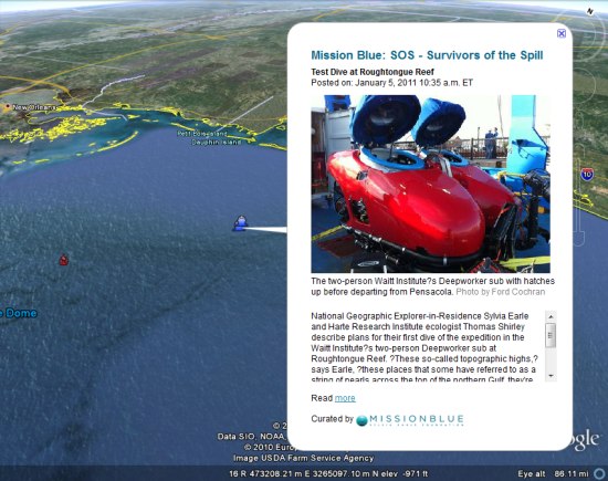
to view the expedition. Through the KML you’ll find photos, videos, updates and links to updates on the National Geographic Mission Blue blog here.