Google Earth New Imagery – March

It’s been a little while since the last update, but it appears that Google Earth has pushed out some fresh imagery! Thanks to GEB reader ‘Andreas’ for letting us know about it.
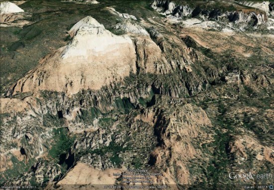
zion.jpg

Due to the new imagery, it’s more difficult to spot fresh imagery. Also, in the time since we first spotted this new imagery it’s also arrived in Google Maps, which makes it even more difficult to determine what is new and what is old. Despite that, we’ve found quite a few areas that have been updated and here is the list so far:


  • Italy: Catania — thanks ‘Munden’
  • Malta: Valetta — thanks ‘Munden’
  • New Zealand: Otorohanga — thanks ‘Munden’
  • Poland: Gdansk, Gdynia, Hel, Poznan, Warsaw — thanks ‘Munden’
  • Serbia: Belgrade — thanks ‘Munden’
  • Russia: Arkhangelsk, Monino, Murmansk — thanks ‘Munden’
  • Slovenia: Ljubljana — thanks ‘Munden’
  • Ukraine: Kurpaty — thanks ‘Munden’
  • United States: California (Beales AFB, Linda, Palmdale, Rosamond, Yuba City), Florida (Apalachicola, Daytona Beach, Gainesville, Jacksonville, Kissimmee, Panama City, Pensacola), Georgia (Valdosta), Illinois (Findlay, Galesburg, Neoga, Taylorville), Louisiana (New Orleans), Mississippi (Jacksonville), South Carolina (Charleston, Hartsville, Lancaster), Texas (Beaumont, Corpus Christi, Freeport, Galveston, Texas City), Utah (Halchita, Mexican Hat, Zion National Park) — thanks ‘Andreas’ and ‘Munden’
New Google Earth Imagery – March 17

It’s been a little while since the most recent imagery update, but thanks to sharp-eyed GEB reader ‘Munden’, we’re now aware that Google has just pushed out a new update!

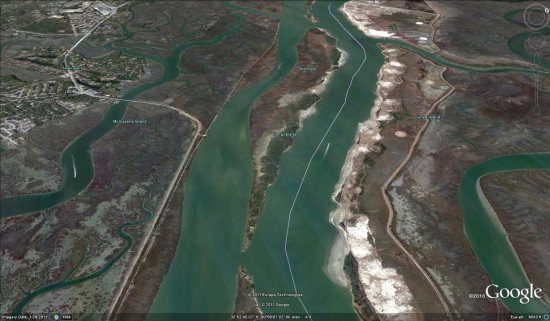
savannah.jpg

As is usually the case, you can use Google Maps to determine for sure whether or not a specific area is fresh. This new imagery isn’t in Google Maps yet, so you can compare Earth vs. Maps to see what’s new; the fresh imagery is already in Google Earth, but the old imagery is still in Google Maps. If you compare the two side-by-side and they’re not identical, that means that you’ve found a freshly updated area in Google Earth!

[UPDATED – 17-March, 11:31am EST]

  • Bahrain: Entire country
  • Canada: Quebec (Granby, Farnham) — thanks ‘Lurgee’
  • Germany: Kappeln, Bad Münstereifel, Wittlich, Kastellaun, Sinzig, Horb am Neckar, Rottenburg am Neckar and others — thanks ‘margin-auto’
  • Japan: (pre-earthquake) Ishinomaki, Kakuda, Minamisoma, Nashushiobara, Soma, Tokyo, Tsuchiura, Tsukuba, Yokohama
  • Poland: Poznan — thanks ‘Paker’
  • Ukraine: Kiev — thanks ‘Roman’
  • United Kingdom: Wales (northern half)
  • United States: California (Arcata, Lone Pine, Los Banos, Merced, Williams, Yuba City), Florida (Boca Raton, Gainesville, Ocala, Oxford, Palm Springs, Spring Hill), Georgia (Buchanan, Jefferson, Savannah), Kansas (Lawrence, Manhattan, Wamego), North Carolina (Asheville), Washington (Sequim, Carlsborg), Wyoming (much of Yellowstone Park including Old Faithful) — thanks ‘GT’ and ‘S B’

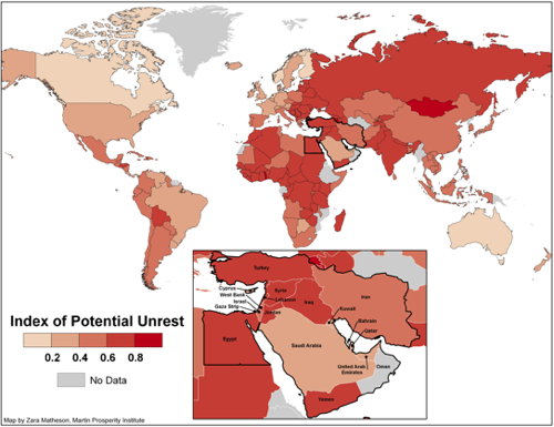
Index of Potential Unrest

Richard Florida’s Index of Potential Unrest attempts to predict “unrest and revolutionary activism” in the Middle East and elsewhere:

With the help of my colleague Charlotta Mellander, we pulled together statistics from 152 nations and sorted them according to eight key variables: human capital levels in combination with percent of the workforce in the creative class, life satisfaction, GDP per capita, perceptions about local labor market conditions, Internet access, freedom, tolerance, and honesty in elections. The data comes from the World Bank, the International Labor Organization, and the Gallup Organization. The map below shows how these nations stack up.

Index of Potential Unrest