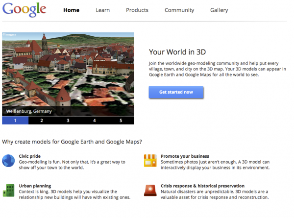
High Performance KML for Maps and Earth


The Keyhole Markup Language (KML) is an open standard for geographic data presentation. There are over one billion KML files on the web, and yet the vast majority of these files are points on a map.

In High Performance KML for Maps and Earth, Sean Askay and I covered advanced techniques for using KML in Google Earth and the Earth API, as well as introduced other Google platforms that support KML. Our hope is that developers will discover the power of using KML on Google’s platform.

Some of the topics we discussed during our talk:

An Introduction to KML

A quick history and some facts and figures about KML.

Advanced data visualization techniques

We demonstrated two new animation techniques using under-utilized KML tags that make for powerful data visualizations.

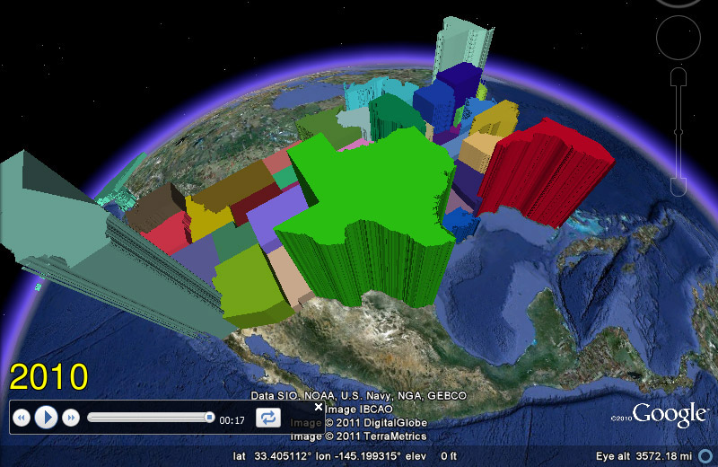
First we showed a time-animated thematic map of U.S. Census data using the and tags to animate the data using a KML Tour. See this post on unchartable.com more information.
We also demonstrated also a proof of concept for pushing near real-time GPS data updates to Google Earth via a that uses and tags to inject new location data into a pre-existing GPS track .

You can download this KML file to see these two techniques in action and the other KMLs demonstrated during the talk.

Developer environment

People often ask us about a developer environment for creating KML, so we covered various options. We looked at editors, validators, and libraries, including the open source library PyKML.

KML on other platforms

We showed how to use KML in the Google Maps API and Google Fusion Tables.

So check out the slides and the video and start bringing the power of KML to your presentations.
 

SketchUp: Discover Your World in 3D

Today, we’re unveiling a totally redesigned Your World in 3D website. If you’re new to geo-modeling — the term given to creating 3D buildings for Google Earth and Google Maps — the Your World in 3D website has all the tools and info you’ll need to get up and running quickly. The new website showcases several examples of what fellow modelers are building and will help connect with other geo-modelers around the world.

So that’s the what, here’s the why. Five years ago, Google acquired a Boulder-based startup called @Last Software, which was making waves in the architectural world with their 3D modeling software, SketchUp. Google had an ambitious idea to add a 3D model of every building on the planet to Google Earth, and SketchUp was a tool up to the task. Not only that, by opening SketchUp to a wider audience, users would have the opportunity to help build a virtual mirror of their world.

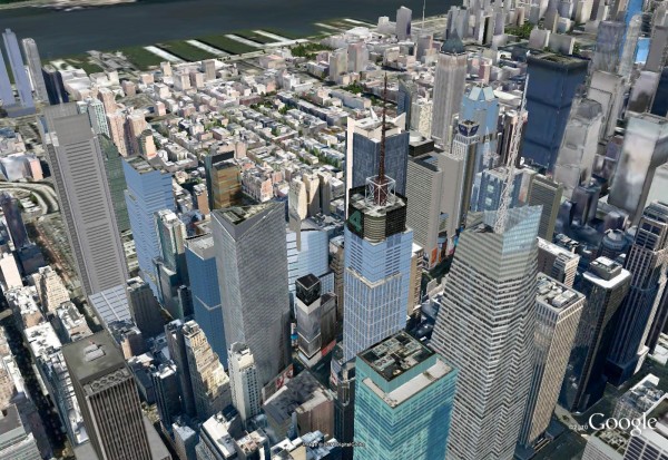
Times Square showcases some of the very first user contributed models

Today, the 3D virtual world is in full bloom: hundreds upon hundreds of villages, towns, and cities have been added to the 3D map representing hundreds of thousands of 3D buildings from every corner of the globe — truly, a testament to the power of open collaboration.

In the intervening half decade, we’ve introduced several new ways of adding buildings to the 3D map, including Google Building Maker and the Cities in 3D program. And you may have noticed 3D buildings surfacing on Google Maps and Google Maps for mobile as well. With so many different ways of creating and viewing 3D models, we realized we needed a destination that would demystify the process of geo-modeling,

Enter: the new Your World in 3D website. We call the website Your World in 3D because it is you, the user, who is helping build this virtual world, and perhaps more importantly, it is you who is finding innovative and surprising ways of using this data.

Your World in 3D has been redesigned from the ground up

Why geo-model? When asked, most geo-modelers say they do it because geo-modeling is just plain fun, but building your town in 3D can also be a great way to show civic pride and encourage tourism for your town. It can also provide an interactive way to promote your business or contextualize the urban planning. 3D modeling has also been used in crisis response situations as we saw in the grassroots modeling effort that happened after the earthquake in L’Aquila, Italy.

Secrets and Surprises in Geo APIs Summer Learning Series

The second session of the Geo track at Google I/O was “Secrets of the Surprises of the Google Geo APIs.” Going into I/O we wanted to have a session that could serve as a foundation for later sessions and one where we can feature some of the latest launches leading up to Google I/O. We covered features of the Maps API v3, the Earth API, Fusion Tables, the Maps API Web Services and the Static Maps API in this one session.

What we hope that you take away from this talk is that there is more to the Maps API than just putting markers on a map – we’ve been actively adding many cool features that can really enhance your mapping application and create a better experience for your users.

Here’s a small subset of the features discussed in the talk:

  • With an ever-growing list of cities with 45° imagery available you’re now able to give your users a new perspective of what a place looks like.
    Don’t forget that there are several easy to enable layers available to quickly add content to your map.
  • Developers have frequently requested the ability for API applications users to drag direction routes around the map in a similar manner to Google Maps, so as you might have guessed, enabling draggable directions in the Maps API is now as simple as a one line code change.
  • A favorite feature of the Maps API is the ability to style the base Google map. With the power to change not only the features shown on the map but the color scheme of those features you have tremendous ability to theme your map to fit a look or brand or remove features that are relevant to your users.
  • Street View in the Maps API v3 is implemented entirely in HTML and Javascript so it’s usable on mobile devices with capable browsers without the use of a plugin. This also gives you the power to provide your own custom panoramic imagery and link it to our standard Street View imagery. Don’t let the experience end at the front door – take your users indoors!
  • We’ve added a Distance Matrix service that lets you quickly and easily get travel time and distance between many origins and destinations in one call.
  • In addition to providing driving, walking and bicycling directions the directions service will even optimize the route, determining the best order to visit several destinations.

We talked about a lot more – including AdSense integration, the Places API, useful open source libraries, Fusion Tables and historical imagery, trees and 3D buildings in the Earth API – check out the video or review the slides to learn more!