San Francisco Tweetography: Twitter Landscapes

Our geo-located twitter data mined from San Francisco has now been processed to create a new look at the city.

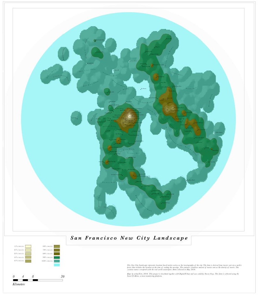
Processed by Fabian Neuhaus, a PhD student here at CASA, University College London, the new city twitter topography creates a unique new media landscape. The data is mined via our ‘Tweet-O-Meter’ system (soon to be seen in physical form in the British Library) which collects all geo-located tweets within a 30km radius of world cities.

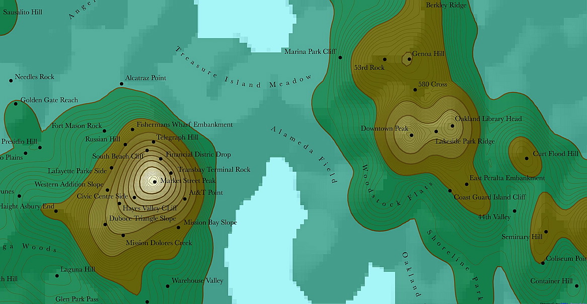
You can view a full screen Google Maps style version of San Francisco over at Urban Tick as well as the previous maps of London, New York, Munich, Paris and Moscow.

Enhanced Flash-Based Local Portals to the Google Map

Google Tech Talks February, 20 2008 ABSTRACT Cheryl Parker, founder of Urban Explorer, will present their patent-pending Flash-based “Local Portals” for the Google Mapping API. Urban Explorer’s “Local Portal” enhances the Google Map with both advanced GIS functionality and dynamically-served polygonal-based map layers. Flash-based map layers are dynamically served via an underlying MySQL database that features time series business, real estate and demographic data sets

http://www.youtube.com/v/W6n68mTBZwI?f=videos&app=youtube_gdata