Google Maps Mashups 3

S-Bahn Munich: Real-Time Map


I’m a great fan of live real-time maps of city transit systems. There is something about watching trains moving in real-time on a map that really appeals to my inner geek.

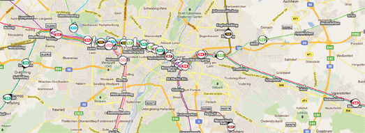
This real-time Google Map of Munich’s S-Bahn shows the transit system’s trains live as they move around the city. Each train is represented on the map with a numbered map marker indicating which line it is travelling on.

You can click on any of the train markers and view its next stop and its destination station. It is also possible to click on any station on the network and view the times and destination of the next trains scheduled to arrive.

The GE Show: Future Flight: Points of Departure
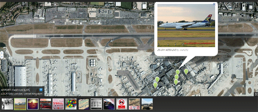

General Electric’s Points of Departure is a nicely designed Google Map showcasing the 6,000 most popular airports in the world. You can browse the airports by name, by the busiest airports, the most scenic or even view those situated on small islands.

Each airport is shown with Google Maps satellite view. Pictures from Flickr are also displayed beneath the map and their location shown on the map with map markers. The map also includes a permalink buttom that allows you to share your favourite map view.

Australian Social Diversity on Google Maps


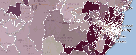
Arek of the All Things Spatial blog has created a series of Google Maps to highlight social diversity in New South Wales, Australia.

The Australian Bureau of Statistics attempts to quantify socio-economic diversity for geographic locations with a suite of four summary measures called Socio-Economic Indexes for Areas (SEIFA). Arek has imported the Bureau’s data for the four measures into Fusion Tables and created a map for each.

Each map provides a heat-map visualisation of one of the measure. In each map you can click on any of New South Wales’ postal areas to view the area’s rank and decile.

Sky Orchestra


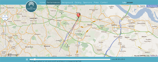
London has today entered into the fantasy world of steampunk. In what seems like an episode from 2D Goggles a number of hot air balloons have been flying over London blasting out music to the populace below.

Don’t worry if you don’t live in London or if you have missed any of the balloons’ flights as you can replay it all on a handy Google Maps based application.

The map shows each of the hot air balloons and their flight track. If you click on the map marker of any of the hot air balloons you can then listen to the music that was played during the flight.

#1yeartogo Twitter Map


There is one year to go to the 2012 London Olympics. A number of events are being held in London to celebrate the occasion (including the flying of musical hot air balloons).

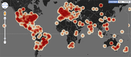
CASA is tracking all of today’s Twitter messages that include the hashtag ‘1yeartogo’ and have created a nice heat map of all the Tweets.

The map is actually a little sneak preview of a new heat map visualisation that will be made available to the general public in the next few weeks on MapTube. CASA are responsible for some of the best Google Maps tools (for example the CASA Image Cutter) so I can’t wait to play with this new heat map tool when it is released.

They Draw & Travel – World Map


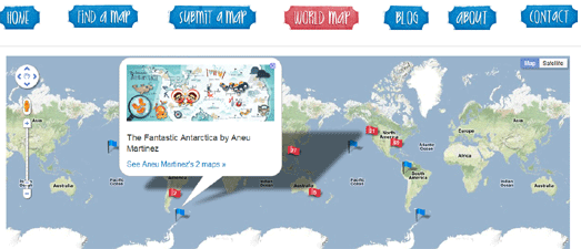
They Draw & Travel is a collection of wonderful user submitted hand drawn maps.

As part of the launch of the website a Marvellous Map competition was held with a grand prize of $1,000 for the winner and 5 runner-ups each receiving $200. The six winners of the competition will be announced on Friday.

The World Map lets you browse the 225 maps (so far) submitted to They Draw & Travel on Google Maps. You can click on any of the 225 map markers and view the hand drawn map submitted for that location.
Official Google Blog


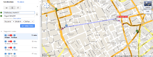
Public transport directions for London has been added to Google Maps. If you want to get around in London you can now get transit directions that include the London Underground, DLR, buses and trams.

To get public transit directions in London on Google Maps you just need to select ‘Get directions’, type in your starting point and destination and click on the train icon that appears in the side panel.

The resulting direction will then tell you which underground station you need to go to and even which tube line you need to catch.
One Day on Earth


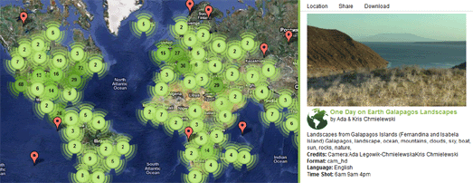
On 10.10.10 One Day on Earth asked people around the world to create a video of their world. The goal of the project was to “create an open shareable archive and documentary film of the world on 10/10/10.”

Whilst you wait for the finished full-length film to be released you can browse and watch the thousands of videos that were contributed around the world on this Google Map.

If you click on a map marker you can watch the selected video in the map sidebar. For each video you can view details, such as where and when it was shot and who by.


By GoogleMapsMania
PND’s sales droping- new modern vehicles offer navigation

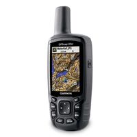
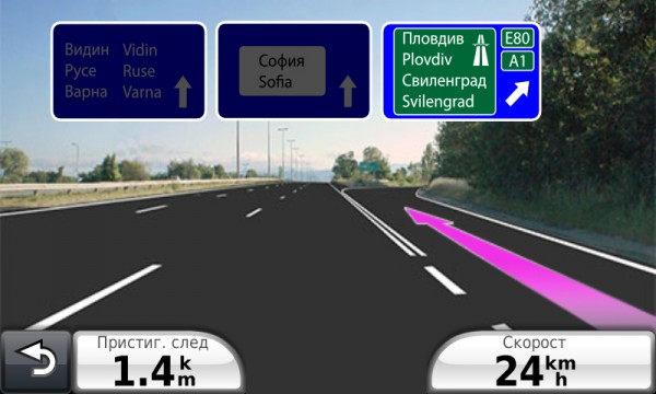
Demand for personal navigation devices (PNDs), the must-have gadget of recent years, is declining as traffic and mapping functions become almost standard in cars and mobiles, forcing Garmin Ltd and Dutch rival TomTom NV to find new revenue drivers to get profits back on course.

Garmin expects the North American PND market to shrink by 25 per cent this year and Europe by up to 10 per cent. TomTom anticipates a 15-20 per cent fall globally, with the steepest falls in North America.

A total of about 41.5 million PND units were shipped in 2010 and that will dip to 39.2 million units this year, according to market research firm IHS iSuppli. Berg Insight sees shipments dropping by a fifth, to 34 million units, by 2015.

PNDs are fast being cannibalized as Google and smartphone makers such as Nokia offer free turn-by-turn navigation.

IHS expects more than 135 million navigation-enabled smartphones to be sold this year, while such phones already in use will almost double to 269 million by 2013.

TomTom CEO Harold Goddijn has said PNDs need to recreate the “cool factor” they’ve lost to tablets and smartphones.

Both Garmin and TomTom posted uninspiring second-quarter results, and were far from upbeat about the outlook.

Both are betting on selling more live traffic and mapping services and navigation devices that auto makers integrate into dashboards.

Garmin has bought Germany-based Navigon to gain more exposure to this in-dash market and boost its core automotive/mobile business, which includes PNDs and accounts for more than half its total revenue.

TomTom’s automotive business accounts for a fifth of group revenue and is its fastest growing unit, but growth is slowing.

Beyond current deals with Renault, Fiat and Mazda, TomTom investors want to see a new major car deal to propel the unit, said Nomura analyst Stuart Jeffrey.

But the in-dash market itself is no panacea.

Selling to auto makers means having to put up with sales cycles, lower margins and a reliance on fickle, belt-tightening consumers who are spending much less on buying new cars.

SET FOR A MARATHON

Eyeing other opportunities, Garmin is looking to the fitness market, tapping into demand by athletes and joggers for watches with GPS sensors.

Its marine unit offers products to plot charts, find fish and hook up on marine networks, while its aviation unit offers automatic flight control and air-traffic advisory systems.

“I think by 2012-13, we’ll reach an inflection point where the auto/mobile unit is less material and other units have a bigger contribution,” said Wedbush analyst Scott Sutherland. “I think revenue is going to stabilize from that point in time.”

Apart from a brief flirtation with Nike about a sports watch, TomTom hasn’t diversified far from automotive navigation, and still relies heavily on its mapping database, which it bought in 2008 with the 2.9 billion euro acquisition of map supplier Tele Atlas.

TomTom’s only competition in the commercial digital map market is from Google and Nokia Oyj’s Navteq.

The Dutch firm has an app for Apple’s iPhone, is working on a Google Android app, and has expanded its content and service offerings to include live traffic, smart or predictive routing information, weather forecasts and location-based points of interest which is layered on the mapping data.

But for all its efforts to transform into a content and service franchise, earnings remain dependent on PNDs.

TomTom issued a profit warning in June due in part to more customers opting for entry-level kit and not subscribing to live content and services. It also warned of increasing inventories – a sign that Christmas sales may be less than robust.

Garmin is also bundling its PNDs with high-margin live traffic and mapping services, but the nature of the business doesn’t allow up-front revenue recognition, and the strategy may only start paying off in the latter half of 2012.

By The Globe And Mail

Cool App: The Kansas airspace awareness tool


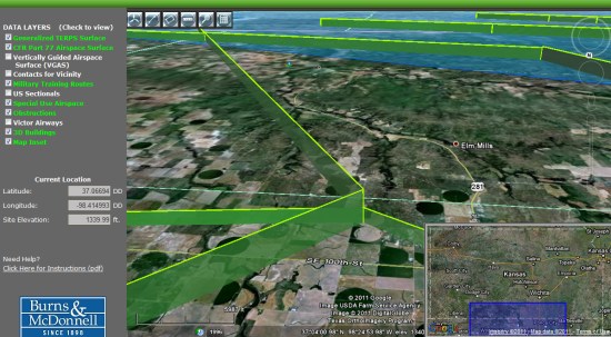
Back in February, the Kansas Department of Transportation announced its new Airspace Awareness tool, which they recently launched.

The software, funded by a grant from the Federal Aviation Administration, allows pilots to visualize data that is normally only presented in 2D charts or apps, rather than the 3D data available here.


airspace.jpg 

According to the Aircraft Owners and Pilots Association, there were more than 2,000 airspace analyses performed in Kansas in 2010, some of which resulted in conflicts with local airspace. With this application in place, the system will alert users to contact the FAA in the event of any potential aispace conflicts with tall structures, such as wind turbines.

As of right now, Kansas is the only state with this kind of system in place, but if things go well I expect we’ll see other states introduce similar applications in the near future.