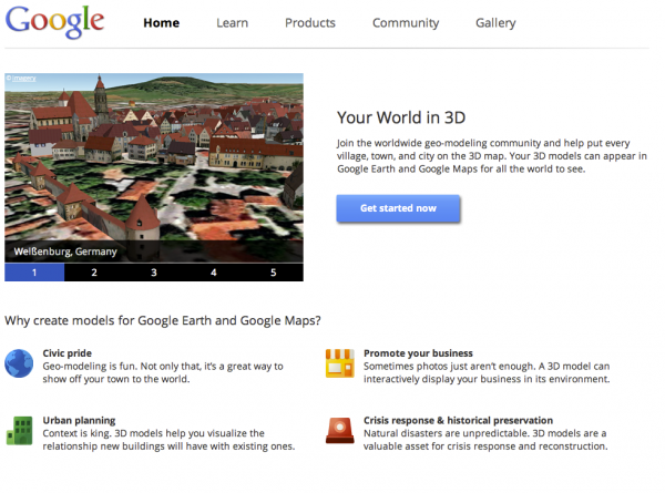
SketchUp: Discover Your World in 3D

Today, we’re unveiling a totally redesigned Your World in 3D website. If you’re new to geo-modeling — the term given to creating 3D buildings for Google Earth and Google Maps — the Your World in 3D website has all the tools and info you’ll need to get up and running quickly. The new website showcases several examples of what fellow modelers are building and will help connect with other geo-modelers around the world.

So that’s the what, here’s the why. Five years ago, Google acquired a Boulder-based startup called @Last Software, which was making waves in the architectural world with their 3D modeling software, SketchUp. Google had an ambitious idea to add a 3D model of every building on the planet to Google Earth, and SketchUp was a tool up to the task. Not only that, by opening SketchUp to a wider audience, users would have the opportunity to help build a virtual mirror of their world.

Times Square showcases some of the very first user contributed models

Today, the 3D virtual world is in full bloom: hundreds upon hundreds of villages, towns, and cities have been added to the 3D map representing hundreds of thousands of 3D buildings from every corner of the globe — truly, a testament to the power of open collaboration.

In the intervening half decade, we’ve introduced several new ways of adding buildings to the 3D map, including Google Building Maker and the Cities in 3D program. And you may have noticed 3D buildings surfacing on Google Maps and Google Maps for mobile as well. With so many different ways of creating and viewing 3D models, we realized we needed a destination that would demystify the process of geo-modeling,

Enter: the new Your World in 3D website. We call the website Your World in 3D because it is you, the user, who is helping build this virtual world, and perhaps more importantly, it is you who is finding innovative and surprising ways of using this data.

Your World in 3D has been redesigned from the ground up

Why geo-model? When asked, most geo-modelers say they do it because geo-modeling is just plain fun, but building your town in 3D can also be a great way to show civic pride and encourage tourism for your town. It can also provide an interactive way to promote your business or contextualize the urban planning. 3D modeling has also been used in crisis response situations as we saw in the grassroots modeling effort that happened after the earthquake in L’Aquila, Italy.

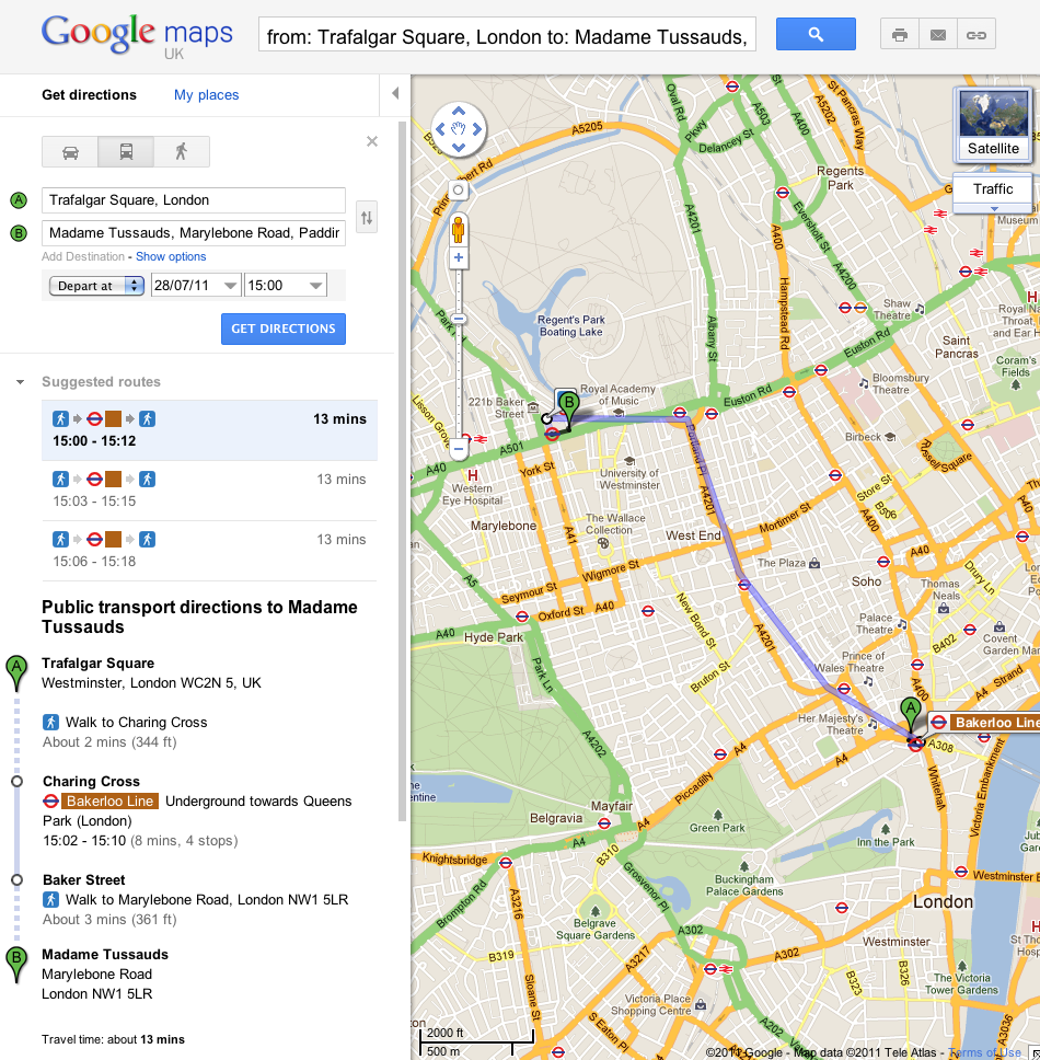
The London Underground with Google Maps

Starting today, you can get public transport directions for London within Google Maps. One of Europe’s largest metropolitan areas, London is a major destination for both business travelers and tourists. More than 1 billion passengers are serviced by Transport for London (TfL) every year across over 18,000 bus stops and over 250 Underground stations.

Let’s say you’re at Trafalgar Square, and you want to visit Madame Tussauds. With a simple directions search, you’ll see all the possible public transport connections. In Maps, click “Get directions” in the left-hand panel, and then the train icon to see public transport directions. Enter your departure location next to A, and your destination next to B. These can be either street addresses or names of popular places, businesses or restaurants. When you’re done, click the “Get directions” button and suggestions for your trip will appear below.

Public transport directions are available on both Google Maps and Google Maps for mobile, so you always have access to a trip planner. When you’re on mobile, Maps even uses your current location to determine the best trip to your destination. Just search for your destination location, select it on the map and choose the “Directions” option. The suggested trips will be based on your location by default, and provide you multiple alternatives whenever possible.

If you’re using an Android-powered device, you can also get public transport directions with Transit Navigation (Beta) in Google Maps. With this new feature, which we launched earlier this month, you’ll get alerts when it’s time to get off the bus or train at your destination or to make a transfer. Transit Navigation is available in all regions where public transport directions are available, including London.
TfL is among the first agencies in a major European city to make its timetable information publicly available through the London Datastore. We’re strong supporters of open data and bringing information out into the open, and believe that making information publicly accessible can be an enormous engine of economic growth and innovation. ITO World has been a great partner in this launch by ensuring TfL’s data was adapted correctly and ready for our use.

Public transport directions are available for all Underground, bus, tram and Docklands Light Railway (DLR) lines, and we’ll include more public transport information as soon as it’s available. Whether you use public transport every day or infrequently, as a commuter, on a business trip or as a tourist, we hope that public transport directions in London make planning your trips more convenient!


Lifted from the Official Google Blog

Google Developer Day coming to a city near you in 2011


As Vic Gundotra announced previously, Google Developer Day (GDD) will be coming to eight cities in 2011. Please save the date, as we prepare to bring our world tour of GDDs to a city near you.

  • September 16: Sao Paulo, Brazil
  • September 19-20: Buenos Aires, Argentina
  • October 10: Moscow, Russia
  • October 18: Prague, Czech Republic
  • November 1: Tokyo, Japan
  • November 8: Sydney, Australia
  • November 13: Tel-Aviv, Israel
  • November 19: Berlin, Germany

Google Developer Days are a chance to learn about our latest developer products and meet the engineers who work on them. As in years past, we will have an application process when registration opens, so stay tuned, as we will continue to bring you updates.