The California Bay Area, now in 3D

Nearly five years ago, Google embarked on an ambitious project to work with everyday users like you to create a 3D model of every building in the world for Google Earth. We’ve made strides toward our goal adding millions of buildings to the 3D layer of Google Earth in cities across the globe. And today, we’re pleased to announce another big step in that direction with the release of expanded 3D coverage of the California Bay Area (which also happens to be the homebase of Google’s headquarters!).

With Google Earth’s “3D Buildings” layer turned on (or by using the Earth View in Google Maps), you are now able to tour tens of thousands of new buildings in the 50-mile stretch between San Francisco and San Jose, as well as select areas of the East Bay, like Oakland and Berkeley. You can now fly through the air and view urban centers of cities like Foster City, Mountain View, Palo Alto, Oakland, Redwood City, Santa Clara, Santa Cruz, San Mateo, and Sunnyvale, in 3D.

If you’ve never been to the Bay Area, start by visiting iconic landmarks like the Golden Gate Bridge and the Ferry Building (note: you will need to have the Google Earth plugin installed to view these links). While in San Francisco, you may notice that in addition to 3D buildings, there are also 3D trees throughout the city. This is a new feature we released with Google Earth 6.0, and San Francisco is one of the first few cities to showcase 3D trees.

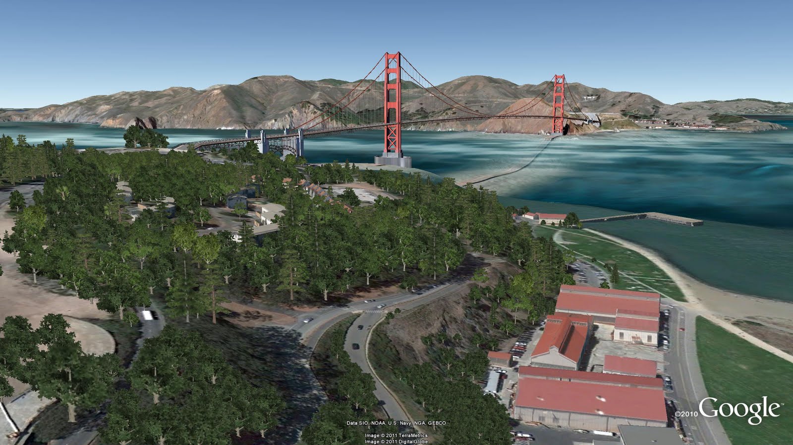
The Golden Gate Bridge and 3D trees

The Bay area peninsula is also the home of Silicon Valley. Several technology companies are available to view in 3D, including of course, the Googleplex in Mountain View.

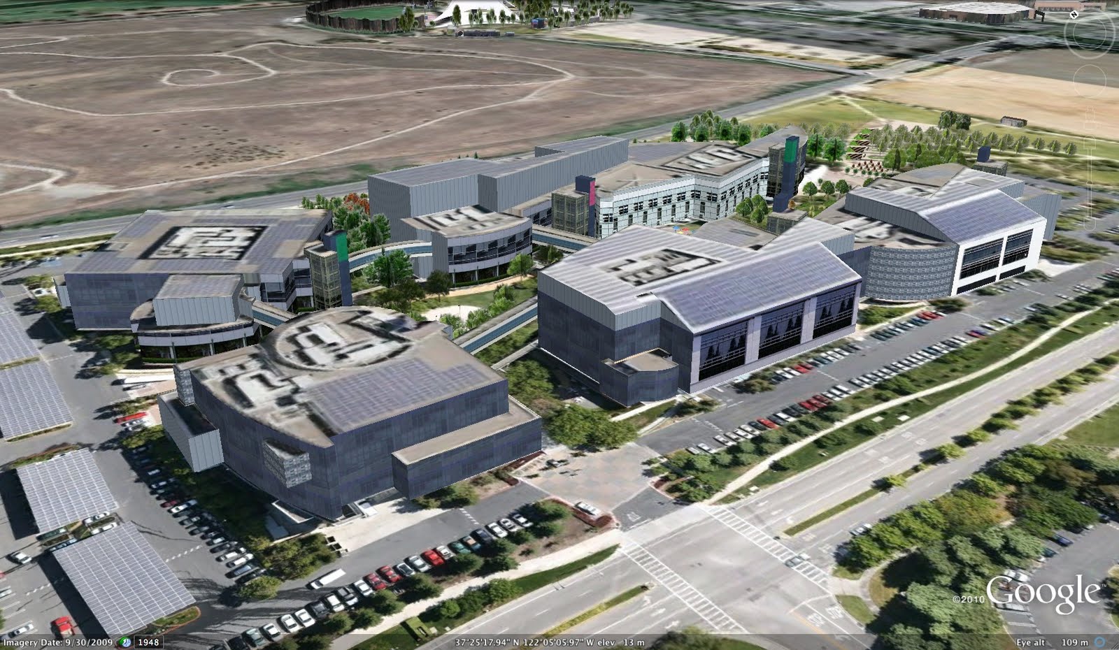
Googleplex in Mountain View, CA

Sports fans might be interested to check out the HP Pavillion, where the San Jose Sharks play, as well as AT&T Park, home of the 2010 worldseries champion, SF Giants. Music lovers may also want to view the Oracle Arena in Oakland and Shoreline Amphitheatre in Mountain View. If you’re starting college soon, take a virtual tour of the Stanford and UC Berkeley campuses.
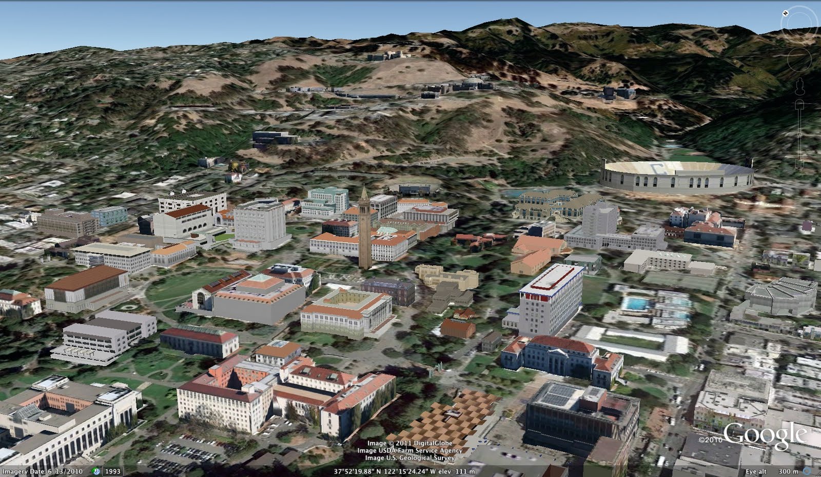
UC Berkeley Campus

Of course, this is just a small sample of the several thousands of buildings you’ll find in the area. You can check out an expanded tour we created, or you can open up Google Earth and explore for yourself. As you go on your virtual tour, you may notice that several buildings were created by users, who continue to be an integral part of our 3D building efforts. For example, supermodeler, PeterX created nearly 1,000 buildings around the Bay Area, including the NASA Ames Research Center.

PeterX’s model of the wind tunnels at the NASA Ames Research Center

If you’d like to get involved in modeling your town (or any other location), we have several free (and easy!) tools to get you started. With Google Building Maker, you can create and contribute a building in as little as 10 minutes. And if you’d like to refine your building, bring it into Google SketchUp for fine-tuning.

Everyday, we are working on adding more 3D cities to Google Earth as part of our larger mission to organize the planet’s geographic information and make it accessible to all.

Happy touring!

5 Great Ad Commercial Campaigns + Maps

The Google Maps API has always been a great way to visualize data, but recently more and more advertising agencies are realizing the potential that the Maps API has for creative and engaging product campaigns.

Whether it’s automobiles, zombie trains, a blockbuster action movie, a board game, or even a bathroom cleaning product, there’s a map application for that product and it is changing the face of interactive advertising.


Domestos Flush Tracker

Domestos is a brand of bleach sold in the UK, South Africa, and Poland. As an advertising campaign for this bathroom product, Domestos created a “Flush Tracker” that lets you track where your flush goes after it leaves your house and enters the local sewer system. The animated line on the map simulates the speed at which refuse moves the through sewer system.


A-Team – Drive the A-Team Van

Nothing is more iconic of the A-Team than Mr. T’s van. Using the Earth API, users can drive Mr. T’s van through 3D models of 15 international cities. This implementation was seamlessly embedded into a YouTube landing page for the movie, where users can watch special movie clips that are unlocked by completing certain driving stunts.


Virgin Trains – Don’t Go Zombie…

From Virgin Trains, “The streets have been taken over by frustrated car-driving zombies who need to be saved. They have to get to the comfort of a Virgin Train and only you can help them with your special ticket machine. Follow the Map to get to your destination, saving zombies on the way.”


Alfa Romeo – Virtual Ownership


Using the Street View API, users can plug in their address and virtually place an Alfa Romeo Giulietta in their driveway. The size, color, and positioning of the vehicle can also be manipulated, creating the perfect postcard to share on Facebook, Twitter, or email to a friend.

Monopoly City Streets

Although no longer live, this highly addictive, global Google Maps version of Monopoly will always be remembered as a great advertising campaign. Users could buy any street in the world and build hotels, houses, stadiums, castles and skyscrapers (to name a few). Fortunately, this truly unique idea was well documented and you can view demos of the game on YouTube: http://goo.gl/p0aEh and http://goo.gl/uXx4k

Street View in Romania

Bram Stoker’s world famous novel Dracula was believed to have been inspired by fifteenth century Wallachian Prince, Vlad Dracul from Romania (better known to many as Vlad the Impaler). The legend of the vampire is still deeply rooted in Transylvanian culture today, and tourists from across the world come to explore the history and mystery of the many beautiful castles that can be found here.
But of course those aren’t all the sights Romania has to offer, and now you can see for yourself, because today we’re making 360-degree Street View imagery available in Romania for several cities and roads.
From your virtual vantage point, you can now take a look over the bridge onto Lacul Vidraru (Vidraru Lake). This is the starting point of the most beautiful road in Romania, the Transfăgărășan mountain pass, which at its highest point reaches 2,034 meters above sea level:
Or check out the summer residence of Romanian Kings, Castelul Peleș (Peleș Castle):
It’s not just Paris that has an Arc de Triomphe. You can whizz round the Romanian
Arcul de Triumf in the capital Bucharest:
And here’s our parliamentary palace, Palatul Parlamentului (Parliament Palace):
There’s heaps to explore but I’ll leave you with one final tip, and that’s to visit
Vatra Ardealului, my favorite cofee shop in Brasov, which you can see below:
Welcome to Romania and enjoy your virtual exploration!