Breaking News- Google Thinks it Needs “Some Support” In Maps

Yesterday Marissa Mayer was quoted as saying in regards to Maps and Places at SXSW: “We do need to have some support there, and step up our customer service,”.

I must admit as a veteran of the “Google Maps support wars”, it was refreshing to hear Marissa Mayer (allegedly?) note the need for support. That being said the fact that it’s taken Google 5 years (or is it 6?) to figure this out and get to the point of publicly so noting has to be cause for concern.

Related posts:

  1. Google Places Dashboard – There’s Good News and There’s Bad News
  2. Google Maps: Good News Bad News Announcement
  3. Is Google Maps Reducing Customer Support?

Google Maps: A new angle on the world with 45° imagery

I’m a window seat person. If given the choice on a plane, I will always take the window seat, and not just so other passengers need not climb over me while I sleep. It’s also because I love the views during take off and landing. Whether it’s flying out over Sydney Harbour, or coming in to land over the Houses of Parliament in London, the view from a plane is a unique perspective on the world below.
Starting today you can bring that perspective to your Maps API applications with the launch of 45° imagery in select cities around the world. 45° imagery offers a superior perspective of city skylines than an overhead view. Tall buildings stand out from those around them, and iconic landmarks such as St. Mark’s Square in Venice are instantly recognisable. In addition you can rotate the map to look at buildings from all four sides:
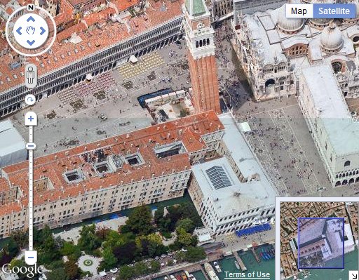
You can track the cities where 45° imagery is currently available on this map. When 45° imagery is available a submenu option is added to the Maps API Satellite button. Right now the overhead imagery remains the default view for these areas. However in three weeks time this will change to match Google Maps, and the 45° imagery will become the default Satellite view where available.

Street Slide Bing Maps

In the video above Blaise Aguera y Arcas of Bing is demonstrating a new Photosynth application for iPhones. The application is expected to be released in the coming months.

It looks like Photosynths captured with the iPhone could be added to Bing Maps. In the second half of the video Blaise demonstrates Street Slide. Street Slide is a side on view of a road, which can be scrolled left and right. If you zoom in Street Slide seamlessly integrates with Street Side (Street View) views.

Street Slide is available in the lastest version of Bing for iPhone.