We’ve written a few posts recently with information about Japan in the wake of their horrible earthquake and tsunami, but the data keeps pouring in so here’s an update on everything that is available to you.
On Friday, we listed all of the available resources, including Google’s very useful People Finder tool. On Saturday, Google started pushing out fresh imagery of the area, courtesy of GeoEye. Check out that post for the list of cities available.
Since then, they’ve also released imagery for Sendai and the surrounding area, which you can view using this KML file .
.
To make it easier to keep up with all of this new imagery, Google has created an all-in-one KML file that includes all of the various imagery updates. On top of that, they include some stunning before/after placemarks for areas that were hit especially hard. Here is an example:
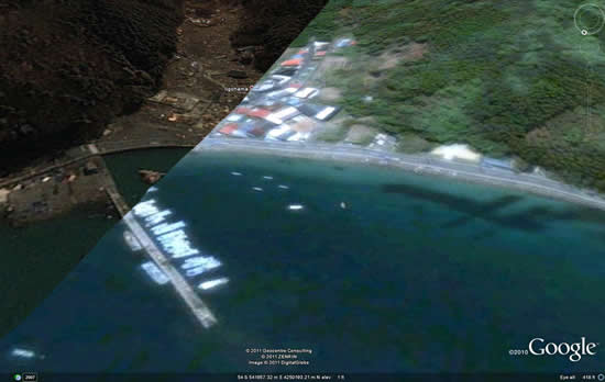
For easier viewing, those before/after shots can also be found in this Picasa web album.
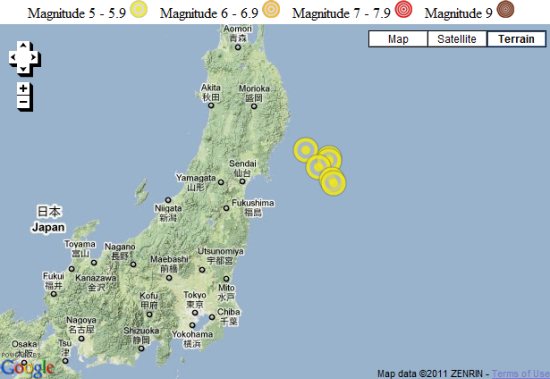
The LA Times has built an interactive timeline of the quakes.
The Washington Post used Google Maps to show their “Wave of Destruction” map, highlighting some of the hardest hit areas.
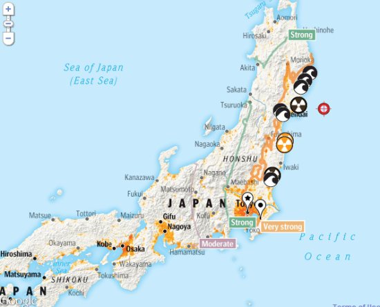
Harvard built a map to show the location of all of the nuclear sites in Japan.
Google Maps Mania also has quite a few more Maps-based resources listed in these two posts.
Finally, Google’s @EarthOutreach twitter account remains to be the best source for updated info/maps, so keep an eye on them.