The Read/Write World connect of the world’s geo-linked media

The experience is best described in the following write up, by David Gedye, Principal Program Manager for Bing Mobile’s Augmented Reality Team:

In a keynote today at the Where 2.0 conference,  Blaise Agüera y Arcas, Chief Architect of Bing Mobile, shared Bing’s plans for the “Read/Write World.”
The Read/Write World is a project to index, unify, and connect of the world’s geo-linked media. Consisting of a cloud-based geo-indexing, matching and processing services, the scenarios it will enable include:
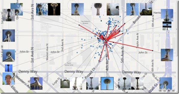
  • Seeing your photos automatically connected to others.
  • Being able to simply create immersive experiences from your own and others’ photos, videos,  panoramas, and models
  • “Fixing” the world, when the official imagery of your street is out of date.
  • Visually mapping your business, your rental apartment, or your local strip mall, and allowing everyone to explore it.
  • Understanding the emergent information from the density and tagging of Geo-media
Microsoft will provide open source viewing code and cloud-based services to power the Read/Write World, and will make available its beautiful map imagery and more than 50,000 “synths” and panoramas that have been publically shared to the Photosynth Web site.

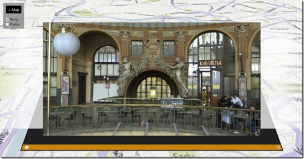
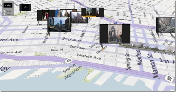
Read / Write World allows users to view fully integrated Block View images on a Bing Map.

Read / Write World interlaces Bing Maps, Photosynths, and the new Reality Markup Language-tagged images to be associated with their respectively places in the world.

We are also proud to announce that the incredible 360 Cities panoramas – the world’s largest and fastest-growing collection of immersive panoramic imagery — are going to be indexed by the Read/Write World, with many available for Creative Commons reuse, under the control of the original photographers.
The more than 90,000 professionally shot panoramas of the world’s landmarks, natural wonders, historic buildings, and places of interest will join forces with the incredible imagery assets of Bing Maps and the Microsoft Photosynth community to create a rich trellis for the Read/Write World.

“Bing is a great partner for 360 Cities” said Jeffrey Martin, founder of 360 Cities. “Bing has created beautiful visual experiences on the web, and shares our passion for high quality imagery. Our network of photographers is very excited to be working with Bing to bring their amazing work to such a wide audience.”
“The 360 Cities panoramic photography is just gorgeous,” said Blaise Agüera y Arcas, architect of the Read/Write World. “It’s exciting to see this community’s beautiful imagery linked into an ecosystem where it’ll be able to connect to and augment the growing corpus of geo-linked media we’re indexing at Bing.”
The Read/Write World is in development at http://readwriteworld.cloudapp.net. You can read more about it there, see videos, and experiment with some of the early code.
Oops, did we just change the world again? I think so! More to come on how developers can engage with Read / Write World and Reality Markup Language (RML) in the coming months, but what you can expect is a schema-less data format, very flexible, where we only need to know several common things like location and author. A platform that is highly user-extensible in JSON-type and XML syntax.
Google Mapmaker: Reflecting the ever-changing world around us

These edits are often visible immediately on Map Maker, but aren’t seen by most users until they’re published on Google Maps. In the past we would process edits in large groups, which meant it could take weeks before approved edits appeared on Google Maps. In preparation for yesterday’s launch, we recently added a new publishing system to reflect Map Maker user contributions on Google Maps more quickly. Once a Map Maker edit has been approved, it will now appear on Google Maps within minutes.

You often have the latest information about changes that occur in the places where you live and work. If a new coffee shop opens along your way to work, or you discover a tennis court nearby, you can add to or update the map and help other users find those spots just minutes after your edit is approved.


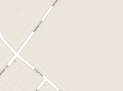
Map before user contributions


Map after user contributions, showing tennis courts in Rehoboth Beach, Delaware


With our new publishing system and the efforts of the Map Maker community, we’re working together to make Google Maps a more detailed, up-to-date reflection of the world around us. You can see the results of these efforts through real-time edits by users around the world atmapmaker.google.com/pulse. To add your local knowledge, learn more or get started mapping at mapmaker.google.com.

More about Google Earth Builder

In a nutshell, Google Earth Builder is a new way for companies to share their vast repositories of geo data. Rather than needing to configure servers and support a local infrastructure, they can simply upload their data to Google Earth Builder and share it that way. It uses a sharing model quite similar to Google Docs (private, individual access, or public), and the data streams extremely quickly.

The implications of this could be huge. Not only will it be a great solution for large corporations and government entities, but provides a way for any company to generate data for a specific client (such as custom 3D buildings) without necessarily having to post them for the world to see.

An interesting point that Google made is that this data will be easily accessible to anyone (with permission) from their desktop, laptop, smartphone, tablet, etc. That makes sense, but currently the tablet and smartphone clients for Google Earth likely can’t handle this kind of data. Either their comments have been misinterpreted by everyone (including cnet and others), or we’re hopefully looking at some nice updates to their mobile products in the coming months.

They keys that Google seems to be pushing with this is that it’s easy and fast. Both of this seemed clearly evident in the live demo that they provided on stage yesterday. You can watch that video demonstration below:

There were a few fun facts in that video: There have been more than 700 million downloads of Google Earth and that people use Maps and Earth for more than one million hours every day. Wow!

The fact that Google Earth Builder isn’t due out for a few months (some sites say July, Google says Q3), means that it will only be getting faster and smoother. This could be a brilliant tool to help large entities deal with their vast amounts of data, and we’ll find out once it launches later this year.