
TomTom’s already seen Google muscle in on its turf in a big way, and it looks like it might now be trying to return the favor. If camera-toting vans like the one above are any indication, it would appear that the company is currently working to bolster its navigation options with its own Street View-like service. So far, all of the van sightings seem to be confined to Europe (France and Belgium, specifically), and they of course don’t necessarily confirm that TomTom is indeed working on a Street View competitor — although we have to wonder what the vans are for if it’s not. It’s also worth noting that TomTom did acquire TeleAtlas, which uses vans equipped with cameras, lasers and GPS in the actual creation of its maps, but the higher, 360-degree camera used on these vans seems much closer to those used on Google’s Street View cars.
The most-popular iPhone navigation apps

TomTom U.S.A. navigation app.
The most significant development in portable navigation this past year has been the rapid advance of smart-phone navigation apps. Apple has led the charge with several brand-name companies developing conventional nav apps. Apple presents a year-end score card showing which are the most popular by three measures: Top Grossing, Best-Selling Overall, and Most-Popular Free.
Top Grossing Navigation App
TomTom has earned the title as the Top Grossing navigation app with its TomTom U.S.A. application (currently $49.99), followed by Navigon MobileNavigator North America ($59.99). Both applications faithfully mimic the experience of using a dedicated navigation device, while integrating into the iPhone well with their latest iterations.
MotionX GPS Drive ranks third with a 99-cent app that offers 30-days of voice guidance for $2.99 and a full year for $19.99.
Geocaching from the group that popularized this form of electronic treasure hunting, Groundspeak, provides a paperless way to enjoy the hobby. At $9.99, the Geocaching app provides a way to access information on more than a million geocaches around the globe, download their coordinates and tips, track down treasures, and log your finds.
The final Top 5 grossing nav app is TomTom U.S. & Canada. As the name implies, this $59.99 application expands on the lower-priced U.S.A. version with broader maps and points of interest.

MotionX GPS Drive
Best-Selling Navigation App
In this category, we see similar players to Top Grossing, though the order has been shuffled. The best-selling nav app for 2010 was the MotionX GPS Drive, followed by MotionX GPS ($2.99), an outdoors-focused navigator for walking, hiking, cycling, skiing, geocaching, and more.
With a clear brand advantage as the defacto site for geocache enthusiasts, Geocaching ranked third.
TomTom U.S.A. made the list, but Navigon did not. Instead, “Where To?” ($2.99) made the cut, an application focused on finding points of interest, such as the nearest restaurant. It can share locations by email, text, and a variety of social networks.

MapQuest 4 Mobile
Most-Popular Free Navigation App
The top free applications are a diverse group. Before Google Maps entered the scene, MapQuest.com was the go-to site for printing directions, and now the site has a popular, free iPhone app called MapQuest 4 Mobile with voice guidance.
While most apps focus on going from point A to point B, Trapster uses crowd sourcing to share the locations of speed traps.
Proving free often comes at a price, the AT&T Navigator is a popular download with a $9.99 per month fee, or $69.99 annual subscription. While there can be appeal in the flexible pricing plan, most users who will want turn-by-turn guidance would find more affordable options than this so-called free app.
A free version of its MotionX GPS ($2.99), MotionX GPS Lite has a lot of guidance features for active lifestylers and a broad map set that includes, Google and Bing road, satellite, and hybrid maps, along with topographic maps.
Not to be confused with Where To?, Where is a points-of-interest guide that helps you find nearby places, share recommendations, and receive suggestions on where to go next. Local guides add depth to the app, and businesses offer deals to encourage visits.
Bottom line
Popularity doesn’t ensure quality. Be sure to check our ratings on lead iPhone Navigation Apps to see how they compare, as well as check the user ratings and comments on any app before downloading. We have found the iPhone nav apps can be quite good, but they trail dedicated devices in sound quality, GPS precision, screen size, and often controls and routing options.
And the most-popular app of the year? Angry Birds. It also came in second place for top grossing and free, in a “light” version.
SketchUp: 3D modeling party in Serbia
Supermodeler Zeljko Zdravkovic, known as zexland on the 3D Warehouse, recently hosted a modeling party in Belgrade, Serbia. A modeling party is a workshop/conference hybrid designed to bring people from around the community to learn about geo-modeling and make models of a specific area. Zeljko invited both experienced modelers and soon-to-be modelers from cities all around Serbia: Belgrade, Novi Sad, Niš, Arandjelovac, Pančevo, Paraćin, Zaječar, Obrenovac, Valjevo, Bačka Palanka, Kosovska Mitrovica, Ćuprija and Jagodina!
People from all around Serbia attended the event in Belgrade.
Two other talented modelers also made the trek from their respective homelands to share their modeling insights with the group, Bruno Redureau from France (3DCité) and Mano Papanikolaou from Greece (}-M@No->).
The first day of the event was spent covering the basics, but the real fun started on the second day when we took a tour of the city and specifically of Skadarlija, the bohemian district of Belgrade. Here you find many small shops and restaurants on the cobblestone streets are made up of watermelon-sized rocks. We took photos of the area to use later to create photo textures for future models.

Ironically, Bruno from France was the first to complete a model in Skadarlija! (“Restaurant Zlatni Bokal”)

Stevan Suklovacki from Belgrade takes the lead, however, with two models already created!(“Stambeni objekat u Skadarskoj ulici” & “Zgrada u Skadarskoj ulici”)
In addition to learning modeling techniques and asking questions, the group shared stories with each other about their own geo-modeling projects, all the while sampling delicious Serbian finger-food. Fellow Serbians were able to meet one another in person, and put a face to a 3D Warehouse name.
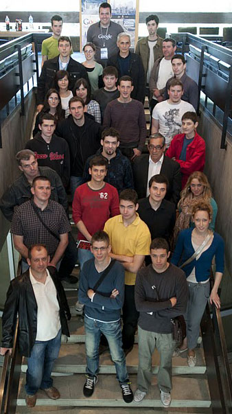
Ready to model!
Srdjan Vidakovic, an avid Google Map Maker and Panoramio user, helped document the second day’s activities. View more photos of the event and watch Belgrade grow in 3D.
If you’re interested in having a modeling event in your town too, find out how and email us at yourworldin3d@google.com.