BusTrack Windows Phone 7 App – Bing Maps

BusTrack Windows Phone 7 App – Bing Maps

Below is a preview of the Windows Phone 7 app used for real-time tracking of Chicago buses.

“This app will make sure you never miss a bus, and perhaps more importantly, will make sure you know the best time to leave your house or office so you don’t end up standing and waiting at the bus stop for a ridiculous amount of time.”

Windows Phone 7 app used for real-time tracking of Chicago buse

  • It takes full advantage of the Bing Maps Silverlight control to plot out exact GPS locations of buses and stops, making sure you always know the optimal time to leave.
  • BusTrack can even group your most frequent stops together by a “location” so you don’t have to bounce in and out of different routes that you might want take to your destination.

More information:
http://matthidinger.com/archive/2010/06/18/bustrack-windows-phone-7-app.aspx

Mappa Mercia Demonstrating the Power of Open Street Maps

Earlier I came across a post on the mappa mercia site that really demonstrates the power of the collaborative nature of Open Street Map compared to other web mapping providers. One determined user has chosen to explore and map all the features in a particular UK postcode area, B72, in Birmingham. And when I say “map”, I don’t just mean the road network… the Open Street Map of this area now shows 3500 individual labelled residential properties, including gardens, almost 300 named retail units, 100 commercial buildings, together with all the normal OSM details of bus stops, litter bins etc. The level of detail in the resulting map is remarkable.

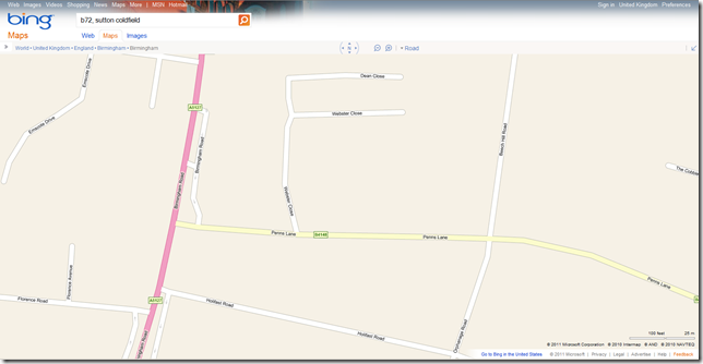
For reference, here’s a screenshot from Bing Maps’ roadmap view of a small area in the B72 postcode area:

image

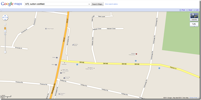
Here’s Google Map’s, marginally more detailed, view of the same area:

image

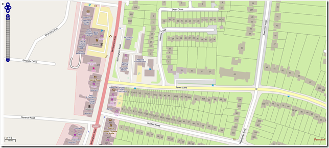
And, largely based on the efforts of one person, here’s the Open Street Map version (click to enlarge):

image

Note the house numbers, additional detail of the shape of roads, boundaries of properties, every individual retail outlet listed separately… just brilliant.

This is only a small area of one country but, with the coordinated effort of talented users on the ground, it’s easy to see how OSM’s collaborative model can create more accurate, more up-to-date mapping information than the commercial data providers used by Google, Bing, Yahoo, and the like could possibly match. The future looks bright for mapping….

5 Great Ad Commercial Campaigns + Maps

The Google Maps API has always been a great way to visualize data, but recently more and more advertising agencies are realizing the potential that the Maps API has for creative and engaging product campaigns.

Whether it’s automobiles, zombie trains, a blockbuster action movie, a board game, or even a bathroom cleaning product, there’s a map application for that product and it is changing the face of interactive advertising.


Domestos Flush Tracker
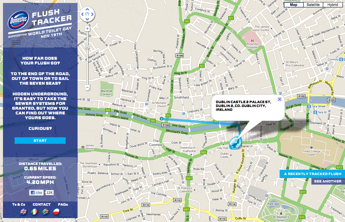
Domestos is a brand of bleach sold in the UK, South Africa, and Poland. As an advertising campaign for this bathroom product, Domestos created a “Flush Tracker” that lets you track where your flush goes after it leaves your house and enters the local sewer system. The animated line on the map simulates the speed at which refuse moves the through sewer system.


A-Team – Drive the A-Team Van
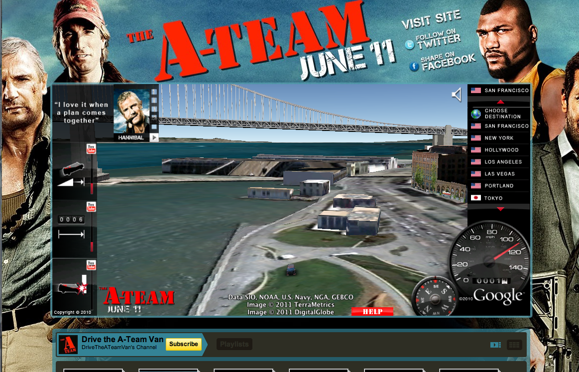
Nothing is more iconic of the A-Team than Mr. T’s van. Using the Earth API, users can drive Mr. T’s van through 3D models of 15 international cities. This implementation was seamlessly embedded into a YouTube landing page for the movie, where users can watch special movie clips that are unlocked by completing certain driving stunts.


Virgin Trains – Don’t Go Zombie…
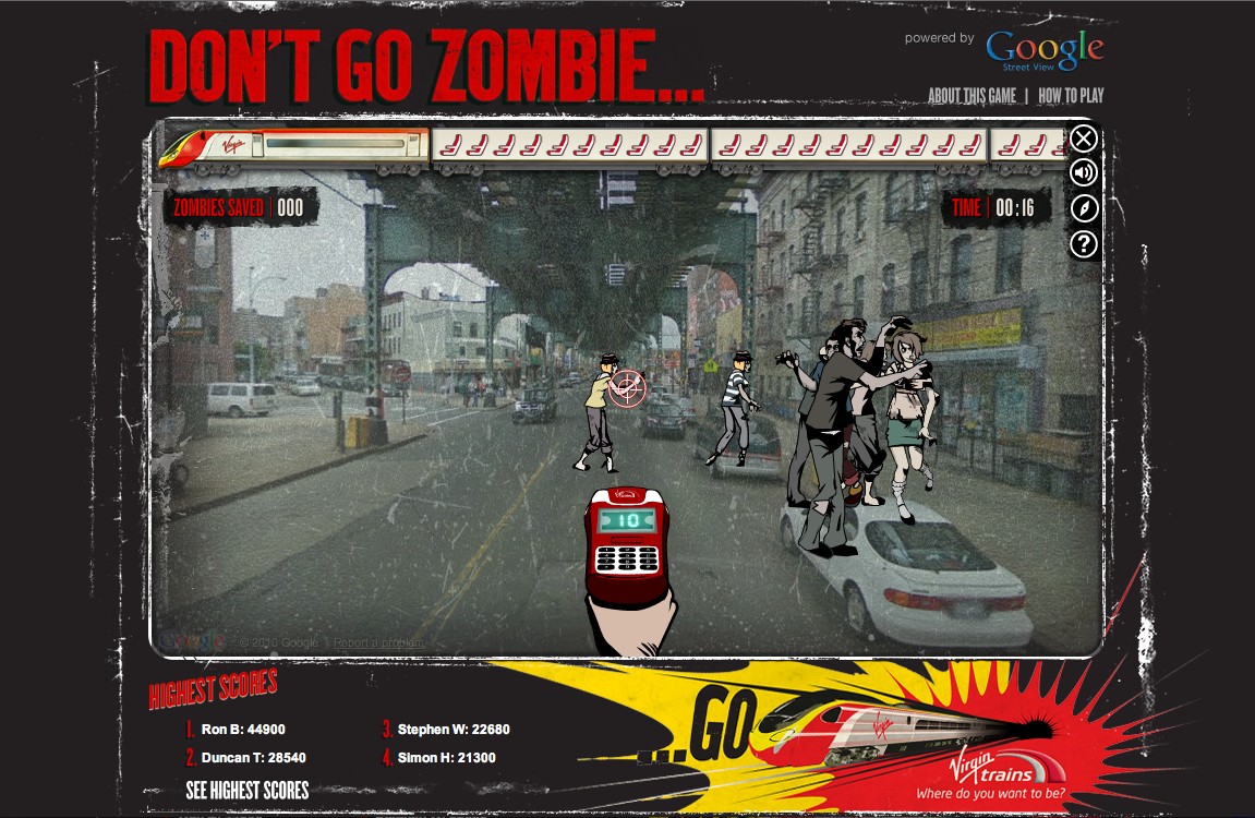
From Virgin Trains, “The streets have been taken over by frustrated car-driving zombies who need to be saved. They have to get to the comfort of a Virgin Train and only you can help them with your special ticket machine. Follow the Map to get to your destination, saving zombies on the way.”


Alfa Romeo – Virtual Ownership


Using the Street View API, users can plug in their address and virtually place an Alfa Romeo Giulietta in their driveway. The size, color, and positioning of the vehicle can also be manipulated, creating the perfect postcard to share on Facebook, Twitter, or email to a friend.

Monopoly City Streets
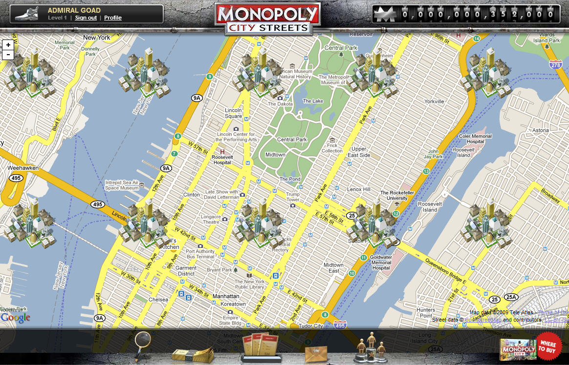
Although no longer live, this highly addictive, global Google Maps version of Monopoly will always be remembered as a great advertising campaign. Users could buy any street in the world and build hotels, houses, stadiums, castles and skyscrapers (to name a few). Fortunately, this truly unique idea was well documented and you can view demos of the game on YouTube: http://goo.gl/p0aEh and http://goo.gl/uXx4k