The Google Earth and Maps Imagery team has just released another aerial and satellite imagery update!
January is the month of resolutions and NASA has one of the biggest: to take us into the next age of space flight. Below is a high-resolution aerial image captured in December of the LC39A launch pad at the Kennedy Space center, Cape Canaveral Florida. Here we can see the Space Shuttle’s primary and secondary fuel tanks being readied for one of the shuttle’s last planned missions (STS-133; the last mission for Discovery), set for launch on February 23. We’re looking forward to publishing our first imagery of the Space Shuttle’s replacement, the CST-100.
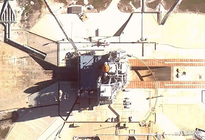
The LC39A launch pad, Kennedy Space Center, Cape Canaveral, Florida
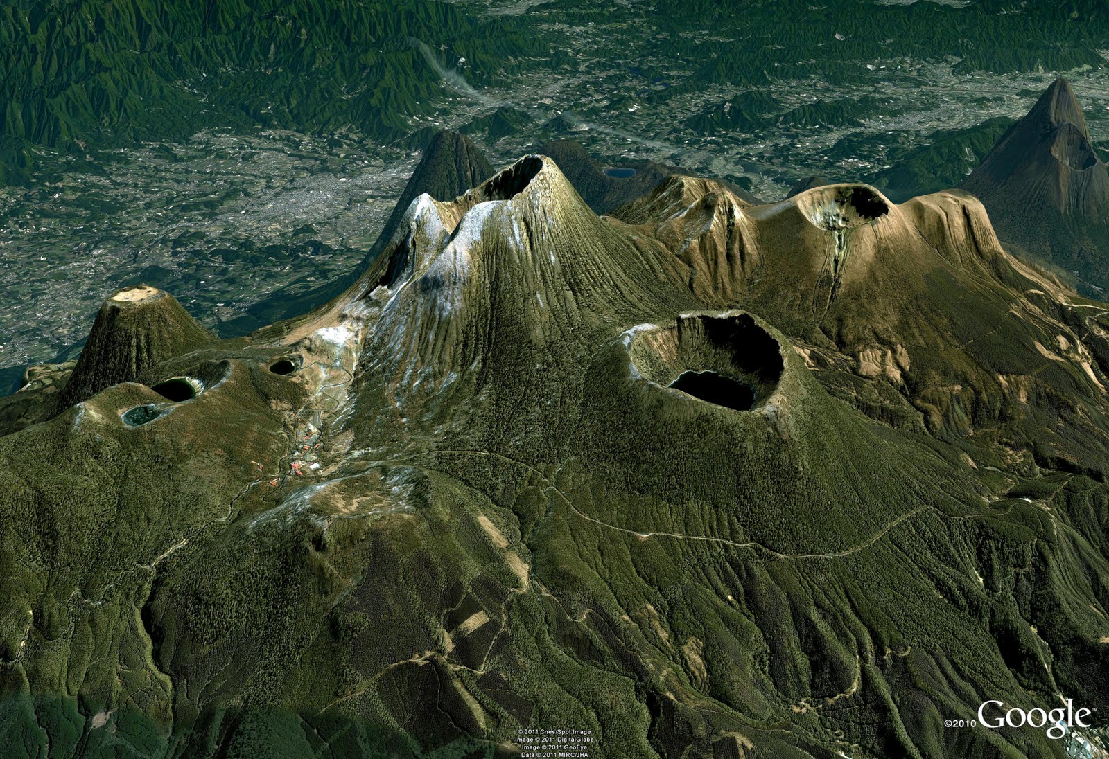
I’m a geologist by training, and so I particularly enjoy publishing new imagery of Earth’s more spectacular features such as the volcanoes shown in the perspective view below. They are part of the 23 volcanoes that comprise the Kirishima Volcanic Group in Kyushu, Japan. This field is particularly cool because it contains many different types of volcanoes, including stratovolcanos, cones, maars, and shields. You can use Google Earth to fly around these active structures, including flying right into their calderas, many of which are filled with crater lakes.
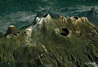
Perspective view of the Kirishima volcanic field, Kyushu, Japan
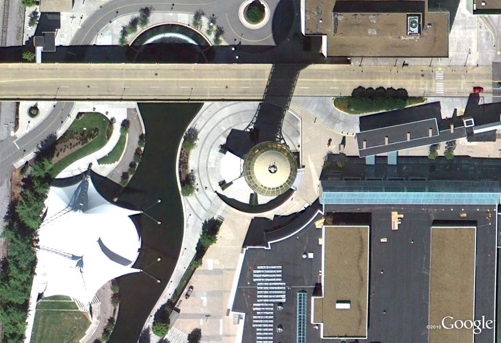
Finally, with all the cotton candy and futuristic exhibits, who wouldn’t want to attend a World’s Fair? Although there is no World’s Fair going on right now, we can check out the sites of previous World’s Fairs such as the 1982 World’s Fair site in Knoxville Tennessee. Below is an aerial image of one of the last remaining attractions of this fair, The Sunsphere. The Sunsphere is a 266 ft high hexagonal steel truss structure, topped with a 75 ft gold-colored glass sphere that serves as an observation deck. It’s been re-opened to the public and also now includes private offices with spectacular views.
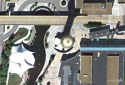
The Sunsphere structure, World’s Fair Park, Knoxville, TN
As always, these are but a few examples of the types of features that can be seen and discovered in our latest batch of published imagery. Happy exploring!
High Resolution Aerial Updates:
USA:Champaign, IL; Lafayette, LA; Lakeland, FL; Knoxville, TN; Lexington, KY; Macon, GA; Palm Bay, FL; Sarasota, FL; Shreveport, LA; Springfield, MO; Toledo, OH
Spain: Catalunya (Catalonia)
Countries/Regions receiving High Resolution Satellite Updates:
Albania, Algeria, Andorra, Argentina, Armenia, Australia, Austria, Azerbaijan, Bahamas, Bangladesh, Belarus, Belgium, Bhutan, Bosnia and Herzegovina, Brazil, Bulgaria, Cambodia, Canada, Central African Republic, Chile, China, Colombia, Costa Rica, Croatia, Cuba, Czech Republic, North Korea, Denmark, Djibouti, Dominican Republic, Ecuador, Egypt, El Salvador, Estonia, Ethiopia, Faroe Islands, Finland, Macedonia (FRYOM), France, Georgia, Germany, Greece, Greenland, Guatemala, Haiti, Honduras, Hong Kong, Hungary, India, Indonesia, Iran, Ireland, Israel, Italy, Japan, Jordan, Kazakhstan, Kenya, Kyrgyzstan, Laos, Latvia, Lebanon, Lesotho, Libya, Lithuania, Macau, Malaysia, Maldives, Mexico, Moldova, Mongolia, Montenegro, Morocco, Myanmar (Burma), Nepal, Nicaragua, Nigeria, Norway, Oman, Pakistan, Papua New Guinea, Paraguay, Peru, Philippines, Poland, Portugal, Puerto Rico, Romania, Russia, Samoa, San Marino, Saudi Arabia, Serbia, Seychelles, Slovakia, Slovenia, Solomon Islands, South Africa, Spain, Sri Lanka, Sudan, Sweden, Switzerland, Syria, Taiwan, Tajikistan, Thailand, , Tunisia, Turkey, Turkmenistan, Ukraine, United Arab Emirates, United Kingdom, United States, Uzbekistan, Venezuela, Vietnam, West Bank, Western Sahara
These updates are currently only available in Google Earth, but they’ll also be in Google Maps soon. To get a complete picture of where we updated imagery, download this KML for viewing in Google Earth.
62BVYFTJQRKR