Street View takes you inside museums around the world

We’re always excited to share new Street View imagery with users, whether a botanical garden in South Africa or ski slopes in Canada. While Street View has enabled users to visit places all around the world virtually, the demand to show a broader range of popular locations has been great. Today we’re entering new territory with our experiment to take Street View technology indoors.
The Art Project, developed by a group of art-loving Googlers, is a collaboration between Google and 17 of the world’s most acclaimed museums. Select works of art chosen by these partners are now available for you to explore through Street View in Google Maps, and the Art Project site offers an immersive experience to explore museum information, floor plans, more than 1000 high-resolution pieces, and Street View imagery. Learn more about the Art Project on the Official Google Blog.
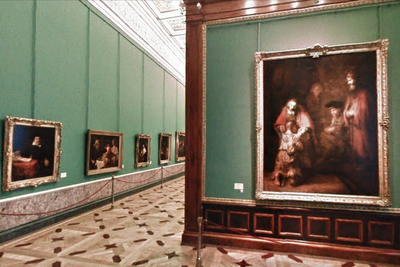
To take you inside magnificent spaces like the State Hermitage Museum in St. Petersburg, Russia, our team needed to update the way we go about gathering Street View images.
The State Hermitage Museum, St. Petersburg, Russia
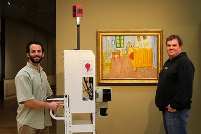
Street View imagery is typically collected using cars and we’re able to utilize the ample roof space and interior storage of these vehicles for all of our equipment. To take Street View technology indoors, we needed to fit all of the equipment on a much smaller vehicle, a push-cart lovingly dubbed Trolley.
Pictured with Trolley: Daniel Ratner, Mechanical Engineer and Matt Williams, Program Manager at the Van Gogh Museum in Amsterdam, The Netherlands
Trolley is outfitted with a few components that are key to collecting indoor imagery: a panoramic camera to collect 360-degree views, lasers to capture distances to walls, motion sensors to track Trolley’s position, a hard drive to store data, and a laptop to operate the system.
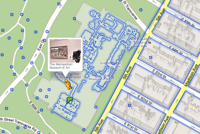
With this adapted equipment, we were able to gather the imagery and bring it into Google Maps, and you can now drag Pegman directly onto museums like the Metropolitan Museum of Art in New York City to explore their impressive European Paintings wing.
The Metropolitan Museum of Art, New York, United States
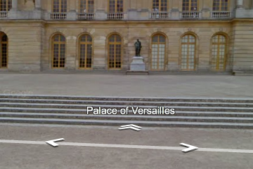
You can also enter museums when you’re already looking at Street View imagery of the museum exterior. You’ll notice new double-arrow navigation links from the nearby streets leading you inside, as you can see here for the Palace of Versailles.
Palace of Versailles, Versailles, France
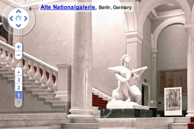
Once inside the museum, you can navigate around rooms freely with the navigation arrows or simply click on a distant spot to jump to a closer view. Movement between floors can also be done with ease by selecting a different level from the new control panel below the Street View compass and zoom controls.
Alte Nationalgalerie, Berlin, Germany
We’re excited to introduce this new imagery in Street View, and will continue to improve and develop this indoor experience. To explore these museums directly through Street View in Google Maps, visit maps.google.com/museums, and to view high-resolution artwork and learn more about the museums, check out the Art Project at www.googleartproject.com.

Satellites around the earth

A few years ago, Frank showed you a great visualization from AGI that shows the real-time positions for over 13,000 satellites around the Earth. That post, along with the page he built to show off the visualization using the Google Earth plug-in, have been some of our most popular pages ever, having been viewed nearly 200,000 times!
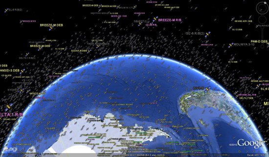
satellites.jpg

With that in mind, we thought we’d show you all of the great ways to view this data so that new users that may have missed it the first time around can see it as well. The Google Earth files below will automatically update every 30 seconds with the current positions of every satellite, so you can just sit back and watch.

There are three great ways to view these satellites:

1 – The official KML file

2 – Via the Google Earth Plug-in

3 – Watching the video below

As BoingBoing pointed out last year, these 13,000 satellites “represent an infinitesimal drop in the overall volume of their orbits”, but it’s still an amazing display. Thanks to AGI for providing such a great tool to view these satellites.

It’s Groundhog Day!

Today is the 125th anniversary of Groundhog Day – a tradition in the US and Canada when a weather-predicting woodchuck named Punxsutawney Phil tells us how long winter will last. Every year on February 2, a group of local dignitaries hold a ceremony at Gobbler’s Knob, about 2 miles outside of Punxsutawney, Pennsylvania. Just after sunrise, Phil emerges from his burrow in front of thousands of spectators. The legend states that if Phil sees his shadow, there will be six more weeks of winter. No shadow means there will be an early spring.

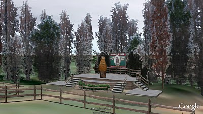
Punxsutawney Phil in Google Earth

This year, Phil emerged at 7:25 AM and did not see his shadow! Despite the major winter storm stretching across 2,000 miles of the continent, it sounds like we’ll be enjoying an early spring!
You can check out Gobbler’s Knob by entering the coordinates 40°55’48.65″N, 78°57’27.53″W into Google Earth or by clicking here to see the area in your browser.