Great User Created Maps Chronicling Egypt

During the crisis in Egypt, third-party Geo developers helped the international community understand the situation and keep persons affected by the crisis safe through the use of innovative new tools. These same tools can be replicated by anyone in any crisis situation. In the developer examples below, three things jump out as particularly striking: How quickly these maps were built and put into action, some within hours of the first protests; how developers (many contributing independently) from all over the world worked together to get these maps up and running; and how geo-context has become extremely important for the international community in understanding and responding to any crisis, be it natural or man-made.

NY Times – Mapping the Protest in Cairo Day by Day
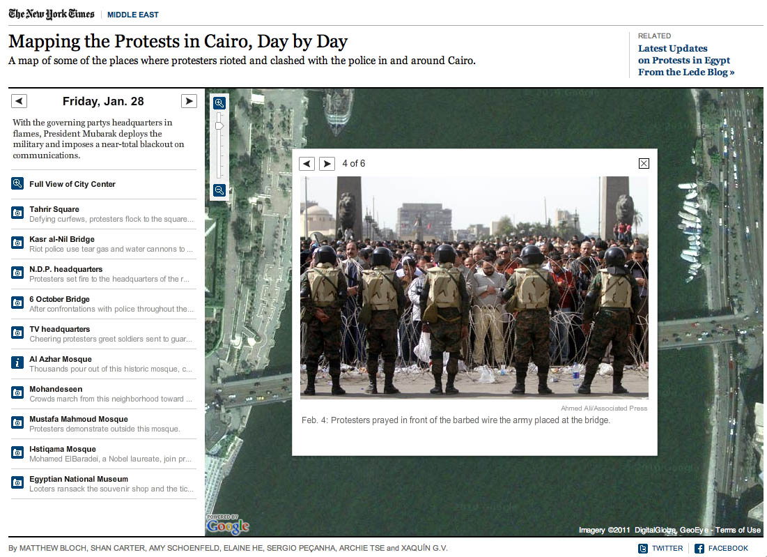
In this map, the New York Times has plotted the locations of the protests and clashes with police. There are also pictures, videos and contextual information provided in the icon info bubbles.

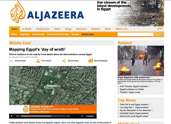
Al Jazeera – Mapping the Day of Wrath

This website features a video illustrating the geographic spread of the protests using fly-over animations in Google Earth. The same webpage includes maps with information about protests in Cairo and throughout Egypt.
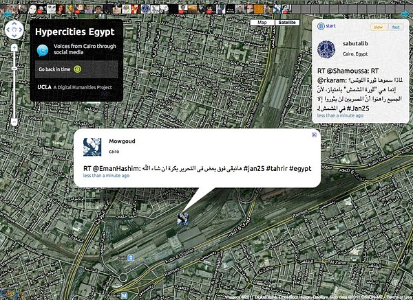
Hypercities Egypt

Twitter’s real-time updates have become an invaluable tool for the Egyptian protest organizers, observers and citizens looking to stay safe. Hypercities Egypt used Google Maps to display geolocated tweets as they came streaming in. Also, view another Egypt Twitter map created by MiBazaar.

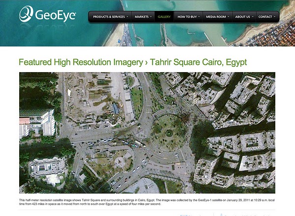
GeoEye Tahrir Square Imagery

The imagery above is of Tahrir Square on January 29, 2011 at around 10:30am local time from more than 400 miles above. This imagery is exclusively viewable in Google Earth (and the Earth API) using the historical imagery tool. The imagery highlights GeoEye’s stunning ability to respond to world events and capture timely imagery.

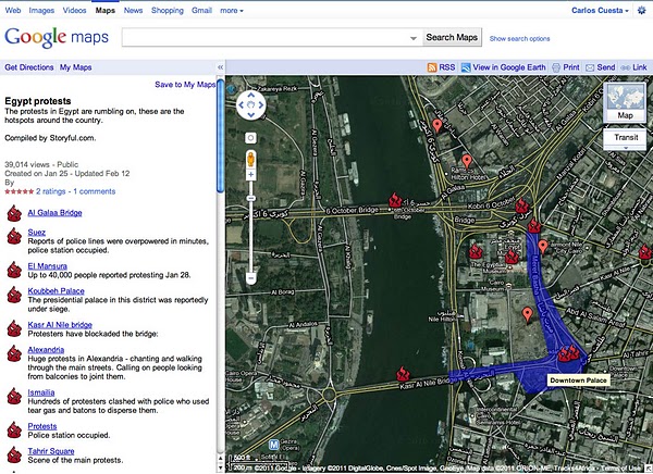
Egypt Protests in Google My Maps by Storyful.com

During the crisis, many Geo developers and persons without a Geo developer background collaborated on Google My Maps to chronicle the events geographically as they unfolded, such as this one by Storyful. Using the My Maps tool, anyone with access to Google Maps could create a collaborative mash-up with custom icons, colored polygons, content rich info-bubbles and many other features. Once completed, the map can be shared globally through My Maps or embedded on a website. Access can also be restricted to a select group of people if need be. Learn more at http://maps.google.com/getmaps.

———–

How you can help: During a crisis situation, up-to-date maps are often crucial for organizing humanitarian aid and effective response. In many regions, however, accurate and local map data is sparse, out of date, or not available at all. You can add your geographic knowledge to Google Maps by contributing map edits in Google Map Maker, which is currently available in select countries and territories.
The Rubicon has Been Crossed -Local Pages as Transaction Interface

Yesterday was a seminal moment in Local. It largely went unnoticed but it reflects the rapid monetization of location pages by the major search engines.

Bing* announced a number of local, map and mobile upgrades that improve an already good, but under rated and under used product. Clearly, they are battling toe to toe feature wise with Google Places and will be giving as good as they get. It is nice to see their staying with Local and keeping in Google’s rearview mirror with a general purpose Local platform.

But the part of the announcement that caught my attention was the following:

Mobile (iPhone):

  • Check-in: Share your current location with friends and family via Facebook, foursquare or Windows Live Activity Stream.
  • Plans: From the Bing homepage or a local search result, people can plan a night out and share the plan with friends via Facebook, who can comment or join the plan.
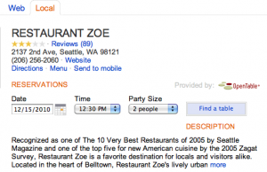
  • Opentable and Grubhub integration: With the integration of Opentable and Grubhub into Bing for Mobile, once you find your restaurant of choice, you can reserve a table on OpenTable or order takeout from Grubhub without leaving the Bing app.

Local enhancements:

  • OpenTable will be integrated into the local search vertical, allowing people to book reservations from the restaurant details page in Bing.
  • FanSnap will be integrated into the local search vertical, allowing people to purchase tickets to a concert or sporting event through the events details page in Bing.

These features when examined in conjunction with new features of the Google Places indicate the arrival of a new era for place pages.

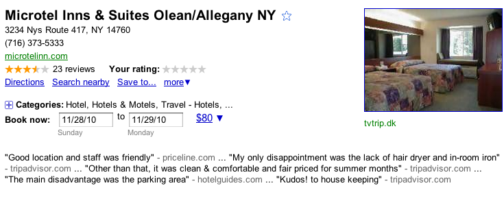
Hotel Booking tool

You recall that recently Google Places’ started including hotel booking options directly on the Places page.  These pages are now (finally?) becoming an entry point for financial and social transactions as opposed to just informational or contact based information.

In this role the search engines will be sitting between the customers and merchants or booking services. This change, while having been predictable, can affect many local business going forward in much the same way that the shift from cash to credit cards has affected them.

On the one hand, it will remove friction from the transaction while on the other, someone will be inserting themselves in the sale, with or without your explicit permission. It is a double edge sword and one that can be a net plus or not depending on how the search engines and social sites handle the process going forward. Historically, whenever a large corporation stuck out their hand in partnership to me, it inevitably ended up in my pocket and no longer felt much like a partnership.

Transparency is one way that could keep this from becoming totally unbalanced. But secrecy seems to be the order of the day as far as the Google Hotel booking system is concerned.

Does the new willingness of Google and Bing need to end up this way? No in fact, like the credit card it might actually increase bookings and sales for SMBs and potentially remove a layer of blood suckers that currently exist in the affiliate world. But then again it seems that the power relationship is so uneven that as the demand of capital markets make their presence felt, more and more of the profit will go to the big boys…

*Full disclosure: Bing is a sponsor of many of our Get Listed University events.

Earthquake motivates New Zealanders to model their town


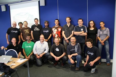
Last week, local volunteers in Christchurch and Dunedin New Zealand invested a day of their time learning how to create 3D models using Google SketchUp. The workshops focused on learning how to geo-model, a process that involves creating 3D models of buildings from photographs for display in Google Earth.

The workshop was led by local architect and geo-technology expert Jason Mill of ZNO, who was inspired to organize the events following the recent earthquake in his hometown of Christchurch. As an architect, Jason recognized the value of having a publicly accessible digital model of the city, and has invested considerable time over several years modeling the central business district of Christchurch.

The value of these models took on new meaning when many of the heritage buildings in town disappeared, leaving the community to decide what should stand in their place.

Five hours away, the city of Dunedin was unaffected by the earthquake, but given its large number of heritage buildings, local residents there decided that it shouldn’t assume that they will be there forever. They suddenly felt a greater sense of urgency around creating a historical record of these buildings.


Historic preservation and city planning are two reasons that many people model their town, but there are numerous other benefits. Local business owners are keen to be represented on the 3D map, enabling virtual tourists another means to locate them on the Internet. Downtown organizations responsible for promoting their city are other beneficiaries. Exploring a destination virtually, whether for business or leisure, is becoming as common as reading a web site.

Google supports these workshops because it aligns with our mission to build a comprehensive atlas of the world online. This atlas is a dynamic, collaborative, open platform for visualizing, sharing, and searching geographic information—whether it’s in your local neighborhood or on the other side of the globe.

By providing free authoring tools like SketchUp and Building Maker, we’re making it easy to introduce 3D buildings to the map. Maps are no longer just 2D static images on paper, they’re living reflections of the local world around us. Everyone has the ability to help shape the map and contribute their local knowledge, experiences and points of view. Adding 3D buildings to the map is just one way to achieve that.

Local residents such as those in Christchurch and Dunedin are doing more than just putting their cities on the map, they’re contributing to an atlas of the world, and becoming the curators of the special places that their cities have to offer.

Posted by Bruce Polderman, Product Manager