The 2011 Google Earth Outreach Developer Grant awardees

The nonprofit mapping community is alive with amazing game-changing ideas. In May, Google Earth Outreach asked nonprofit organizations to think big: what kind of map would they want to create if they had the funding or developer resources to do so? We were thrilled by the number of applications we received, full of concrete ideas for tremendously impactful maps.

While it was difficult to select projects with the highest potential impact from the long list of great applications we received, we are excited to announce the Google Earth Outreach Developer Grant awardees. Each organization below proposed cutting-edge visualizations in the public benefit sector utilizing a broad spectrum of tools ranging from narrated tours in Google Earth to Google Maps and Places API applications for Android to Google Fusion Tables. In total, we’ve awarded over $300,000 to the Google Earth Outreach Developer Grantees. We wish to congratulate all awardees for developing proposals that we hope will help them make the world a better place.

These organizations are all currently making great progress towards their project goals. Within the coming months, they will complete development of their mapping applications. We look forward to sharing the completed projects with you on the Google Earth Outreach site, so check back soon!


Atlantic Public Media One Species at a Time: Stories of Biodiversity on the Move, with the Encyclopedia of Life (in Google Earth narrated tours)
California Academy of Sciences A Global Water Story: Translating immersive programming about water from the Planetarium to Google Earth
David Suzuki Foundation Our Natural Capital: mapping ecosystem services in southern Ontario, Canada
Golden Gate Parks Conservancy The Story of Crissy Field: the transformation of an urban park in Google Earth
HabitatMap, Inc. AirCasting: citizen air quality monitoring using Android devices
The HALO Trust Notes from the (Mine)Field: a Google Earth tour of humanitarian landmine clearance
International Rivers Network The Wrong Climate for Damming Rivers
The Nature Conservancy Adopt an Acre in Google Earth & Maps
Pepperwood Foundation, on behalf of iNaturalist.org iNaturalist App on Android: citizen naturalists armed with Android devices can upload photos of flora and fauna to iNaturalist.org
Save the Elephants Tracking Animals for Conservation: Real-time mapping in the field on Android and Publishing Elephant Tracking Data in Fusion Tables
Water for People SanMap: supporting sanitation-related businesses in urban African cities
When I Walk, Inc. AXSmap mobile app using Google Places API for reviews and ratings of accessibility
Widecast Wider Caribbean Sea Turtle Conservation Network – Bonaire Track Your Turtles: The Great Migration Game and sea turtle monitoring in Bonaire
World Resources Institute Google Earth Tour of Reefs at Risk
World Wildlife Fund Eyes on the Forest: Interactive map on Sumatran Deforestation


These organizations were funded through the Google Inc. Charitable Giving Fund at the Tides Foundation.

The Pictarine: Building a mashup in the cloud with Google App Engine


Pictarine is a photo management web application, launched in 2010, that allows people to easily manage and share all of their photos from Flickr, Picasa, Facebook, Twitter and other sites. Pictarine developers Guillaume Martin and Maxime Rafalimanana have contributed the following post discussing their experiences using Google App Engine and Google Web Toolkit.

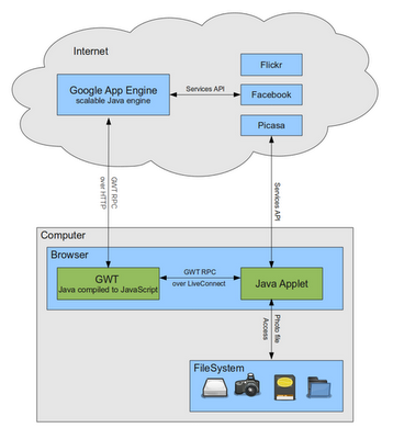
From the start, we used Google technologies in developing Pictarine and we wanted to share our experience with them so far. In this post, we will shed some light on the weaknesses and strengths we found in Google Web Toolkit (GWT) and Google App Engine. We will also discuss how we leveraged GWT to build a new technology that allows Pictarine to seamlessly display photos from the computer directly into the browser. The following diagram is an overview of how our application works.

Building a mashup in the cloud with Google App Engine

The Pictarine team is made of a web designer and two developers who previously worked mainly with Java based enterprise technologies and had a little experience with web technologies. When we started the project in early 2009, we were quite open on learning new languages like Python or Ruby, but when App Engine announced that Java would be supported, we were really excited to give Google App Engine a try.

The first few months, learning about the App Engine environment was quite easy and dare I say fun. Testing our code on Google’s servers from Eclipse IDE was only one click away. So we built our first prototype fast and we quickly decided to adopt App Engine. Then we started to build the core of our application: the engine that uses the API from Flickr, Picasa, Facebook to fetch the users’ photos. This is where we hit the first limitations of App Engine. Most users have a lot of photos on these services and retrieving them can take some time. But App Engine has strict limits on how long a request should last: an outgoing HTTP request cannot last more than 10 seconds and cannot process a request for more than 30 seconds. So while building our architecture we found ourselves writing approximately one third of our code dealing with these limitations: paginating our requests, creating background tasks to store data in small batches, etc.

In early 2010, when we launched our alpha version, everything went smoothly. We had some good press coverage and App Engine met our expectations in handling our first users. During 2010, we worked on implementing new features requested by our users, and during this period of time we were really impressed by the way App Engine evolved. Many of the limitations were lifted and great new features were added. We are now able to use Task Queues for requests that last up to 10 minutes, which we fully use to sync our users’ photos and albums. One of the features we like the most is the Channel API, a push notification system that allows us to instantly show a photo in every connected browser as soon as it is uploaded.
App Engine is still not perfect but has greatly improved and when we see its roadmap, we are quite confident it will continue to improve.

Google Maps Mashups 16

They Draw & Travel – World Map
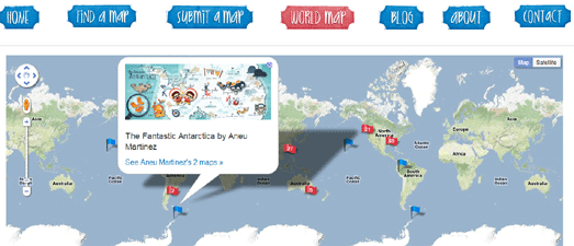
They Draw & Travel is a collection of wonderful user submitted hand drawn maps.

The World Map lets you browse the maps submitted to They Draw & Travel on Google Maps. You can click on any of the map markers and view the hand drawn map submitted for that location.

One Day on Earth
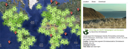
On 10.10.10 One Day on Earth asked people around the world to create a video of their world. The goal of the project was to “create an open shareable archive and documentary film of the world on 10/10/10.”

You can browse and watch the thousands of videos that were contributed around the world on this Google Map.

#rorschmap
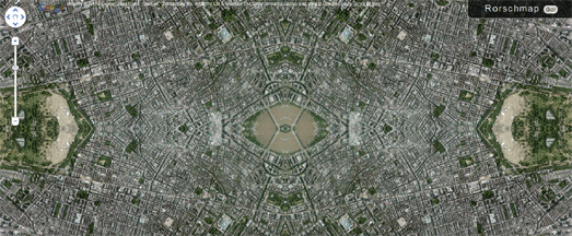
I only found this map yesterday and it has already become a firm favourite.

#rorschmap uses the Google Maps API to create a kaleidoscope for any location on the Earth. Essentially the application displays the Google Maps satellite view of a location and, using the same principle of multiple reflection that you find in kaleidoscopes, creates an animated Rorschach test effect.

Great British Picnics
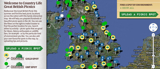

The Guardian newspaper is increasingly working with partners to produce useful Google Map based guides. The newspaper are collaborating with lastminute.com to create their City Guides. They have also worked with Enjoy England to create a Google Map based guide to great destinations in the UK.

The Guardian has now partnered with Country Life Butter to create a Google Maps guide to great picnic spots in the UK.

The map helps you search for a picnic spot by activity, for example spots that are good for hikers, photographers or wildlife fans. You can also search by environment, such as by beach, riverside or country park.

If you have a favourite picnic spot of your own you can add it to the map.

Maersk Fleet – Live Map
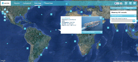

This Google Map allows you to track in real-time the the huge shipping containers of Maersk as they travel around the world.

The position of the ships are displayed live on this Google Map. You can click on any of the ship map markers to view a photograph of the ship and read further details, such as the ship’s destination and current speed.

This map presumably uses the Automatic Identification System (AIS), an automated tracking system used on ships to plot real-time positions.

Integrate Google Maps and Flickr into a Real-Time App
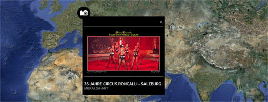

.net magazine has published a great tutorial on how to create a real-time animated Flickr map. The tutorial was written by James Christian and Ben Gannaway the creators of the excellent Net-a-Porter Live Google Map.

The tutorial explains how to create a Google Map that animates in near real-time through images posted on Flickr. The tutorial includes how to work with the Flickr API and how to customise the look of your map.

Alongside the tutorial is a demo map and a link to download the full source code.

Rendezview
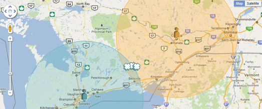

Yellow Pages in Canada has released a useful application to help two or more people find the best place to meet.

To find a place to meet you need to enter your address and the address of the person you plan to meet. You can then select the type of venue where you wish to meet, for example a restaurant, a bar or a cafe.

Rendezview will then create a Google Map showing you the most convenient venues that you could meet (based on your selected preferences), roughly half-way between the two locations.

Japanese Castle Explorer
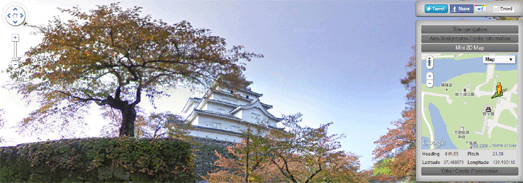

Daniel O’Grady’s excellent Japanese Castle Explorer has been updated to take advantage of all the new wonderful Street View imagery available for Japan.

This year the Street View trike has been very busy in Japan capturing a lot of beautiful new off-road imagery, particular in the grounds of some of Japan’s castles.

The Japanese Castle Explorer is a great map that shows the locations of Japan’s most famous (and plenty of lesser known) castles. The map allows you to view Japan’s castles in Google Maps satellite view. Now it is also possible, where available, to view the castles in Street View.

The map is available in English and Japanese versions. You can view an example of the Street View at Himeji Castle (use the link to ‘Other Castle Panoramas’ in the sidebar to navigate to view other castles in Street View).

The Bath Schools Map
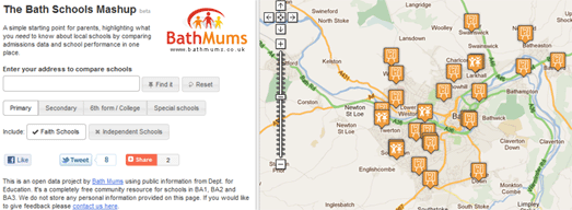

The Bath Schools Map is designed to help parents choosing schools in Bath, in the UK, by displaying local schools and admissions and performance data on Google Maps.

In Bath parents are only allowed to indicate 3 schools as a preference for their children. Using the map it is possible to find the nearest ten schools and compare their academic mini-league tables on a range of metrics with a sidebar. This helps parents make school choices from a broad base of information rather than gearing towards a single metric.

GeoBus
Geobus is a nice little app that can find the nearest bus-stops for any location in the UK. Just enter a postcode or use the ‘locate me’ button and the nearest bus-stops to your current location will be displayed on a Google Map.

The application was developed as part of the recent Young Rewired State initiative.

England’s Health Data Map
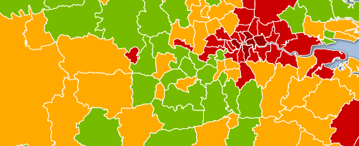

The Guardian has used Fusion Tables to map the latest Health Profiles data from the Department of Health and the Public Health Observatories.

Using the Google Map it is possible to compare a number of health indicators for regions in the UK. For example, it is possible to view child obesity throughout the UK or view where the most people die from smoking.

There are still quite a lot of gaps in Street View’s coverage around the world. Luckily a number of other providers have created their own Google Maps based Street View applications to try and plug these gaps.

China – with City8
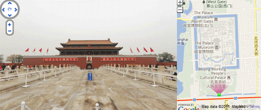

In China City8 have created extensive interactive 360 degree panoramas in 45 of the country’s biggest cities.

MapJack
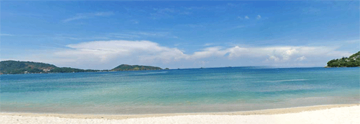

As well as providing Street View type imagery in the USA, Canada, Singapore and Sweden Mapjack has also ventured where Google Street View has so far feared to tread. MapJack has great coverage in Malaysia, Thailand and Puerto Rico.

Norc
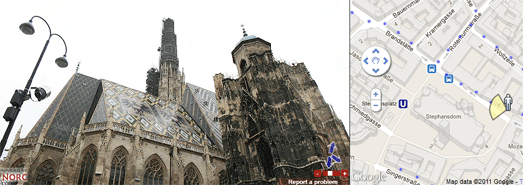

Norc has great coverage in central and eastern Europe, including in Poland and Austria, where Google’s Street View cars have yet to drive.

via:goglemapsmania