Huxley on Can Do, Will Do


“Do what you can to do what you ought, and leave hoping and
fearing alone.”

–Thomas Henry Huxley (1825–1895)
English biologist and educator

A couple bright sides to remember…

  1. Those gatekeepers keeping you from your prospects… You’ll love them once you’re on the other side and your competition comes calling. (Just be sure you’re continually qualifying your prospects — investing your effort only with the best possibilities… ).
  2. That deal you lose to a low-cost provider… Sometimes it can be more valuable in the long run. When the lowest priced product or service doesn’t meet the expectations of a customer, a deeper appreciation of the price/ value relationship is developed. This can create a new sales opportunity from what was initially lost – an opportunity for a much stronger business relationship than otherwise may have existed. (Make sure you keep your cool & kindness so you’re called if it happens.)

_____
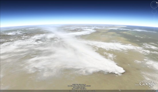
The Nabro Volcano in Africa imaginery

The Nabro volcano in the northeast African nation of Eritrea erupted for the first time in recorded history following a series of earthquakes. The ash has since spread more than 60km over the Ethiopian border and the volcano has emitted the highest levels for sulfer dioxide gas ever detected from space.

nabro.jpg


NASA has been publishing a small stream of images from the volcano, including some stunning shots such as the one seen above. Even better, they happened to capture a photo of Nabro back in January of this year, providing a crystal clear shot of the volcano prior to the eruption.

nabro-jan.jpg

You can view that image on NASA’s site, or in Google Earth using this KML file.

The volcano has caused some minor disruption to air travel, but nothing on the scale of Eyjafjallajokull eruption in Iceland last year. Even better, the level of ash coming out of the volcano has begun to diminish, as has the level of seismic activity in the region.

Be sure to check out the full gallery of images on the NASA Earth Observatory site to see all of the amazing imagery that they’ve captured so far.

Mississippi floods: images and data

Emerging as one of the worst flooding events along the U.S. waterway in the past century, the Mississippi River floods of April and May 2011 have caused widespread destruction along the 2,300 mile river system. Historically high water levels from heavy rains and springtime snowmelt have provided no shortage of dramatic scenes — levees breached, downtown areas completely submerged, spillways opened, and more.


The Google Crisis Response team has assembled a collection of flood data including satellite imagery for impacted cities along the river from GeoEye, flood extent and crest data forecasts from the US Army Corps of Engineers (kml) and NOAA’s National Weather Service (kml), and shelter locations from the American Red Cross (kml).

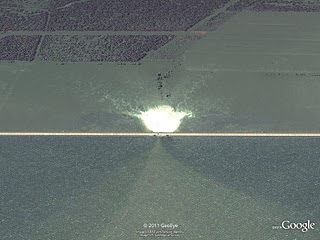
Opened floodgate in Morganza spillway in Louisiana on May 15, 2011.

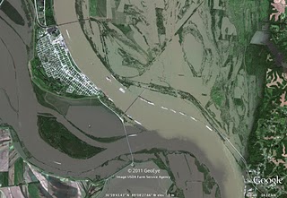
Cairo, Illinois on May 8, 2011.

This collection of data is available on Google Maps by searching for “Mississippi flooding.” These data can also be accessed within Google Earth by turning on the ‘Places’ layer and flying to the Mississippi river south of Memphis, TN, or by downloading this kml to open in Google Earth.