Sarawak: The damaged rainforest

The state of Sarawak, in Malaysian Borneo, is the site of an interesting political battle recently. Their Chief Minister claims that 70 of Sarawak’s forest cover is intact, but imagery from Google Earth seems to indicate that it’s far worse than that. In fact, some environmentalist groups estimate that logging has cost Sarawak 90 of it’s primary forest cover.

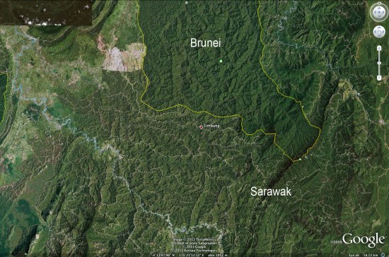
Mongabay has written a very detailed article about this situation, including quite a few photos. For example, the image below clearly shows logging roads all throughout Sarawak, while virtually none are visible in Brunei to the north.
 

sarawak.jpg 

Google Earth is making it increasing difficult for governments to lie about this kind of behavior. As the pace and quality of imagery updates continue to improve, things will only get better for those that wish to expose this type of thing.

Be sure to read the entire article on Mongabay for more information and many more photos.
LiDAR views of the Carolina Bays

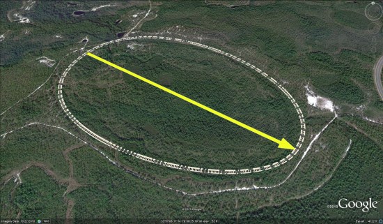
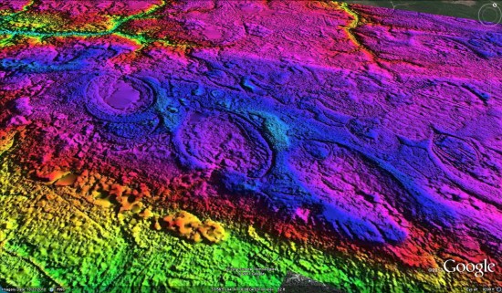
We’ve talked about the Carolina Bays before, but today we’ve got a great new way to view them. Michael at Cintos Research sent over some information about their new use of LiDAR DEM hsv-shaded imagery to expose as many of the Bays as they could — over 22,000 so far!


bays.jpg 

If you want to just see one quickly, here’s a KMZ file to download. To see the rest of them, you can pull individual KMZ files from this Google Fusion Table that they’ve put together.

To take it even further, their data includes placemarks for each of the 22,000 bays, with transparent png overlays to show the exact location of each Bay. Turning the overlays on and off help to reveal the bay in the standard Google Earth imagery.


bay-overlay.jpg 

For more about this project, check out the entry at IdeaScale.com.

Geospatial Revolution: Episode Four Released

The fourth,  final episode of the Geospatial Revolution project, created by Penn State Public Broadcasting, has been released.

If you’ve missed any of the previous episodes, I strongly recommend that you check them out. Episode One covered a wide overview of “how” and “why” questions regarding geospatial technologies, and Episode Two dug into more specific examples including the City of Portland and the well-known shipping company UPS. Episode Three discussed how geospatial technologies are using in war and in keeping the peace.

Episode Four covers four main topics:

• Monitoring a Changing Climate

• Preventing Hunger

• Tracking Disease

• Mapping Power to the People

As with the previous episodes, you can choose to watch each segment individually or simply watch the full 17 minute video below.

Congratulations to PSPB on creating such an excellent series of videos!