Round-up of all imagery and resources available for Japan Earthquake

We’ve written a few posts recently with information about Japan in the wake of their horrible earthquake and tsunami, but the data keeps pouring in so here’s an update on everything that is available to you.

On Friday, we listed all of the available resources, including Google’s very useful People Finder tool. On Saturday, Google started pushing out fresh imagery of the area, courtesy of GeoEye. Check out that post for the list of cities available.

Since then, they’ve also released imagery for Sendai and the surrounding area, which you can view using this KML file.

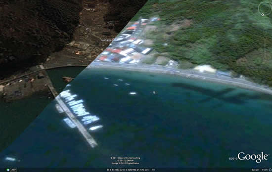
To make it easier to keep up with all of this new imagery, Google has created an all-in-one KML file that includes all of the various imagery updates. On top of that, they include some stunning before/after placemarks for areas that were hit especially hard. Here is an example:
ligohama.jpg

For easier viewing, those before/after shots can also be found in this Picasa web album.

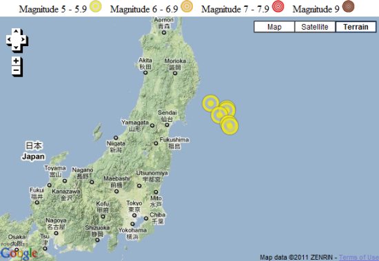
The LA Times has built an interactive timeline of the quakes.
la-times.jpg

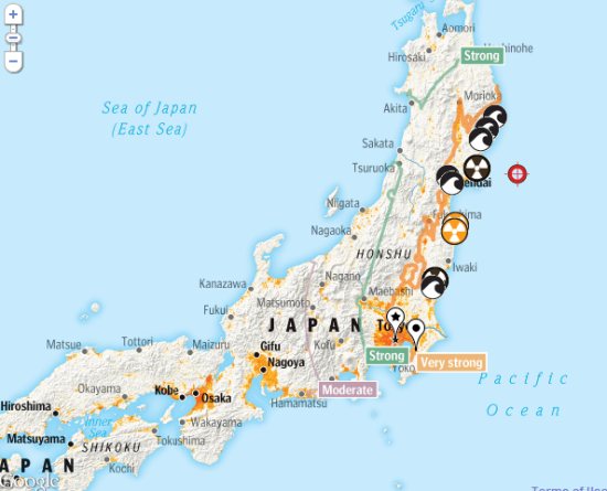
The Washington Post used Google Maps to show their “Wave of Destruction” map, highlighting some of the hardest hit areas.
wave-of-destruction.jpg

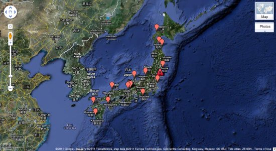
Harvard built a map to show the location of all of the nuclear sites in Japan.
harvard.jpg

Google Maps Mania also has quite a few more Maps-based resources listed in these two posts.

Finally, Google’s @EarthOutreach twitter account remains to be the best source for updated info/maps, so keep an eye on them.
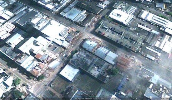
Fresh imagery from Christchurch

In the wake of the earthquake that struck Christchurch last month, GeoEye captured some fresh imagery of the area and has now made it available to everyone.

While the imagery is a bit cloudy, it really gives a sense of the widespread damage in the area. These images were captured two days after the quake, on February 24.

christchurch.jpg

To view the imagery in Google Earth, they’ve made a few files available for you to download:

Central and Northern Christchurch
Southern Christchurch

As Frank mentioned on the Tahina Expedition blog a few days ago you’re encouraged to contribute to the families affected by the quake on the Christchurch Earthquake Appeal site.

(Via National Business Review)

New imagery in Sudan to help with humanitarian efforts

In the past few years, Google has been working harder than ever to provide high-quality imagery to help in various relief efforts, such as the earthquake in Haiti, the Yazoo City tornado and the Qinghai earthquake.

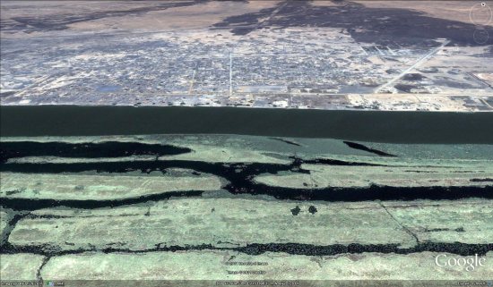
They’re at it again with some amazingly fresh imagery from Sudan, to help the various humanitarian organizations on the ground over there. The new imagery went up just a few days ago, and the imagery from Sudan was less than two weeks old at that point! If you understand how Google Earth imagery works, you’ll agree that it’s a remarkably fast turnaround.

melut.jpg

Over the years, we’ve had users ask why this kind of imagery is useful to those working on the ground. Google has provided a list of potential uses for this imagery, which they stated in a recent blog entry:

In Melut, there is a humanitarian hub where many services are delivered to at risk populations, including food, water, health care, education, and more. Given the varying needs of each of these services, maps can provide a variety of planning benefits for expansion, staff safety, and emergency procedures.

Google is asking for your help to build other tools to assist those in Sudan, such as using Map Maker to help map out the various roads and natural features in the area. A full list of tools available can be found here.

If you’d like to fly to Sudan in Google Earth to see the new imagery for yourself, you can use this KML file to fly to Melut.