Imagery Update – Week of February 21st

We’re just nearly two months into the new year but the Google Earth and Google Maps Imagery team’s aerial and satellite imagery updates keep coming!

Since it’s February, love is in the air and romance is on people’s minds (I mean, why stop at Valentine’s Day). And when it comes to all things amatory, no features and locations conjure up those feelings better than châteaux, castles, and royal wedding sites. Lucky for all our quixotic Earth and Maps users, we’ve got all that and more in our latest batch of published images.

Let’s start with the big one in the room. The Royal wedding isn’t until April, but we’re getting ready for the big day by updating London, UK and wedding-related sites with high-resolution aerial imagery acquired this past June. In the image below, you can see the site of the royal wedding, the Collegiate Church of St Peter at Westminster, more commonly referred to as Westminster Abbey. While viewing this site in Google Earth, make sure you turn on the Photos Layer, and check out the several pano360 immersive images that dot the church confines.

Westminster Abbey, London, UK

Let’s move west a bit to the beautiful Emerald Isle. Below we’re looking at Trim Castle and adjacent grounds in the county town of Trim, in County Meath, Ireland. The castle is the remains of Ireland’s largest and dates to the 11th century. As with the Westminster Abbey location, make sure to click on the Photos layer and check out the pano360 images; the immersive images include 360° views of the castle interior.

Trim Castle, Trim, Ireland.

Lastly, let’s take a look below at some new aerial imagery of a section of the Biltmore Estate which contains the châteauesque house, the Biltmore (upper-right section of the image). The house was finished in 1895 and is located near Asheville, North Carolina. It is the largest privately-owned home in the U.S., owned continuously by members of the William Vanderbilt family.

The Biltmore Estate, Asheville, NC.

Do you have a place you love that you’d want to receive notification from us when the Earth and Maps Imagery team updates your beloved site? We’ve got just the tool: The Follow Your World application!

As always, these are but a few examples of the types of features that can be seen and discovered in our latest batch of published imagery. Happy exploring!

High Resolution Aerial Updates:

USA: Asheville, NC; Charleston, WV; Chattanooga, TN; Daytona, FL; Fayetteville, AR; Key West, FL; Perry, FL; Wachula, FL

Ireland: Kells; Navan; Omagh; Strabane; Trim

UK: Greater London; Immingham; Somerset

Switzerland: Valais

Countries/Regions receiving High Resolution Satellite Updates:

Algeria, Angola, Argentina, Australia, Austria, Bangladesh, Bolivia, Botswana, Brazil, Bulgaria, Burundi, Canada, Central African Republic, Chile, China, Colombia, Costa Rica, Cuba, Czech Republic, Côte d’Ivoire, Democratic Republic of the Congo, Dominican Republic, Ecuador, Egypt, El Salvador, Ethiopia, Faroe Islands, Finland, France, French Guiana, Germany, Greece, Guatemala, Haiti, Honduras, India, Indonesia, Iran, Ireland, Israel, Italy, Japan, Jordan, Kazakhstan, Kenya, Kuwait, Kyrgyzstan, Lebanon, Lesotho, Libya, Macedonia (FRYOM), Mexico, Morocco, Mozambique, Myanmar (Burma), Namibia, Nepal, New Zealand, Nicaragua, Niger, Nigeria, Norway, North Korea, Oman, Pakistan, Panama, Paraguay, People’s Republic of the Congo, Peru, Poland, Republic of Korea, Romania, Russia, Rwanda, Saudi Arabia, Somalia, South Africa, Spain, Sri Lanka, Sudan, Suriname, Swaziland, Sweden, Switzerland, Syria, Tajikistan, Tanzania, Thailand, Togo, Trinidad and Tobago, Tunisia, Turkey, Turkmenistan, Uganda, United Arab Emirates, United Kingdom, United States, Uruguay, Uzbekistan, Venezuela, West Bank, Yemen, Zambia, Zimbabwe

These updates are now available in both Google Maps and Google Earth. To get a complete picture of where we updated imagery, download this KML for viewing in Google Earth.
5 Great Ad Commercial Campaigns + Maps

The Google Maps API has always been a great way to visualize data, but recently more and more advertising agencies are realizing the potential that the Maps API has for creative and engaging product campaigns.

Whether it’s automobiles, zombie trains, a blockbuster action movie, a board game, or even a bathroom cleaning product, there’s a map application for that product and it is changing the face of interactive advertising.


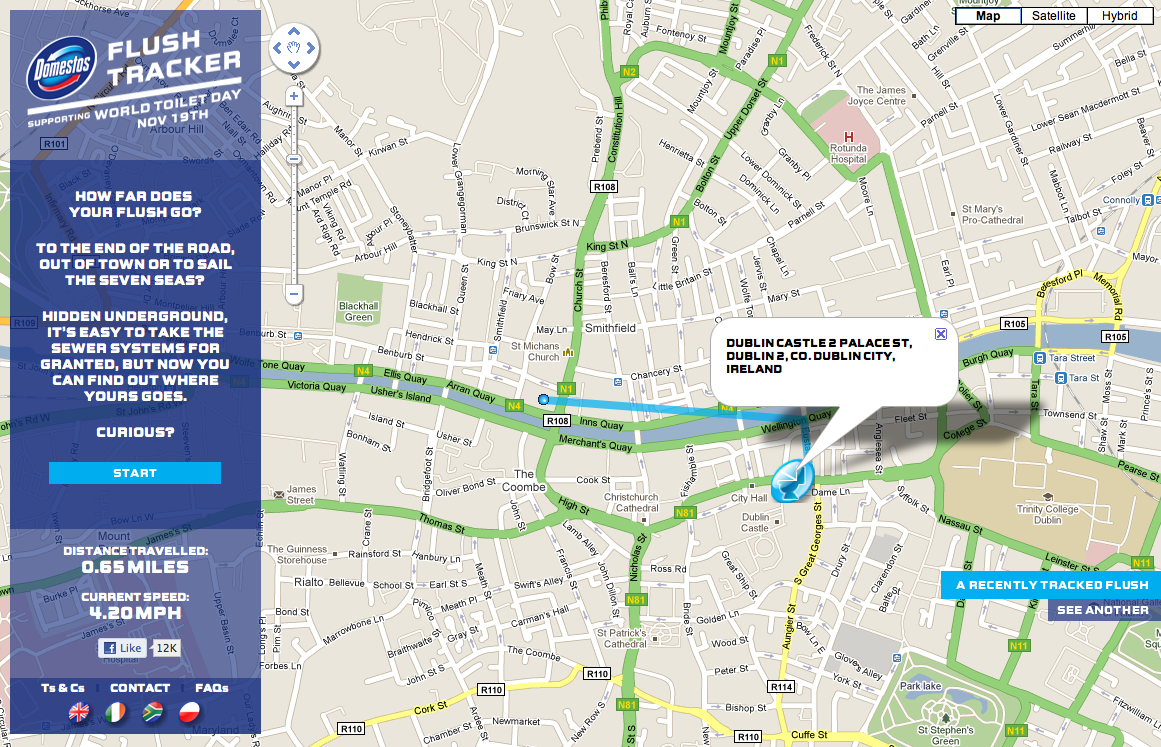
Domestos Flush Tracker

Domestos is a brand of bleach sold in the UK, South Africa, and Poland. As an advertising campaign for this bathroom product, Domestos created a “Flush Tracker” that lets you track where your flush goes after it leaves your house and enters the local sewer system. The animated line on the map simulates the speed at which refuse moves the through sewer system.


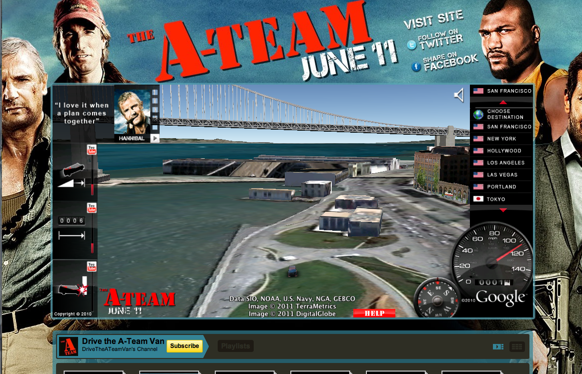
A-Team – Drive the A-Team Van

Nothing is more iconic of the A-Team than Mr. T’s van. Using the Earth API, users can drive Mr. T’s van through 3D models of 15 international cities. This implementation was seamlessly embedded into a YouTube landing page for the movie, where users can watch special movie clips that are unlocked by completing certain driving stunts.


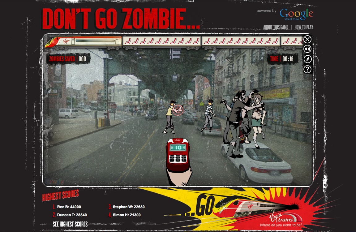
Virgin Trains – Don’t Go Zombie…

From Virgin Trains, “The streets have been taken over by frustrated car-driving zombies who need to be saved. They have to get to the comfort of a Virgin Train and only you can help them with your special ticket machine. Follow the Map to get to your destination, saving zombies on the way.”


Alfa Romeo – Virtual Ownership


Using the Street View API, users can plug in their address and virtually place an Alfa Romeo Giulietta in their driveway. The size, color, and positioning of the vehicle can also be manipulated, creating the perfect postcard to share on Facebook, Twitter, or email to a friend.

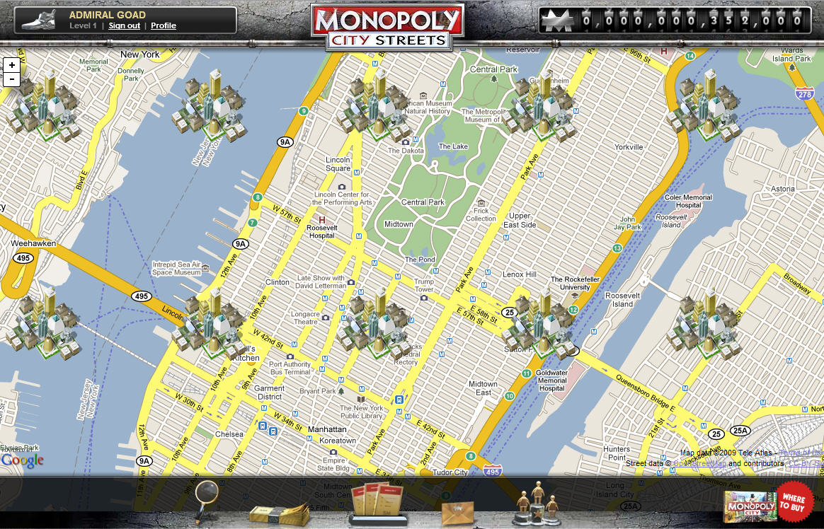
Monopoly City Streets

Although no longer live, this highly addictive, global Google Maps version of Monopoly will always be remembered as a great advertising campaign. Users could buy any street in the world and build hotels, houses, stadiums, castles and skyscrapers (to name a few). Fortunately, this truly unique idea was well documented and you can view demos of the game on YouTube: http://goo.gl/p0aEh and http://goo.gl/uXx4k

Imagery Update – Week of December 12th

‘Tis the season of giving! For those of you who’d like nothing more than to receive the gift of new places to explore on Google Earth and Maps, you’re in luck. Our imagery team’s latest update includes many places that relate metaphorically to the holiday season.
For example, it’s often at the end of the year that we remark “Out with the old, and in with the new.” That concept can also be applied to the below image that captures two military installations located North West of Beijing. You can see the fascinating juxtaposition of the modern Yongning Air Force base (bottom right) and an adjacent section of the ancient Great Wall of China (upper left quadrant) that outlines parts of the Shibapan Ling mountain range. And yes, you really can see the wall from space!
Near Beijing, China
Wouldn’t gold make a great stocking stuffer? Take a look at the below image of Jin Xixin Lake, the dammed section of the Minjiang River also known as the Gold Lake, located south of Mount Wuyi, China. In this image, you can see lots of prime locations that might make great prospecting camps. Get out your pans!
Gold (but no frankincense) near Mount Wuyi, China
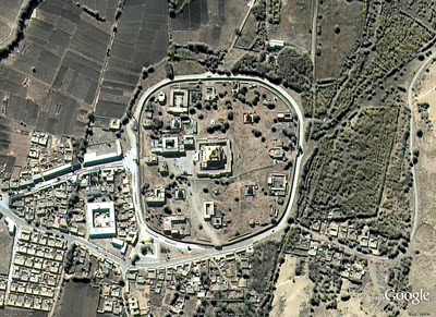
Finally, although this time of year is often associated with the Christian-based holidays, when thinking about China, thoughts naturally turn to Buddhism. Just the other day on the Google campus in Mountain View, a group of Tibetan monks visited to build a Sand Mandala and lead a meditation group. In this spirit, I’ve included the below image of the first Buddhist monastery built in Tibet, the Samye Monastery.
A site of enlightenment in Tibet
The examples above only hint at the type and breadth of features that can be seen and discovered in our latest batch of published imagery. Happy exploring and happy holidays!
High resolution aerial updates:
USA: Birmingham AL, Little Rock AK, Peoria IL, Tuscaloosa AL, Worcester MA, Jerome ID, Stevenson WA, Knoxville TN, Morganton NC, and Statesville NC
Canada: Powell River, and Sunshine Coast, BC., Canmore, and Cold Lake
Netherlands: Hilversum
South Africa: Northern, Eastern, and Western Cape, and Limpopo
Sweden: Gävleborgs Län, Jönköpings Län, Uppsala Län, Västerbottens Län, and Västra Götalands Län
Countries receiving high resolution satellite updates:
Albania, Algeria, Angola, Argentina, Armenia, Australia, Austria, Azerbaijan, Bahrain, Bangladesh, Belgium, Bhutan, Bolivia, Bosnia and Herzegovina, Botswana, Brazil, British Virgin Islands, Brunei Darussalam, Bulgaria, Burkina Faso, Cambodia, Cameroon, Canada, Chad, Chile, China, Colombia, Costa Rica, Croatia, Cuba, Democratic People’s Republic of Korea, Democratic Republic of the Congo, Denmark, Dominican Republic, Ecuador, El Salvador, Estonia, Ethiopia, Finland, France, Georgia, Germany, Greece, Guatemala, Haiti, Honduras, Hungary, India, Indonesia, Iran, Ireland, Israel, Italy, Japan, Jordan, Kazakhstan, Kenya, Kuwait, Kyrgyzstan, Laos, Latvia, Lesotho, Liberia, Libya, Lithuania, Luxembourg, Madagascar, Malawi, Malaysia, Mali, Mauritania, Mexico, Mongolia, Montenegro, Morocco, Mozambique, Myanmar, Namibia, Nepal, Netherlands, New Caledonia, New Zealand, Nigeria, Norway, Oman, Pakistan, Panama, Papua New Guinea, Paraguay, Peru, Philippines, Poland, Portugal, Puerto Rico, Republic of Korea, Romania, Russia, Samoa, Saudi Arabia, Senegal, Serbia, Slovakia, Slovenia, Solomon Islands, South Africa, Spain, Sri Lanka, Sudan, Sweden, Switzerland, Syria, Taiwan, Tajikistan, Tanzania, Thailand, Turkey, Turkmenistan, Uganda, Ukraine, United Arab Emirates, United Kingdom, United States, Uruguay, Uzbekistan, Venezuela, Vietnam, Virgin Islands, West Bank, Yemen, Zambia, Zimbabwe
These updates are currently only available in Google Earth, but they’ll also be in Google Maps soon. To get a complete picture of where we updated imagery, download this KML for viewing in Google Earth.