Google Maps Applications

Mini Maps on Facebook


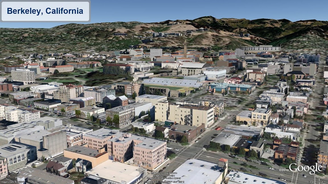
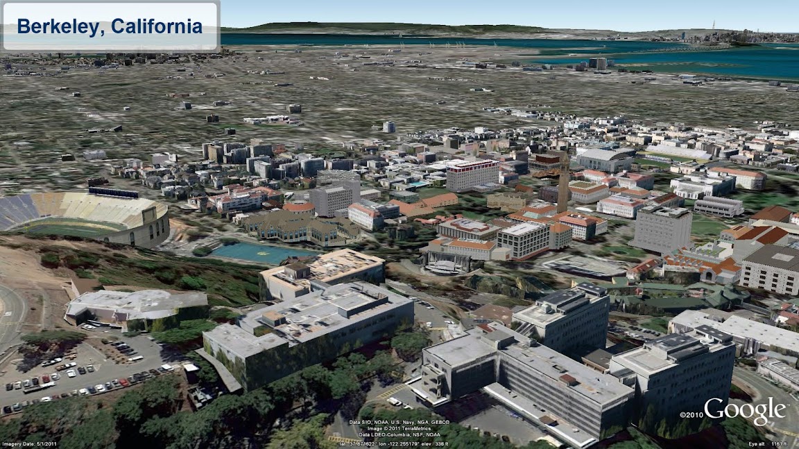
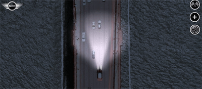
The most retweeted map on Google Maps Mania this week was definitely this racing game from Mini.

Mini Maps is a great driving game for Facebook that lets you race anywhere in the world on Google Maps. You can race on tracks created by other players, competing against the best track times or even race against others by inviting your Facebook friends to play.

Alternatively you can create your own tracks, set the best time and challenge others to try and beat you.

WorkSnug


If you are tired of working out of coffee shops then you might want to give WorkSnug a go. WorkSnug uses Google Maps to show you your nearest workspaces with WiFi access.

To find your nearest workspace you just need to enter your location. The results will show you the nearest coffee shops with WiFi but will also show you nearby libraries and other communal spaces where you can work.

If you click on a mapped workspace you can click through to read details about the venue, which includes information about the availability of power, refreshments and the noise levels.

Cooler Planet: Solar Energy Installation Map


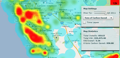
Cooler Planet has created an animated time-line with Google Maps to show the progress of solar installations in California from 1999 through to 2011.

Using data from Go Solar California Statistics the map lets you view time-lines of ‘total installs’, ‘total watts’, ‘watts per install’ and ‘total carbon saved’. It is fascinating using the map to view how solar power installations have blossomed in California over the last decade.

TripsQ


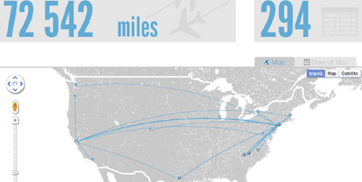
TripsQ is a data visualisation application that aims to help people make full use of the data that they have generated through Foursquare. It uses all the data you have gathered while travelling, by turning your check-ins at airports into useful travel statistics.

Everyone who uses Foursquare can easily sign in to tripsQ and visualise their trips and travel itineraries. TripsQ also provides users with detailed statistics on the distance they’ve travelled, the amount of CO² they’ve produced during each trip and other information about their travels.

Google Earth: Expanded 3D Buildings

Looking for new 3D cities to explore in far off places? Well, you’re in luck! We’ve been hard at work expanding our 3D coverage by adding ten of thousands of 3D buildings to these cities:

  • Berkeley, California USA
  • Cologne, Germany
  • The Hague, Netherlands

See the new buildings for yourself with the “3D Buildings” layer in Google Earth or by using Google Maps with Earth view.


Google I/O 2011 – The Geo Developers

Google I/O was about the maturation of many of the Geo APIs, this year’s was more about their sophistication, both in the designs discussed and the applications on display. Like the sun standing still at the solstice, let’s take a moment to reflect on recent events and look ahead to the coming season.

Several new features made their debut at I/O this year. The much-anticipated Places API took the stage, as did its companion the Places Autocomplete API. Dynamic Styling was introduced for Fusion Tables layers in the Maps API, allowing layer styling to be defined by the API application via Javascript. Finally, some extremely helpful open source Javascript libraries were introduced to make Maps API development even easier.

Joining us on stage were several developers who came to share their expertise. Justin O’Beirne of 41Latitude talked about map usability and design in the “Designing Maps Applications for Usability” session. The Guardian UK’s Simon Rogers joined us to talk about how the Guardian is using Fusion Tables to visualize the data they collect in “Managing and Visualizing Your Location Based Data.” Yoni Samlan from SCVNGR also came to discuss developing with the Places API in “Location-based App Development.”

In addition to the sessions led by the Geo team, the developer sandbox featured eight Geo API partners who engaged directly with I/O attendees. Joining us in the sandbox were HistoryPin, Icon Fitness, Ubisense, The Wall Street Journal, Footprint Feed, The Bay Citizen, Arc2Earth, and Travel Game. The apps on display ranged from location-based gaming using the Latitude API to tools for citizen journalists to map public data using Fusion Tables. You can learn more about two of our sandbox partners in these video case studies:

  • The Bay Citizen (video) – The Bay Citizen explains the benefits of the Fusion Tables layer with Google Maps API to build infographics for their online newspaper. The Bike Accident Tracker visualizes the prevalence of bike accidents across San Francisco.
  • Historypin (video) – HistoryPin lets users upload historical photos, geotag them on a Google Maps, and overlay the old imagery on top of new Street View imagery, enabling users to see what their cities looked like at different points in time.


Geo APIs Summer Learning Series (apologies to the Southern Hemisphere)

But at the heart of Google I/O are the sessions themselves. This year, speakers from the Maps, Earth, and Fusion Tables teams covered a wide range of topics, from ensuring high performance and usability across all browsers to visualizing huge data sets with Fusion Tables. The amount of material covered was enormous…but we want to expand upon it.

To that end, we’re pleased to announce the “Geo APIs Summer Learning Series” on the Geo Developers Blog. Over the coming weeks, each talk will be getting its own blog post from the session speaker, pulling in what was discussed at I/O and then digging deeper into the technical content. Here is how the series will unfold:

Week of July 6th
Connecting People and Places
Location Based App Development using Google APIs
Secrets and Surprises of the Google Geo APIs

Week of July 11th
Managing and visualizing your location based data with Fusion Tables
Designing Maps Applications for Usability on Mobile and Desktop

Week of July 18th
High Performance KML for Maps and Earth
Speedy Maps

Week of July 25th
Map your business, inside and out
GIS with Google Earth and Google Maps

If you’d like a head start, videos of all the I/O sessions are linked above. Be sure to visit the Geo Developers Blog throughout July for even more great content from the Maps, Earth, and Fusion Tables teams.