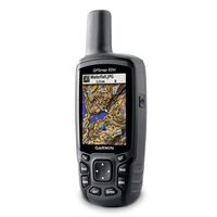
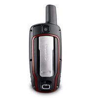
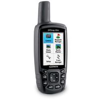
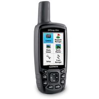
 We’re wrapping up our exciting week of product announcements with an addition to the GPSMAP 62 series of rugged outdoor handheld devices – a built-in 5 megapixel camera with automatic geotagging to capture the highlights of any adventure and allow you to share the locations or navigate back to that site. We’re showing off GPSMAP 62stc and GPSMAP 62sc here at the Teva Mountain Games in Vail, CO, capping four days of fun that included this and other big news in the popular eTrex, Rino and Astro families.
Hikers, hunters, mountain bikers and other outdoors enthusiasts often don’t have the time or energy to dig through their pack every time they see something memorable or worth sharing later,” said Dan Bartel, Garmin’s vice president of worldwide sales. “The built-in camera seamlessly integrates photography into your basic navigation, whether you’re out for a day of leisurely sightseeing or serious reconnaissance – or simply trying to get back safely to where you started.”
 Picture perfect: Whenever a picture is taken in stunning clarity with the 5 megapixel, auto-focus camera on GPSMAP 62stc or GPSMAP 62sc, the photograph is geotagged – meaning the location is saved and encoded into the file – so that the geographical information can be used at any time as a point of reference or as a destination that can be reached through GPS guidance and directions. And because the GPSMAP family is waterproof to IPX7 standards, the built-in camera will still be snapping photos even in the worst conditions. Ample built-in memory (3.5 GB for both models) allows you to take plenty of pictures on the trail and save the downloading and deciding for later. Once your GPSMAP 62stc or GPSMAP 62sc is connected via USB, you can use Garmin’s free BaseCamp software (http://garmin.com/basecamp) to easily store and share your photos. BaseCamp also helps you view, plan and organize your maps (in 2D or 3D), waypoints, routes and tracks – including elevation profiles – and send them to your Garmin handheld.
 Options abound: Boasting a 2.6” sunlight-readable color display, intuitive push-button interface, up to 16 hours of battery life and a high-sensitivity GPS receiver and quad helix antenna for unparalleled reception, the GPSMAP 62 series features various models and custom dashboards to suit various activities and interests. And thanks to enhanced navigation and the 3D digital elevation model (DEM) data, users navigating to a destination on an active track will see changes in elevation ahead as well as where they’ve been. Also, waypoints and other key locations along the active route – such as start, end and high and low elevation points – appear on the map and active route pages. When choosing the best model for your lifestyle, it’s easy to remember that the “s” stands for integrated sensors (electronic compass and barometric altimeter), “t” denotes preloaded topographic maps, and “c” indicates the built-in camera described above. Learn more about the GPSMAP 62 models and features at the interactive minisite at http://www.garmin.com/gpsmap62.
 What’s inside: GPSMAP 62 models with an “s” include a 3-axis tilt-compensated electronic compass and wireless connectivity for sharing routes, tracks, waypoints and geocaches between other compatible Garmin handhelds. These models feature a barometric altimeter that tracks changes in pressure to pinpoint your precise altitude. Users can also plot barometric pressure over time, which can help keep an eye on changing weather conditions. These devices also use ANT+ for wireless sharing between compatible devices, monitoring heart rate and cadence with those optional accessories, and interacting with chirp geocaching beacons (www.garmin.com/chirp).
Taming the terrain: GPSMAP 62 models with a “t” in the name feature preloaded 100K topographic maps for the entire United States (or preloaded 50K topographic mapping of Canada for the Canadian version). Detailed coverage includes major trails, urban and rural roads, interstates, highways, coastlines, rivers and lakes as well as national, state and local parks, forests and wilderness areas. In addition, you can search for points of interest by name or proximity to your location and view descriptive details for terrain contours, topo elevations, summits and geographical points.