Rain Alarm Map

Rain Alarm Map


Rain Alarm Map

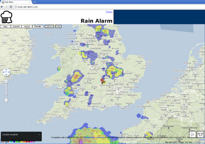
Get live alerts for incoming rain or snow.

The simple idea of this web map and app is to warn you against approaching precipitation like rain or snow. Therefore the app checks in a perimeter of 75 km / 47 miles every 30 minutes, if there is something approaching. Simply leave the page open in the background and you’ll get notified.

Note that the map is refreshed automatically so you do not have to reload the page. The buttons on the bottom right en- or disable the animation and the alarm functionality.

The data used originates from governmental weather services and is available for the USA, Canada, Australia, the UK, Ireland, Norway, Germany, the Netherlands, Spain including the Balearic and the Canary Islands.

Browsers:
The alarm notifications work best with Google Chrome. For Mozilla Firefox and Microsoft Internet Explorer the alarms work as well, though they are not as pretty and intuitive.

With some browsers your location can be determined automatically or otherwise a rough estimate is used. To correct your location, simply drag the marker to be able to receive correct alarms.

Internet Explorer
You need to keep Rain Alarm as the active tab to be able to receive alarm notifications even when the Internet Explorer is minimized.

Mobile

The app is also available for Android as well as iOS.
Map:
http://www.rain-alarm.com/

Dutch geo-modelers gather to model The Hague

Delft, The Netherlands was the most recent location for a Your World in 3D workshop. The goal of the event was to gather members of the local community to learn Building Maker so that they could model The Hague. Design8, an established Google SketchUp distributor in The Netherlands, organized, promoted and led a very successful event. Over 60 people attended the workshop, which was held at the ultra-modern technical facilities of TU Delft, a prominent Dutch engineering school.

The Dutch version of YMCA?

The day was kicked-off with a presentation from Professor Alexander Verbraeck of TU Delft, where he shared numerous examples of how 3D digital models were being used today. “It’s no longer a fringe area of study” he said, “3D is very much here to stay.”

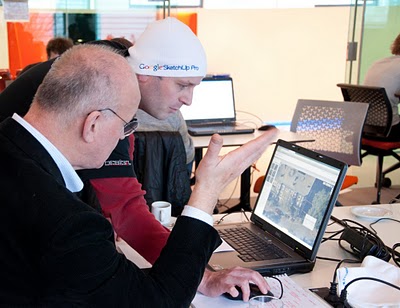
Participants listen to opening remarks.

I followed with a brief summary of why Google was supporting these workshops and why it was important for local residents to develop and maintain 3D models of their cities. To paraphrase: “The built-world is undergoing change every day. Local residents are in a far better position to maintain an accurate view of their town than Google.”

Workshop attendees ranged in both age and experience. We had everyone from teenagers who have grown up with computers in their lives, to retirees who are eager to learn a new skill. Building Maker is a tool that suits all ages and skill levels. The Hague was added to Building Maker in December with a few other cities. Geo-modeling has been popular in The Netherlands since the concept was first introduced in 2006, so the strong interest the workshop received wasn’t unexpected.

Orlando from Design8 assisting a workshop participant

After a short introductory demonstration by Orlando Sardaro of Design8, attendees began modeling. Prizes were offered for the best model and for the most models created. Had we offered a prize for “most distance traveled”, Supermodeler MILO Minderbinder would have walked away with two awards. The young man, (who is not yet old enough to drive) endured a three-hour train ride (each way!) to attend the workshop. Not unexpectedly, MILO put his modeling talents to work and created this terrific model in SketchUp in the short time he was there. The prize for his work is a 3D print of the model, provided by i.materialise.

Nicole and I would like to thank Design8, TU Delft, and all the attendees for a terrific day!

Another OpenStreetMap Book Review

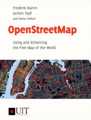
Book cover: OpenStreetMap

Oliver O’Brien reviews OpenStreetMap: Using and Enhancing the Free Map of the World by Frederik Ramm, Jochen Topf and Steve Chilton. “The book succeeds in simultaneously being OpenStreetMap for Dummies, OpenStreetMap: The Missing Manual and the O’Reilly OpenStreetMap book — that is to say, complete beginners, intermediate users and enthusiasts/hackers will all get something out of the book. If you are at all interested in the OpenStreetMap project, even if you don’t intend to contribute to the project but are just curious about what it is or what you can do with it, then I recommend this book. It’s as near-perfect as any book can be about one of the web’s, and the geospatial community’s, most exciting projects.”