In celebration of World Oceans Day, Google has released a significant amount of brand new high-resolution ocean floor imagery, amounting to an area larger than North America!
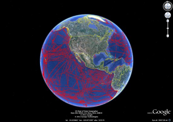
Captured from nearly 500 ship cruises and 12 different institutions, the data was curated by the Lamont-Dohery Earth Observatory. The image below shows the areas that have been udpated:

To explore more of the new features, Google has created a “Seafloor Updates layer” to show off the highlights, seen here:
The deepest volcanic eruption ever recorded was at the West Mata volcano near Fiji, photos of which can be seen in the Deep Sea Vents Ridge 2000 tour. Coincidentally, Frank is celebrating World Oceans Day by spending a full day diving in the ocean in Fiji. You can read about that experience on the Tahina Expedition blog.
All of this data is fun to look at, but there are some important scientific benefits as well. In particular, a more detailed ocean map can help us understand how tsunamis will spread around the globe. At this point, we know more about the surface of Mars and the Moon than we do about the ocean floor, so advances like these are becoming more critical.


