USGS Historical Map Release

USGS Historical Map Release (Coming Soon)

The USGS Historical Quadrangle Scanning Project (HQSP) is scanning all scales and all editions of approximately 250,000 topographic maps published by the U.S. Geological Survey (USGS) since the inception of the topographic mapping program in 1884.

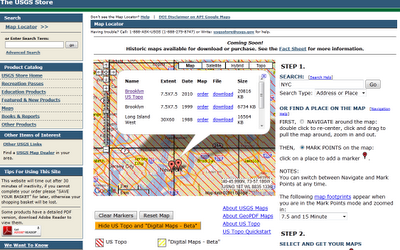
USGS Map Locator

National Map Viewer can locate historical Maps for user to download

Because historical maps are stored in a limited number of collections and are not readily available, the USGS National Geospatial Program has begun a project to convert these historical printed topographic quadrangles to an electronic format (GeoTIFF and GeoPDF®). This project serves the dual purpose of creating a master catalog and digital archive copies of the irreplaceable collection of topographic maps in the USGS Reston Map Library as well as making the maps available for viewing and downloading from theUSGS Store and The National Map Viewer.

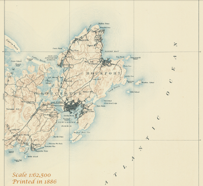
USGS Map 1886

One of the first Maps Created by USGS back in1886 will be available to download.

Source:

http://dracutlibrary.wordpress.com/2011/08/11/historical-maps/

Official PDF on the project

http://pubs.usgs.gov/fs/2011/3009/fs20113009_013111.pdf [PDF]

Link to the National Map Viewer [USGS Store]

http://store.usgs.gov/b2c_usgs/usgs/maplocator/%28ctype=areaDetails&xcm=r3standardpitrex_prd&carea=%24ROOT&layout=6_1_61_48&uiarea=2%29/.do

*Some maps will require a purchase – but most will be free of charge to download in GeoPDF and GeoTiff formats.

 
Mapperz Mapping News Blog
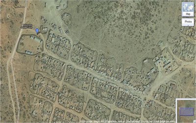
Refugee Camp at Ethiopia

In the wake of intense drought, the Horn of Africa is gripped by its worst famine in more than 60 years. Over 12.4 million people across Kenya, Ethiopia, Djibouti and Somalia are threatened with hunger and disease as they are unable to access basic survival means. UN agencies and other humanitarian organizations are rallying to support refugees on the move, particularly to the thousands fleeing Somalia. Valerie Amos, OCHA Emergency Relief Coordinator, has stated that “This will not be a short crisis.” The emergency is expected to persist at least three to four months, and the number of people needing humanitarian assistance could increase by as much as 25 percent. Fresh and accurate maps are among the many critical factors in assessing such a state of crisis, as they provide vital information to facilitate emergency response and planning. Thanks to the efforts of our satellite imagery partner, GeoEye, we now have high resolution imagery of locations with the most pressing humanitarian needs. This has made Google Map Maker community mapping efforts even more effective, by allowing the creation of improved maps over refugee camps in Kenya, Ethiopia and the city of Mogadishu. Volunteers are mapping roads, hospitals, schools, community centers, and water resources, among other vital landmarks. The map data contributed is being shared periodically with the UN agencies engaged in this crisis. Google has also donated 1 million USD to help local and international organizations provide famine and drought relief support in the Horn of Africa.

Bokolmanyo Refugee Camp, Ethiopia. IKONOS imagery, July 29th 2011, © 2011 GeoEye

You can help the Horn of Africa during its time of crisis by creating detailed maps using your local knowledge of places, such as cities, roads, and natural landmarks. If you’re unfamiliar with the region, try pairing up with people who have local knowledge, who can help by reviewing and correcting your edits. To participate in these ways and more, and offer feedback, please join our Africa mailing list and visit the Horn of Africa community mapping site as we all map the way toward crisis relief.

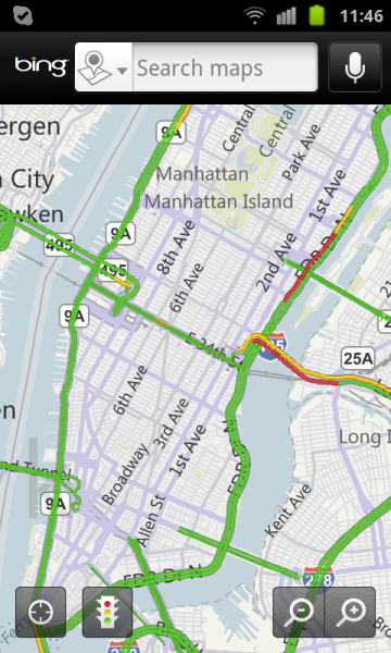
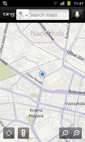
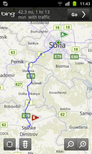
Microsoft’s Bing Maps for Android- pleasant surprise for me!

Microsoft’s Bing for Android may not technically be the first Microsoft-made app for Android phones (that honor belongs to the rather obscure Microsoft Tag Reader,) but the Bing is its highest-profile app.

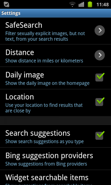
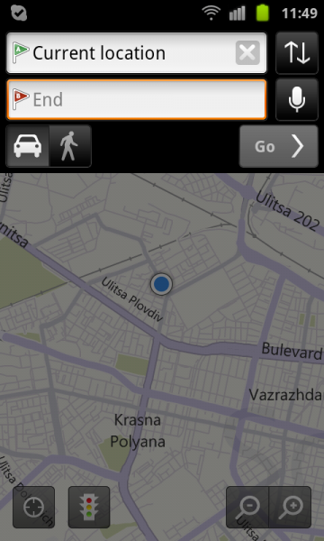
Bing for Android closely resembles Bing for iPhone, with an image of the day marking the backdrop, and a pop-up menu to search by images, movies, maps, news, or what’s nearby. There’s also an option for directions. A search field sits at the top, next to a voice search button. Bing for Android hides your history, settings, and favorites in the phone’s hard-coded Menu button.

The Android version of Bing also integrates maps, and the touchable hot spots hidden in the day’s image that reveal additional information about the photo du jour. Swiping backward loads previous images.

However, Bing for Android lacks two significant features found in the iPhone version-options for scanning an item’s bar code with your camera, and connecting to your Twitter and Facebook feeds.

We’re fans of the Bing app on all platforms we’ve tested, and while we’d like to see this Android version gain parity with the iPhone version, usabilitywise, it’s no exception. We’d also like to see the Maps portion add directions for public transit–a la Google Maps-to complement its driving and walking directions.