Google Maps Applications

Mini Maps on Facebook


The most retweeted map on Google Maps Mania this week was definitely this racing game from Mini.

Mini Maps is a great driving game for Facebook that lets you race anywhere in the world on Google Maps. You can race on tracks created by other players, competing against the best track times or even race against others by inviting your Facebook friends to play.

Alternatively you can create your own tracks, set the best time and challenge others to try and beat you.

WorkSnug


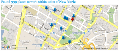
If you are tired of working out of coffee shops then you might want to give WorkSnug a go. WorkSnug uses Google Maps to show you your nearest workspaces with WiFi access.

To find your nearest workspace you just need to enter your location. The results will show you the nearest coffee shops with WiFi but will also show you nearby libraries and other communal spaces where you can work.

If you click on a mapped workspace you can click through to read details about the venue, which includes information about the availability of power, refreshments and the noise levels.

Cooler Planet: Solar Energy Installation Map


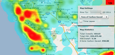
Cooler Planet has created an animated time-line with Google Maps to show the progress of solar installations in California from 1999 through to 2011.

Using data from Go Solar California Statistics the map lets you view time-lines of ‘total installs’, ‘total watts’, ‘watts per install’ and ‘total carbon saved’. It is fascinating using the map to view how solar power installations have blossomed in California over the last decade.

TripsQ


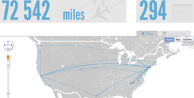
TripsQ is a data visualisation application that aims to help people make full use of the data that they have generated through Foursquare. It uses all the data you have gathered while travelling, by turning your check-ins at airports into useful travel statistics.

Everyone who uses Foursquare can easily sign in to tripsQ and visualise their trips and travel itineraries. TripsQ also provides users with detailed statistics on the distance they’ve travelled, the amount of CO² they’ve produced during each trip and other information about their travels.

OGR2OGR Importing Spatial Data to SQL Server

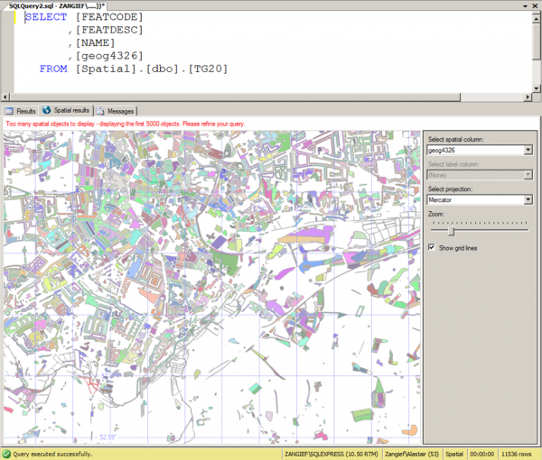
A few months back, I posted an article explaining how to import spatial data into SQL Server 2008 from any format supported by the OGR library (including ESRI shapefiles, GML, and TIGER data), using OGR2OGR. That article was written using OGR2OGR from v1.7 of the GDAL 1.7 library, which doesn’t support SQL Server 2008 directly, so I instead used OGR2OGR to create a CSV file containing spatial data in Well-Known Text format and then parsed that data in SQL Server using the STGeomFromText() method.

The good news is that things have become a bit easier since then, and version 1.8 of the GDAL library now has a MSSQLSpatial driver that can interface directly with geometry and geography data in SQL Server 2008.

The bad news is that most of the places that offer pre-compiled GDAL binaries for Windows have yet to update to the new version. FWTools, for example, still comes packaged only with v1.7. Likewise, the osgeo download site at http://download.osgeo.org/gdal/win32/ also lists GDAL versions up to v1.7.

So, if you want to get hold of the latest GDAL to import directly into SQL Server you’ll have to build it yourself from source, which can be downloaded from http://download.osgeo.org/gdal/gdal180.zip

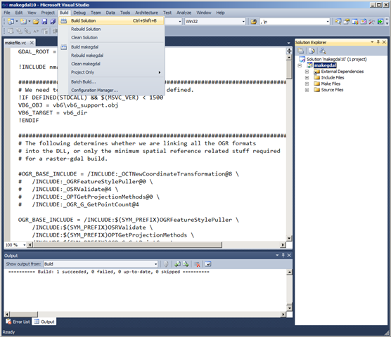
Fortunately, the source has been very considerately packaged, and includes solution files that will build GDAL out-of-the-box in VS2005, 2008, and 2010. Simply load the .sln file, click build, and wait a few minutes:

Building GDAL 1.8 in VS2010

Then, if you look in the output directory (warmerdabldbin, by default) you should see a lovely collection of utilities for working with spatial data – GDAL (for working with raster data), and OGR (for its vector sibling).

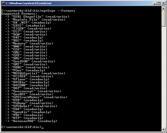
Here’s the output of calling ogr2ogr –formats, which retrieves the list of supported vector spatial formats – note the MSSQLSpatial format supported for both read/write:

image

Example usage to load a shapefile to SQL Server as follows:

[php]
ogr2ogr -overwrite -f MSSQLSpatial "MSSQL:server=.\MSSQLSERVER2008;database=spatial;trusted_connection=yes" "TG20.shp"
[/php]


Best of Bing Maps Summer Xbox & Kinect Contest


Capture the sights of summer and share them with friends using the updated Photosynth app, available in iTunes today (http://www.itunes.com/apps/photosynth )! We listened to the 3,500,000 people who downloaded the first version of the app and added some of the most requested features: email, simplified sharing, and exploration of great panoramas by other users. To celebrate the launch of these new features, we’re even awarding Xbox360 with Kinect prize packages for the very best panoramas shared with Bing Maps!


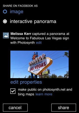
The Photosynth app captures full 360° panoramas with a fun, interactive experience and makes it simple to share with friends and family. Today’s update adds email sharing and image cropping capabilities when you save a panorama to the Camera Roll, which means you can more easily bring your panoramas into other apps. We’ve also made sharing to Facebook and Bing Maps easier than before, allowing you to share to both at the same time.

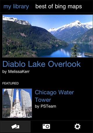
The new “Best of Bing Maps” feature lets you explore great panoramas created by others and shared on Bing Maps directly within the app. View stunning full-sphere panoramas from people around the world and get inspired by the creative possibilities of Photosynth.

We’re excited about “Best of Bing Maps,” and we want you to get excited too! Which is why this summer, we’re giving away an Xbox 360 with Kinect prize package every week to the best panoramas shared to Bing Maps.* In the app, go to the library and click “Best of Bing Maps” to learn more and enter the contest. We can’t wait to see the amazing and creative panoramas you share!


With the Photosynth App, you can:

  • See your panoramas take shape with each picture you take.
  • Get sharp, seamless, and high-resolution results looking in all directions.
  • See most panoramas within seconds of taking your last picture.
  • Explore the world’s best panoramas on Bing Maps through the “Best of Bing Maps.”
  • Zoom, pan, stretch, and view your panorama in landscape or portrait mode.
  • Save and view your panoramas on your device and view them online at Photosynth.net.
  • Share your panoramas to Bing Maps and see them throughout Bing.
  • Share your images or interactive panoramas with friends on Facebook
  • Send email panoramas directly from the app or save them to the Camera Roll.

The new and improved Photosynth app is available on a variety of iOS devices (iPhone 4, iPhone 3Gs, iPod Touch fourth generation, and iPad 2) and will be coming next to a Windows Phone near you. You can download the app for free from the iTunes App Store today.